Cafe nearby Warnas Dan Warkop Rizky II
Indonesia
Cafe nearby Warnas Dan Warkop Rizky II
Warnas Dan Warkop Rizky II
Jalan Inpres Cimpaeun No.1, Cimpaeun Indonesien
contacts phone
:
+62
Latitude:
-6.4457214
, Longitude:
106.8756392
read more
nearest Cafe
98 m
Warung Nasi Liwet Uhuy
Jl. Kiray, RT.02/RW.15, no 51, Cimpaeun
Cafe
read more
206 m
Cafe Tika
Cimpaeun
Cafe
read more
292 m
Kedai Tjiandjoer
16957 Jl. Tapos Raya Rt. 01 Rw. 03, Cimpaeun
Cafe
read more
330 m
Moncoz Motor/Moncoz steam/Wedang jahe Moncoz Joss
Jalan Raya Tapos No.17, Cimpaeun
Cafe
read more
383 m
Warung Bude Sarnih
Cimpaeun
Cafe
read more
452 m
agen kelapa muda kurnia
Jalan Raya Tapos No.82, Cimpaeun
Cafe
read more
460 m
Warkop SPBU Cimpaeun
16467, Jalan Raya Cibinong Tapos Kampung Cimpaeun, Cimpaeun
Cafe
read more
557 m
Toko Yogiva Yogurt & Fresh Milk
Jalan Raya Tapos, Cimpaeun
Cafe
read more
634 m
Warkop Aris Gituloh
Jalan H.Sara No.72, RT.02, Cimpaeun
Cafe
read more
744 m
InitehMilk
Parkiran Ruko Permata cimanggis, Cimpaeun
Cafe
read more
805 m
Warkop Ata
Jalan Tapos Raya Rt.01/04, Cimpaeun, Tapos, Cimpaeun
Cafe
read more
845 m
Order Grab Tapos Raya
Tapos
Cafe
read more
969 m
Azzam Sea Food
Jalan Raya Tapos No.47-17, Cimpaeun
Cafe
read more
974 m
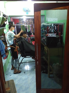
Engkeng BarberShop
Cimpaeun
Cafe
read more
975 m
Warung Devi
Cimpaeun
Cafe
read more
976 m
Susu Jahe
Jalan Raya Tapos No.26-49, Cimpaeun
Cafe
read more
980 m
Es Kelapa Muda Sukabumi
Cimpaeun
Cafe
read more
1.008 km
Breakfast Station
Cimpaeun
Cafe
read more
1.029 km
Warung Yovan
Cimpaeun
Cafe
read more
1.073 km
Damkar Corner
Safir Permata Cianggis, Cimpaeun
Cafe
read more
1.073 km
Warung Nasi Dan Soto Ayam
No 69, Cimpaeun
Cafe
read more
1.09 km
Cafe Ceemar
Jalan Raya Tapos Gang Bhakti Suci No.59, Cimpaeun
Cafe
read more
1.101 km
Warung Mang Midi
Gang Masjid Nurul Iman, Tanah Baru
Cafe
read more
1.211 km
WARUNG SOTO MPOK YATI
Jalan Raya Tapos Gang Bhakti Suci No.100, Cimpaeun
Cafe
read more
1.329 km
Warung Empo
Cimpaeun
Cafe
read more
📑
all categories
Accounting
Administrative area level 1
Administrative area level 2
Airport
Amusement park
Aquarium
Art gallery
Atm
Bakery
Bank
Bar
Beauty salon
Bicycle store
Book store
Bowling alley
Bus station
Cafe
Campground
Car dealer
Car rental
Car repair
Car wash
Casino
Cemetery
Church
City hall
Clothing store
Colloquial area
Convenience store
Courthouse
Dentist
Department store
Doctor
Electrician
Electronics store
Embassy
Finance
Fire station
Florist
Food
Funeral home
Furniture store
Gas station
General contractor
Grocery or supermarket
Gym
Hair care
Hardware store
Health
Hindu Temple
Home goods store
Hospital
Insurance agency
Intersection
Jewelry store
Laundry
Lawyer
Library
Liquor store
Local government office
Locality
Locksmith
Lodging
Meal delivery
Meal takeaway
Mosque
Movie rental
Movie theater
Moving company
Museum
Natural feature
Neighborhood
Night club
Painter
Park
Parking
Pet store
Pharmacy
Physiotherapist
Place of worship
Plumber
Point of interest
Police
Political
Post office
Premise
Real estate agency
Restaurant
Roofing contractor
Route
Rv park, camping
School
Shoe store
Shopping mall
Spa
Stadium
Storage
Store
Subpremise
Supermarket
Synagogue
Taxi stand
Train station
Transit station
Travel agency
University
Veterinary care
Zoo
administrative area level 3
administrative area level 4
administrative area level 5
sublocality level 1
↑