Cafe nearby Warung Mang Midi
Indonesia
Cafe nearby Warung Mang Midi
Warung Mang Midi
Gang Masjid Nurul Iman, 16426, Kota Depok, Jawa Barat, ID Indonesia
contacts phone
:
+62
Latitude:
-6.437533
, Longitude:
106.8812361
larger map & directions
read more
nearest Cafe
78 m
Nasi Uduk Po Misi
Jalan Raya Tapos Gang Bhakti Suci, Cimpaeun
Cafe
read more
132 m
Es Kelapa Muda Sukabumi
Cimpaeun
Cafe
read more
138 m
Azzam Sea Food
Jalan Raya Tapos No.47-17, Cimpaeun
Cafe
read more
193 m
Warung Yovan
Cimpaeun
Cafe
read more
237 m
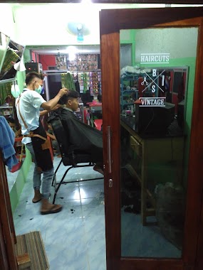
Engkeng BarberShop
Cimpaeun
Cafe
read more
290 m
Cafe Ceemar
Jalan Raya Tapos Gang Bhakti Suci No.59, Cimpaeun
Cafe
read more
293 m
WARUNG SOTO MPOK YATI
Jalan Raya Tapos Gang Bhakti Suci No.100, Cimpaeun
Cafe
read more
338 m
Warkop Opik
Jalan Tapos Raya Rt.04/03 Tapos, Tapos
Cafe
read more
374 m
Axl Torres
Jalan Palm, Tapos
Cafe
read more
433 m
Order Grab Tapos Raya
Tapos
Cafe
read more
616 m
Polpos Tapos
Jalan Mayor Idrus No.63-13, Tapos
Cafe
read more
698 m
Grab Order SF tapos
Tapos
Cafe
read more
729 m
Warung Bude Sarnih
Cimpaeun
Cafe
read more
802 m
agen kelapa muda kurnia
Jalan Raya Cibinong Tapos Kampung Cimpaeun No.43, Cimpaeun
Cafe
read more
850 m
SAUNG EKO
Rt.02 Rw.04,, Tapos
Cafe
read more
889 m
Kedai Tjiandjoer
16957 Jl. Tapos Raya Rt. 01 Rw. 03, Cimpaeun
Cafe
read more
908 m
Cafe Tika
Cimpaeun
Cafe
read more
1.007 km
Warung Nasi Liwet Uhuy
Jl. Kiray, RT.02/RW.15, no 51, Cimpaeun
Cafe
read more
1.069 km
Moncoz Motor/Moncoz steam/Wedang jahe Moncoz Joss
Jalan Raya Tapos No.17, Cimpaeun
Cafe
read more
1.077 km
WARUNG KOPI WARKIT
Jalan Raya Tapos No.51, Tapos
Cafe
read more
1.101 km
Warnas Dan Warkop Rizky II
Jalan Inpres Cimpaeun No.1, Cimpaeun
Cafe
read more
1.279 km
E&E Cafe
Unnamed Road, Bojong Nangka
Cafe
read more
1.32 km
Warkop Mang Ican
Tapos
Cafe
read more
1.341 km
NINA BASLUB
Jalan Banjaran Pucung, Cilangkap
Cafe
read more
1.356 km
Friends Cafe 21
Jalan Banjaran Pucung No.107 Rt.01/10, Cilangkap, Tapos, Cilangkap
Cafe
read more
📑
all categories
Accounting
Administrative area level 1
Administrative area level 2
Airport
Amusement park
Aquarium
Art gallery
Atm
Bakery
Bank
Bar
Beauty salon
Bicycle store
Book store
Bowling alley
Bus station
Cafe
Campground
Car dealer
Car rental
Car repair
Car wash
Casino
Cemetery
Church
City hall
Clothing store
Colloquial area
Convenience store
Courthouse
Dentist
Department store
Doctor
Electrician
Electronics store
Embassy
Finance
Fire station
Florist
Food
Funeral home
Furniture store
Gas station
General contractor
Grocery or supermarket
Gym
Hair care
Hardware store
Health
Hindu Temple
Home goods store
Hospital
Insurance agency
Intersection
Jewelry store
Laundry
Lawyer
Library
Liquor store
Local government office
Locality
Locksmith
Lodging
Meal delivery
Meal takeaway
Mosque
Movie rental
Movie theater
Moving company
Museum
Natural feature
Neighborhood
Night club
Painter
Park
Parking
Pet store
Pharmacy
Physiotherapist
Place of worship
Plumber
Point of interest
Police
Political
Post office
Premise
Real estate agency
Restaurant
Roofing contractor
Route
Rv park, camping
School
Shoe store
Shopping mall
Spa
Stadium
Storage
Store
Subpremise
Supermarket
Synagogue
Taxi stand
Train station
Transit station
Travel agency
University
Veterinary care
Zoo
administrative area level 3
administrative area level 4
administrative area level 5
sublocality level 1
↑