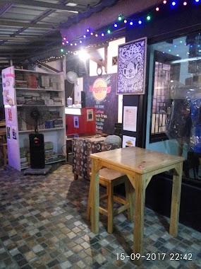
Cafe nearby Lung cafe club
Indonesia
Cafe nearby Lung cafe club
Lung cafe club
Unnamed Road, Cipenjo Indonesia
contacts phone
:
+62
Latitude:
-6.3878638
, Longitude:
107.0032033
read more
nearest Cafe
53 m
Harvest City Cluster Florentina
Jalan Harvest City Boulevard, Cipenjo
Cafe
read more
434 m
Alkateri Record Store
Jalan Metland, Cipenjo
Cafe
read more
612 m
warung khas suroboyo mbak nieta
Cipenjo
Cafe
read more
639 m
kedai jaman
Cipenjo
Cafe
read more
750 m
Es Kelapa TPU
Cipenjo
Cafe
read more
874 m
Kedai Mamah
Unnamed Road, Cipenjo
Cafe
read more
887 m
Angkringanenyong
Jalan Metland Raya 3 No.8, Cipenjo
Cafe
read more
906 m
Ketoprak Mas yanto
Cipenjo
Cafe
read more
1.029 km
Catering Nusantara
Cipenjo
Cafe
read more
1.066 km
warkop bram nonstop
Jalan metland raya1, Cipenjo
Cafe
read more
1.091 km
@lfrescho Bubble Drink
Blok Ca1/, Jalan Metland Raya 1 No.7, Cipenjo
Cafe
read more
1.094 km
Ayam Kokoro
Jalan Metland Cileungsi, Cipenjo
Cafe
read more
1.095 km
Warung Makan Ibu Umi Kosasih
Cipenjo
Cafe
read more
1.097 km
Roti Ponti Metland Cileungsi
12A, Metland Cileungsi blok AB 2 No, Cipenjo
Cafe
read more
1.098 km
Angkringan Salim
Jalan Mandor Senan, Cipenjo
Cafe
read more
1.107 km
Kopi Santai Nyong Odher
Jalan Metland Cileungsi, Cipenjo
Cafe
read more
1.121 km
Bakso Gajah Mungkur
AC9/1&2, Jalan Metland Cileungsi, Cipenjo
Cafe
read more
1.163 km
Angkringan mba E
Cipenjo
Cafe
read more
1.207 km
AlishaPic., Member Of Tahta Studio n Milestone Pic.
Pasir Angin
Cafe
read more
1.635 km
Waroeng Nongkrong
Jl. Boulevard Metland Cileungsi Blok DB2 No.1, Cipenjo, Cileungsi, Cipenjo Cileungsi, Cipenjo
Cafe
read more
1.715 km
Opet Babershop
Cikarageman
Cafe
read more
1.765 km
Tuty Sulastri
Blok D18 No.14, Jalan Griya Pratama Mas, Cikarageman
Cafe
read more
1.801 km
Bakso Kipli 2
Mekarsari
Cafe
read more
1.963 km
Warung Pojok
Mekarsari
Cafe
read more
1.989 km
toko alvino. grosir dan eceran
Harvest City Cluster Orchid C,, Ragemanunggal
Cafe
read more
📑
all categories
Accounting
Administrative area level 1
Administrative area level 2
Airport
Amusement park
Aquarium
Art gallery
Atm
Bakery
Bank
Bar
Beauty salon
Bicycle store
Book store
Bowling alley
Bus station
Cafe
Campground
Car dealer
Car rental
Car repair
Car wash
Casino
Cemetery
Church
City hall
Clothing store
Colloquial area
Convenience store
Courthouse
Dentist
Department store
Doctor
Electrician
Electronics store
Embassy
Finance
Fire station
Florist
Food
Funeral home
Furniture store
Gas station
General contractor
Grocery or supermarket
Gym
Hair care
Hardware store
Health
Hindu Temple
Home goods store
Hospital
Insurance agency
Intersection
Jewelry store
Laundry
Lawyer
Library
Liquor store
Local government office
Locality
Locksmith
Lodging
Meal delivery
Meal takeaway
Mosque
Movie rental
Movie theater
Moving company
Museum
Natural feature
Neighborhood
Night club
Painter
Park
Parking
Pet store
Pharmacy
Physiotherapist
Place of worship
Plumber
Point of interest
Police
Political
Post office
Premise
Real estate agency
Restaurant
Roofing contractor
Route
Rv park, camping
School
Shoe store
Shopping mall
Spa
Stadium
Storage
Store
Subpremise
Supermarket
Synagogue
Taxi stand
Train station
Transit station
Travel agency
University
Veterinary care
Zoo
administrative area level 3
administrative area level 4
administrative area level 5
sublocality level 1
↑