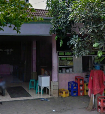
Cafe nearby Angkringanenyong
Indonesia
Cafe nearby Angkringanenyong
Angkringanenyong
8, Jalan Metland Raya 3, 16820, Bogor, Jawa Barat, ID Indonesia
contacts phone
:
+62 815-9945-560
Latitude:
-6.3799453
, Longitude:
107.0021977
larger map & directions
read more
nearest Cafe
19 m
Ketoprak Mas yanto
Cipenjo
Cafe
read more
347 m
warkop bram nonstop
Jalan metland raya1, Cipenjo
Cafe
read more
436 m
Angkringan Calliber'45
Jalan Raya Setu, Taman Rahayu
Cafe
read more
440 m
Warung Makan Ibu Umi Kosasih
Cipenjo
Cafe
read more
441 m
Bakso Pakde Supri
Metland cileungsi blok CM, Lapangan, Cikarageman
Cafe
read more
479 m
kedai jaman
Cipenjo
Cafe
read more
501 m
Metland Cileungsi CM 5
blok Camar, Jalan Metland, Cipenjo
Cafe
read more
613 m
warung kopi teh sapnah
Taman Rahayu, Setu, Taman Rahayu
Cafe
read more
639 m
Angkringan mba E
Cipenjo
Cafe
read more
661 m
Angkringan Winan
Jalan Cileungsi - Setu, Pasir Angin
Cafe
read more
662 m
Segara Madu Juice & Sopbuah
Jalan Metland, Cipenjo
Cafe
read more
676 m
Pisang Kipas Nuget 86
Jalan MT. Haryono, Taman Rahayu
Cafe
read more
682 m
Kedai Mamah
Unnamed Road, Cipenjo
Cafe
read more
689 m
Kopi Santai Nyong Odher
Jalan Metland Cileungsi, Cipenjo
Cafe
read more
774 m
AlishaPic., Member Of Tahta Studio n Milestone Pic.
Pasir Angin
Cafe
read more
800 m
Ayam Kokoro
Jalan Metland Cileungsi, Cipenjo
Cafe
read more
811 m
Warung Kopi Harmud
Jalan Al-Hikmah No.14, Pasir Angin
Cafe
read more
811 m
Roti Ponti Metland Cileungsi
12A, Metland Cileungsi blok AB 2 No, Cipenjo
Cafe
read more
812 m
Warung Kopi
Jalan Cileungsi - Setu, Pasir Angin
Cafe
read more
827 m
NYOKLAT KLASIK
Jalan MT. Haryono No.12, Taman Rahayu
Cafe
read more
887 m
Lung cafe club
Unnamed Road, Cipenjo
Cafe
read more
920 m
Cafe Dhe Bohay
Jalan Adenium 4, Pasir Angin
Cafe
read more
941 m
Bakso Gajah Mungkur
AC9/1&2, Jalan Metland Cileungsi, Cipenjo
Cafe
read more
966 m
Alkateri Record Store
Jalan Metland, Cipenjo
Cafe
read more
1000 m
Catering Nusantara
Cipenjo
Cafe
read more
📑
all categories
Accounting
Administrative area level 1
Administrative area level 2
Airport
Amusement park
Aquarium
Art gallery
Atm
Bakery
Bank
Bar
Beauty salon
Bicycle store
Book store
Bowling alley
Bus station
Cafe
Campground
Car dealer
Car rental
Car repair
Car wash
Casino
Cemetery
Church
City hall
Clothing store
Colloquial area
Convenience store
Courthouse
Dentist
Department store
Doctor
Electrician
Electronics store
Embassy
Finance
Fire station
Florist
Food
Funeral home
Furniture store
Gas station
General contractor
Grocery or supermarket
Gym
Hair care
Hardware store
Health
Hindu Temple
Home goods store
Hospital
Insurance agency
Intersection
Jewelry store
Laundry
Lawyer
Library
Liquor store
Local government office
Locality
Locksmith
Lodging
Meal delivery
Meal takeaway
Mosque
Movie rental
Movie theater
Moving company
Museum
Natural feature
Neighborhood
Night club
Painter
Park
Parking
Pet store
Pharmacy
Physiotherapist
Place of worship
Plumber
Point of interest
Police
Political
Post office
Premise
Real estate agency
Restaurant
Roofing contractor
Route
Rv park, camping
School
Shoe store
Shopping mall
Spa
Stadium
Storage
Store
Subpremise
Supermarket
Synagogue
Taxi stand
Train station
Transit station
Travel agency
University
Veterinary care
Zoo
administrative area level 3
administrative area level 4
administrative area level 5
sublocality level 1
↑