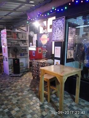
Cafe nearby Angkringan Salim
Indonesia
Cafe nearby Angkringan Salim
Angkringan Salim
Jalan Mandor Senan, 16820, Bogor, Jawa Barat, ID Indonesia
contacts phone
:
+62
Latitude:
-6.3925245
, Longitude:
106.9944468
larger map & directions
read more
nearest Cafe
215 m
Warung One Soul
Jalan Metland, Cipenjo
Cafe
read more
254 m
Warung Neneng
Unnamed Road, Cipenjo
Cafe
read more
255 m
Warung Neneng Wina
Durio 2 blok DD12/5 Harvest City, Cipenjo
Cafe
read more
308 m
Soft Ice Cream Me Queen
Cipenjo
Cafe
read more
380 m
Es Kelapa TPU
Cipenjo
Cafe
read more
488 m
Tower Petir - Cipenjo
Cipenjo
Cafe
read more
490 m
Nyoklat Klasik Cipenjo
Jalan Mandor Senan, Cipenjo
Cafe
read more
608 m
Dedi Rohendi DK 10/9
Cipenjo
Cafe
read more
615 m
BFC Metland Cileungsi
Cluster Mawar Blok DK 2 no.6 Cileungsi, Kampung Parung Jambu, Cipenjo
Cafe
read more
625 m
Kedai Kedayan (K2)
Cipenjo
Cafe
read more
665 m
warung khas suroboyo mbak nieta
Cipenjo
Cafe
read more
672 m
Warung Ma Wanih
Jalan Dahlia 1, Cipenjo
Cafe
read more
699 m
Resto Abang Adek
Cipenjo
Cafe
read more
724 m
Alkateri Record Store
Jalan Metland, Cipenjo
Cafe
read more
789 m
PASCO ICE BLEND
Boulevard Metland Cileungsi No.4, Cipenjo
Cafe
read more
835 m
Waroeng Nongkrong
Jl. Boulevard Metland Cileungsi Blok DB2 No.1, Cipenjo, Cileungsi, Cipenjo Cileungsi, Cipenjo
Cafe
read more
848 m
KEDAI AMZIR
Cipenjo
Cafe
read more
873 m
Kedai Bakso Ayam Mama Gathan
Cipenjo
Cafe
read more
877 m
Catering Nusantara
Cipenjo
Cafe
read more
905 m
Slompret Melayoe Koffie & Toast
perumahan Metland Blok DH1 no.2., Cipenjo
Cafe
read more
905 m
Warkop Mirip Caffe
Jalan Mandor Senan, Cipenjo
Cafe
read more
911 m
Slompret Melayoe Kafe
Jalan Metland, Cipenjo
Cafe
read more
922 m
Cafe BELIYA
Perum Metland Cileungsi Blok BA2 No, 12, Cipenjo
Cafe
read more
951 m
Waroeng Star21
Jl. Metland Cileungsi blok bb 2 no.11, Cipenjo
Cafe
read more
1.098 km
Lung cafe club
Unnamed Road, Cipenjo
Cafe
read more
📑
all categories
Accounting
Administrative area level 1
Administrative area level 2
Airport
Amusement park
Aquarium
Art gallery
Atm
Bakery
Bank
Bar
Beauty salon
Bicycle store
Book store
Bowling alley
Bus station
Cafe
Campground
Car dealer
Car rental
Car repair
Car wash
Casino
Cemetery
Church
City hall
Clothing store
Colloquial area
Convenience store
Courthouse
Dentist
Department store
Doctor
Electrician
Electronics store
Embassy
Finance
Fire station
Florist
Food
Funeral home
Furniture store
Gas station
General contractor
Grocery or supermarket
Gym
Hair care
Hardware store
Health
Hindu Temple
Home goods store
Hospital
Insurance agency
Intersection
Jewelry store
Laundry
Lawyer
Library
Liquor store
Local government office
Locality
Locksmith
Lodging
Meal delivery
Meal takeaway
Mosque
Movie rental
Movie theater
Moving company
Museum
Natural feature
Neighborhood
Night club
Painter
Park
Parking
Pet store
Pharmacy
Physiotherapist
Place of worship
Plumber
Point of interest
Police
Political
Post office
Premise
Real estate agency
Restaurant
Roofing contractor
Route
Rv park, camping
School
Shoe store
Shopping mall
Spa
Stadium
Storage
Store
Subpremise
Supermarket
Synagogue
Taxi stand
Train station
Transit station
Travel agency
University
Veterinary care
Zoo
administrative area level 3
administrative area level 4
administrative area level 5
sublocality level 1
↑