Train station nearby Kranji Station
Indonesia
Train station nearby Kranji Station
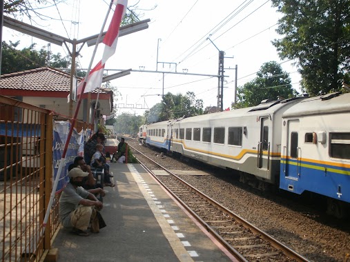
Kranji Station
Jalan I Gusti Ngurah Rai, Kranji, Bekasi Barat, Kranji, Bekasi Bar., Kota Bks, Jawa Barat 17135, Indonesia
contacts phone
:
+62
website:
www.kai.go.id
Latitude:
-6.2243369
, Longitude:
106.9793964
larger map & directions
read more
nearest Train station
2.573 km
Bekasi railway station
Jalan Pusdiklat Raya No.7, Marga Mulya, Bekasi Utara
Train station
read more
2.573 km
Bekasi railway station
Jalan Pusdiklat Raya No.7, Marga Mulya
Train station
read more
3.065 km
Stasiun Cakung
Jalan Stasiun Cakung, Pulo Gebang
Train station
read more
4.453 km
KLENDERBARU
Indonesia
Train station
read more
4.958 km
Stasiun Bekasi Timur
Indonesia
Train station
read more
4.961 km
Sation Bekasi Timur
Jalan Ir. Haji Juanda No.25, Duren Jaya, Bekasi Timur
Train station
read more
4.962 km
Bekasi Timur
Indonesia
Train station
read more
5.721 km
Buaran Station
East Jakarta, Penggilingan
Train station
read more
5.829 km
Mega Raya Indah
Rawa Lumbu Jalan Pengasinan Raya No.35, Pengasinan
Train station
read more
5.829 km
Mega Raya Indah
Rawa Lumbu Jalan Pengasinan No.35, Pengasinan
Train station
read more
8.877 km
Klender
Jalan Haji Jubris, Jatinegara, Cakung
Train station
read more
9.296 km
Tambun
Jalan Mekar Sari, Tambun, Tambun Selatan
Train station
read more
10.189 km
Bilad Tour
JL. Kelapa Cengkir Timur Raya, EB No. 6, Kelapa Gading Timur
Train station
read more
10.479 km
Cipinang Station
RT.1/RW.9, Pisangan Timur
Train station
read more
12.256 km
CIBITUNG
Indonesia
Train station
read more
13.057 km
Pondok Jati Station
RT.10/RW.9, Pisangan Baru
Train station
read more
13.387 km
Tebet Station
Tim., Jalan Tebet Raya No.62, Tebet Timur
Train station
read more
13.998 km
Kramat
Jalan Pramuka Jati, Paseban
Train station
read more
14.173 km
Duren Kalibata
Jalan Raya Kalibata No.60, Rawajati, Pancoran
Train station
read more
14.368 km
Manggarai
H7, Jalan Manggarai Utara 1, Manggarai
Train station
read more
14.733 km
Pasar Minggu Baru Station
Jalan Batu Merah IV, Pejaten Timur, Pasar Minggu
Train station
read more
14.853 km
Sentiong Station
Jalan Kramat Pulo Dalam I, Kramat
Train station
read more
15.908 km
Stasiun Pasar Senen
Jalan Stasiun Senen No.14, Senen
Train station
read more
16.639 km
Tanjung Priuk
14130, Jalan Taman Stasiun Tanjung Priok, Tanjung Priok
Train station
read more
18.307 km
Ancol Station
Jalan R E Martadinata, Ancol, Pademangan
Train station
read more
📑
all categories
Accounting
Administrative area level 1
Administrative area level 2
Airport
Amusement park
Aquarium
Art gallery
Atm
Bakery
Bank
Bar
Beauty salon
Bicycle store
Book store
Bowling alley
Bus station
Cafe
Campground
Car dealer
Car rental
Car repair
Car wash
Casino
Cemetery
Church
City hall
Clothing store
Colloquial area
Convenience store
Courthouse
Dentist
Department store
Doctor
Electrician
Electronics store
Embassy
Finance
Fire station
Florist
Food
Funeral home
Furniture store
Gas station
General contractor
Grocery or supermarket
Gym
Hair care
Hardware store
Health
Hindu Temple
Home goods store
Hospital
Insurance agency
Intersection
Jewelry store
Laundry
Lawyer
Library
Liquor store
Local government office
Locality
Locksmith
Lodging
Meal delivery
Meal takeaway
Mosque
Movie rental
Movie theater
Moving company
Museum
Natural feature
Neighborhood
Night club
Painter
Park
Parking
Pet store
Pharmacy
Physiotherapist
Place of worship
Plumber
Point of interest
Police
Political
Post office
Premise
Real estate agency
Restaurant
Roofing contractor
Route
Rv park, camping
School
Shoe store
Shopping mall
Spa
Stadium
Storage
Store
Subpremise
Supermarket
Synagogue
Taxi stand
Train station
Transit station
Travel agency
University
Veterinary care
Zoo
administrative area level 3
administrative area level 4
administrative area level 5
sublocality level 1
↑