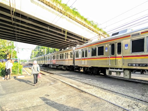
Train station nearby Buaran Station
Coronavirus disease (COVID-19) Situation
confirmed cases
6829221
deaths
162063
Indonesia
Train station nearby Buaran Station
Buaran Station
East Jakarta, Penggilingan, Cakung, East Jakarta City, Jakarta, Indonesia
contacts phone
:
+62 21 53206589
Latitude:
-6.2163004
, Longitude:
106.928273
larger map & directions
read more
nearest Train station
698 m
Stasiun Buaran
East Jakarta, Malaka Sari
Train station
read more
1.27 km
KLENDERBARU
Indonesia
Train station
read more
2.658 km
Stasiun Cakung
Jalan Stasiun Cakung, Pulo Gebang
Train station
read more
3.159 km
Klender
Jalan Haji Jubris, Jatinegara, Cakung
Train station
read more
4.773 km
Cipinang Station
RT.1/RW.9, Pisangan Timur
Train station
read more
7.34 km
Pondok Jati Station
RT.10/RW.9, Pisangan Baru
Train station
read more
8.167 km
Bekasi railway station
Jalan Pusdiklat Raya No.7, Marga Mulya, Bekasi Utara
Train station
read more
9.187 km
Duren Kalibata
Jalan Raya Kalibata No.60, Rawajati, Pancoran
Train station
read more
9.216 km
Sentiong Station
Jalan Kramat Pulo Dalam I, Kramat
Train station
read more
9.906 km
Pasar Minggu Baru Station
Jalan Batu Merah IV, Pejaten Timur, Pasar Minggu
Train station
read more
10.456 km
Mega Raya Indah
Rawa Lumbu Jalan Pengasinan No.35, Pengasinan
Train station
read more
10.498 km
Sation Bekasi Timur
Jalan Ir. Haji Juanda No.25, Duren Jaya, Bekasi Timur
Train station
read more
11.09 km
Gondangdia Station
Jalan Srikaya No.1, Kebon Sirih, Menteng
Train station
read more
11.347 km
Kemayoran Station
Kemayoran, rt 15/rw 01 Gn. Sahari Sel., Gunung Sahari Selatan, Kemayoran
Train station
read more
11.652 km
Gambir Train Station
Jalan Medan Merdeka Timur No.1, RT.2/RW.1, Gambir
Train station
read more
11.688 km
Sudirman Station
Jalan Kendal No.24, RT.10/RW.6, Menteng
Train station
read more
12.539 km
Stasiun Karet
Jl.Duping 1, Kb. Melati, Tanah Abang
Train station
read more
12.725 km
Sawah Besar Station
Jalan Krekot Raya No.6, Pasar Baru, Sawah Besar
Train station
read more
12.818 km
Tanjung Priuk
14130, Jalan Taman Stasiun Tanjung Priok, Tanjung Priok
Train station
read more
13.414 km
Mangga Besar Station
Jalan Karang Anyar, Karang Anyar, Sawah Besar
Train station
read more
13.451 km
Ancol Station
Jalan R E Martadinata, Ancol, Pademangan
Train station
read more
14.188 km
Tanjung Barat Station
Jalan Raya Lenteng Agung No.40, RT.4/RW.1, Lenteng Agung, Jagakarsa
Train station
read more
14.301 km
Jayakarta Station
Jalan Pangeran Jayakarta No.28, Mangga Dua Selatan
Train station
read more
14.472 km
Palmerah
RT.1/RW.3, Gelora
Train station
read more
15.308 km
Jakartakota Station
Jakan Lada, Pinangsia, Tamansari
Train station
read more
📑
all categories
Accounting
Administrative area level 1
Administrative area level 2
Airport
Amusement park
Aquarium
Art gallery
Atm
Bakery
Bank
Bar
Beauty salon
Bicycle store
Book store
Bowling alley
Bus station
Cafe
Campground
Car dealer
Car rental
Car repair
Car wash
Casino
Cemetery
Church
City hall
Clothing store
Colloquial area
Convenience store
Courthouse
Dentist
Department store
Doctor
Electrician
Electronics store
Embassy
Finance
Fire station
Florist
Food
Funeral home
Furniture store
Gas station
General contractor
Grocery or supermarket
Gym
Hair care
Hardware store
Health
Hindu Temple
Home goods store
Hospital
Insurance agency
Intersection
Jewelry store
Laundry
Lawyer
Library
Liquor store
Local government office
Locality
Locksmith
Lodging
Meal delivery
Meal takeaway
Mosque
Movie rental
Movie theater
Moving company
Museum
Natural feature
Neighborhood
Night club
Painter
Park
Parking
Pet store
Pharmacy
Physiotherapist
Place of worship
Plumber
Point of interest
Police
Political
Post office
Premise
Real estate agency
Restaurant
Roofing contractor
Route
Rv park, camping
School
Shoe store
Shopping mall
Spa
Stadium
Storage
Store
Subpremise
Supermarket
Synagogue
Taxi stand
Train station
Transit station
Travel agency
University
Veterinary care
Zoo
administrative area level 3
administrative area level 4
administrative area level 5
sublocality level 1
↑