School nearby Yayasan Al Bakriyah Citayam
Indonesia
School nearby Yayasan Al Bakriyah Citayam
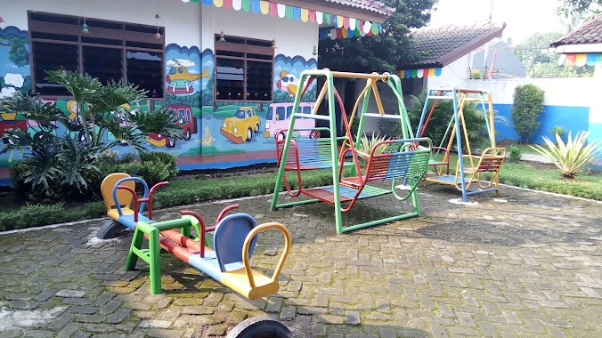
Yayasan Al Bakriyah Citayam
Ragajaya, Bojong Gede, Bogor, West Java, Indonesia
contacts phone
:
+62 812-8605-2627
Latitude:
-6.4509479
, Longitude:
106.7924305
larger map & directions
read more
nearest School
503 m
RA AL DENA
Jalan Komplek Depag, Pabuaran
School
read more
553 m
sekolah smpn 02 bojong gede
Jalan Akar Wangi II, Ragajaya
School
read more
576 m
Sdn citayem 3
Cipayung Jaya
School
read more
599 m
Sanggar Gambar Azalia
Jalan Pemuda Kampung Pulo No.17, Cipayung Jaya
School
read more
702 m
Tk Al Amin
No., Jalan Raya Pesona Citayam No.73, Pabuaran
School
read more
704 m
SDI Perwanida Nurul Fajar
Jalan Kompleks Departemen Agama Ri No.59, RT.13/RW.15, Pabuaran
School
read more
718 m
Mi Tansyitul Muta'allimin
Jalan Raya Pabuaran No.3, Bojong Pondok Terong
School
read more
738 m
SD Islam Perwanida Nurul Fajar
Komp DEPAG,, Pabuaran
School
read more
748 m
sekolah dutaekselensia
Jalan Aira Raya No.3, RT.1/RW.16, Pabuaran
School
read more
759 m
RA. Nurul Fajar
Jalan Raya Pabuaran, Pabuaran
School
read more
789 m
SDI NURUL KARIMAH
Pabuaran
School
read more
815 m
SDN Citayam 03
Jalan Raya Citayam Parung
School
read more
815 m
TKIT-SDIT MAURITANIYYAH
Jalan Perum Lembah Griya Citayam No.6, Cipayung Jaya
School
read more
818 m
SDN Citayam 01
Jalan Setapak No.7, RT.3/RW.6, Bojong Pondok Terong
School
read more
825 m
Smp Bojong Satu
Jalan Pertanian, Ragajaya
School
read more
840 m
Madrasah Ibtidaiyah Swasta Muhammadiyah 2
Jalan Raya Cipayung Jaya No.12, Bojong Pondok Terong
School
read more
851 m
Komplek statistik
komplek, Jalan Statistik, Pondok Bambu
School
read more
862 m
TPA AL UMARIYAH HJ NUR
Jalan Raya Pesona Citayam No.44, Pabuaran
School
read more
872 m
Majelis Assyifa
Gang Kenanga No.24, Ragajaya
School
read more
884 m
RA/Ba/Ta Nurul Hayat
JL. Cipayung Raya, Bojong Pondok Terong
School
read more
905 m
SMA WIRA BUANA BOJONGGEDE
Jalan Camat Kanang No.89, Pabuaran
School
read more
915 m
SD Negeri 02 Karehkel
JL Pabuaran, RT. 002/10, Keracak Leuwiliang
School
read more
933 m
Paud Al Istiqomah
Kampung Poncol Duren Baru, Susukan
School
read more
949 m
YPI UMMU'L AMINAH
Jalan Raya Citayam No.99, Ratu Jaya
School
read more
1.254 km
TK / RA. Imam Fadhilah
Gang Tiang 2, Pabuaran
School
read more
📑
all categories
Accounting
Administrative area level 1
Administrative area level 2
Airport
Amusement park
Aquarium
Art gallery
Atm
Bakery
Bank
Bar
Beauty salon
Bicycle store
Book store
Bowling alley
Bus station
Cafe
Campground
Car dealer
Car rental
Car repair
Car wash
Casino
Cemetery
Church
City hall
Clothing store
Colloquial area
Convenience store
Courthouse
Dentist
Department store
Doctor
Electrician
Electronics store
Embassy
Finance
Fire station
Florist
Food
Funeral home
Furniture store
Gas station
General contractor
Grocery or supermarket
Gym
Hair care
Hardware store
Health
Hindu Temple
Home goods store
Hospital
Insurance agency
Intersection
Jewelry store
Laundry
Lawyer
Library
Liquor store
Local government office
Locality
Locksmith
Lodging
Meal delivery
Meal takeaway
Mosque
Movie rental
Movie theater
Moving company
Museum
Natural feature
Neighborhood
Night club
Painter
Park
Parking
Pet store
Pharmacy
Physiotherapist
Place of worship
Plumber
Point of interest
Police
Political
Post office
Premise
Real estate agency
Restaurant
Roofing contractor
Route
Rv park, camping
School
Shoe store
Shopping mall
Spa
Stadium
Storage
Store
Subpremise
Supermarket
Synagogue
Taxi stand
Train station
Transit station
Travel agency
University
Veterinary care
Zoo
administrative area level 3
administrative area level 4
administrative area level 5
sublocality level 1
↑