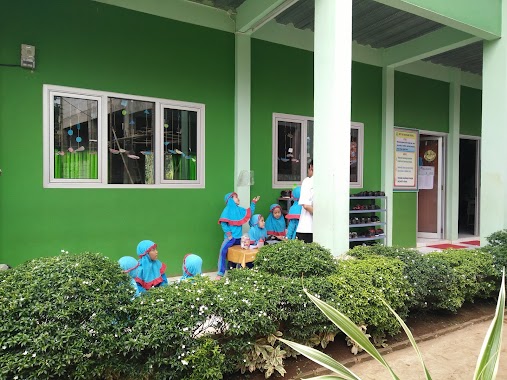
School nearby Indopallet
Indonesia
School nearby Indopallet
Indopallet
Jalan Cileungsi - Setu, 16820, Bogor, Jawa Barat, ID Indonesia
contacts phone
:
+62
Latitude:
-6.3877298
, Longitude:
106.9852202
larger map & directions
read more
nearest School
202 m
PAUD Nurul Islam 2
Cipenjo
School
read more
315 m
SDN 2 PASIR ANGIN
Pasir Angin
School
read more
330 m
Futsal Academy Pastwo
Jalan Gempol, Pasir Angin
School
read more
350 m
TPQ At-Tashfiyah
Cipenjo
School
read more
464 m
SDN Pasirangin 01
Jl. Nandor Senan Cipenjo, Cileungsi, Cipenjo
School
read more
499 m
TK. Salman Al-Farisi
Jalan Mandor Senan, Cipenjo
School
read more
678 m
SPS Perintis Azahra
Cipenjo
School
read more
744 m
Ravasia Hills Preschool & Kindergarten
Metland Cileungsi Melati DB1 no, 10, Cipenjo
School
read more
744 m
Perumahan Harvest City
Blok DD XII, Cipenjo
School
read more
770 m
Tk Islam As Syahid
Cipenjo
School
read more
841 m
TKIT, SDIT, SMPIT IQRO KAIRO
Jalan Mandor Senan, Cipenjo
School
read more
843 m
Paud Ahyabi
pasirangin 001/003, Jalan RT, Pasir Angin
School
read more
874 m
TK ISLAM AL KHOIR
Jalan Metland Cileungsi No.9, Cipenjo
School
read more
881 m
Smp Perintis Cileungsi
Cipenjo
School
read more
893 m
MAJLIS TAKLIM AL-USMAN MASHURI
Pasir Angin
School
read more
930 m
Louisian-Music
Griya alam sentosa Blok R2 No. 08 RT008/RW010 Kec, Pasir Angin
School
read more
987 m
SDIT Prayasqi Islamic School
Pasir Angin
School
read more
1.002 km
TK USMANAH
Perumahan Taman Ria Persada Jalan Bogor-Bekasi, Pasir Angin
School
read more
1.035 km
Sekolah Tunas Islam Global
Metland Cileungsi blok AB 26 no 1 Pasir angin, Cileungsi, Bogor, Pasir Angin
School
read more
1.087 km
MTA Cileungsi
Gang Anggrek, RT. 003 / RW. 001, Pasir Angin, Cileungsi, Pasir Angin
School
read more
1.093 km
Jalan Asthelia 3
Jalan Astelia 3, Pasir Angin
School
read more
1.101 km
Yayasan Al-jihad Suganda Husein
Pasir Angin
School
read more
1.282 km
Bina Masjid dan Iman Boarding School
Dusun cinyosog, Pasir Angin
School
read more
1.395 km
AYOPINTER HARVEST CITY
Jalan Harvest City Boulevard, Mekarsari
School
read more
1.405 km
Harvest Stars School - Toddler, Playgroup & Kindergarten
Harvest City Ruko Dianthus Blok RD1 No. 26 Cileungsi, Cipenjo
School
read more
📑
all categories
Accounting
Administrative area level 1
Administrative area level 2
Airport
Amusement park
Aquarium
Art gallery
Atm
Bakery
Bank
Bar
Beauty salon
Bicycle store
Book store
Bowling alley
Bus station
Cafe
Campground
Car dealer
Car rental
Car repair
Car wash
Casino
Cemetery
Church
City hall
Clothing store
Colloquial area
Convenience store
Courthouse
Dentist
Department store
Doctor
Electrician
Electronics store
Embassy
Finance
Fire station
Florist
Food
Funeral home
Furniture store
Gas station
General contractor
Grocery or supermarket
Gym
Hair care
Hardware store
Health
Hindu Temple
Home goods store
Hospital
Insurance agency
Intersection
Jewelry store
Laundry
Lawyer
Library
Liquor store
Local government office
Locality
Locksmith
Lodging
Meal delivery
Meal takeaway
Mosque
Movie rental
Movie theater
Moving company
Museum
Natural feature
Neighborhood
Night club
Painter
Park
Parking
Pet store
Pharmacy
Physiotherapist
Place of worship
Plumber
Point of interest
Police
Political
Post office
Premise
Real estate agency
Restaurant
Roofing contractor
Route
Rv park, camping
School
Shoe store
Shopping mall
Spa
Stadium
Storage
Store
Subpremise
Supermarket
Synagogue
Taxi stand
Train station
Transit station
Travel agency
University
Veterinary care
Zoo
administrative area level 3
administrative area level 4
administrative area level 5
sublocality level 1
↑