Mosque nearby Mushola Al-mumin
Indonesia
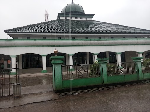
Mosque nearby Mushola Al-mumin
Mushola Al-mumin
Cicadas, Gunung Putri, Bogor, West Java 16964, Indonesia
contacts phone
:
+62 813-8200-4247
Latitude:
-6.4322374
, Longitude:
106.9293951
larger map & directions
read more
nearest Mosque
358 m
Masjid Baitul Marifat
Jalan Desa Cicadas No.17, Cicadas
Mosque
read more
358 m
Musholla Nurul Huda
Cicadas
Mosque
read more
410 m
Masjid Parung Tanjung
Cicadas
Mosque
read more
474 m
Masjid Jami Al-Ikhlash
Jalan Mercedes Benz No.23, Cicadas
Mosque
read more
477 m
Masjid
Jalan Mercedes Benz No.257, Cicadas
Mosque
read more
568 m
Masjid Al-Hidayah Pt. Corinthian
Cicadas
Mosque
read more
594 m
Masjid Jami Alhidayah Pabuaran
Cicadas
Mosque
read more
780 m
Masjid Darussalam Alam Segar Sejahtera
Cicadas
Mosque
read more
878 m
Masjid Jami' Baeturrahmah
Jalan Mercedes Benz No.69, Gunung Putri, Cicadas
Mosque
read more
881 m
Masjid Baiturrahman
Jalan Kampung Cicadas No.4, Cicadas
Mosque
read more
907 m
Masjid Jami' Nurul Iman
Cicadas
Mosque
read more
910 m
Musholla Nurus Sa'adah
Cicadas
Mosque
read more
920 m
Mushola Al Muttaqin
Cicadas
Mosque
read more
955 m
Masjid At-Taqwa
No., Jalan Mercedes Benz No.257, Cicadas
Mosque
read more
1.013 km
Masjid Tazul Muluk
Wanaherang
Mosque
read more
1.217 km
Masjid Al Istiqomah
Jalan Mercedes Benz No.105, Cicadas
Mosque
read more
1.244 km
Masjid Al-Hidayah
Tlajung Udik
Mosque
read more
1.265 km
Musholla Al Ikhlas
Cicadas
Mosque
read more
1.38 km
Masjid Jami' Al Kholid
Bojong Nangka
Mosque
read more
1.38 km
Masjid Jami' Al Khalid
Cicadas
Mosque
read more
1.553 km
Musholah At-Thoyyibah
Jalan Kampung Cicadas No.30, Tlajung Udik
Mosque
read more
1.765 km
Masjid Jami Al Mujahidin
Jl. Taman Depok Permai Bl C%2F1-A RT 004 RW 23 Abadijaya Sukmajaya Depok Jawa Barat, Tlajung Udik
Mosque
read more
1.776 km
Musholla Al-Munawaroh
Jalan Kampung Cicadas, Bojong Nangka
Mosque
read more
1.943 km
Mushola Darrut Taqwa
Klapanunggal
Mosque
read more
2.372 km
Masjid Jami' Nurul Amal
Unnamed Road, Klp. Nunggal, Kembang Kuning
Mosque
read more
📑
all categories
Accounting
Administrative area level 1
Administrative area level 2
Airport
Amusement park
Aquarium
Art gallery
Atm
Bakery
Bank
Bar
Beauty salon
Bicycle store
Book store
Bowling alley
Bus station
Cafe
Campground
Car dealer
Car rental
Car repair
Car wash
Casino
Cemetery
Church
City hall
Clothing store
Colloquial area
Convenience store
Courthouse
Dentist
Department store
Doctor
Electrician
Electronics store
Embassy
Finance
Fire station
Florist
Food
Funeral home
Furniture store
Gas station
General contractor
Grocery or supermarket
Gym
Hair care
Hardware store
Health
Hindu Temple
Home goods store
Hospital
Insurance agency
Intersection
Jewelry store
Laundry
Lawyer
Library
Liquor store
Local government office
Locality
Locksmith
Lodging
Meal delivery
Meal takeaway
Mosque
Movie rental
Movie theater
Moving company
Museum
Natural feature
Neighborhood
Night club
Painter
Park
Parking
Pet store
Pharmacy
Physiotherapist
Place of worship
Plumber
Point of interest
Police
Political
Post office
Premise
Real estate agency
Restaurant
Roofing contractor
Route
Rv park, camping
School
Shoe store
Shopping mall
Spa
Stadium
Storage
Store
Subpremise
Supermarket
Synagogue
Taxi stand
Train station
Transit station
Travel agency
University
Veterinary care
Zoo
administrative area level 3
administrative area level 4
administrative area level 5
sublocality level 1
↑