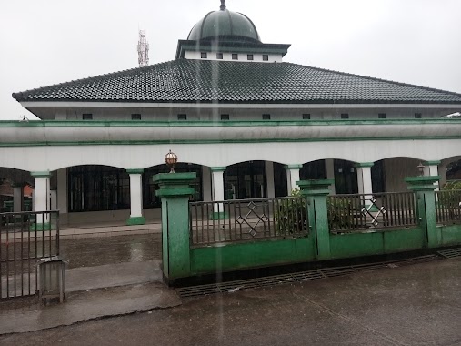
Mosque nearby Masjid
Indonesia
Mosque nearby Masjid
Masjid
Jalan Mercedes Benz No.257, Cicadas Indonesien
contacts phone
:
+62
Latitude:
-6.4279458
, Longitude:
106.9294891
read more
nearest Mosque
18 m
Masjid Jami Al-Ikhlash
Jalan Mercedes Benz No.23, Cicadas
Mosque
read more
464 m
Mushola Al Muttaqin
Cicadas
Mosque
read more
477 m
Mushola Al-mumin
Cicadas
Mosque
read more
502 m
Musholla Nurus Sa'adah
Cicadas
Mosque
read more
512 m
Masjid At-Taqwa
No., Jalan Mercedes Benz No.257, Cicadas
Mosque
read more
516 m
Masjid Jami Alhidayah Pabuaran
Cicadas
Mosque
read more
639 m
Masjid Parung Tanjung
Cicadas
Mosque
read more
697 m
Masjid Darussalam Alam Segar Sejahtera
Cicadas
Mosque
read more
742 m
Musholla Nurul Huda
Cicadas
Mosque
read more
761 m
Masjid Nurut Tauhid
Jl. Raya Mercedess Benz Belakang sariwangi Kp. Pabuaran Desa Cicadas Rt. 03/Rw. 09, Gn. Putri,, Cicadas
Mosque
read more
783 m
Masjid Baitul Marifat
Jalan Desa Cicadas No.17, Cicadas
Mosque
read more
788 m
Masjid Tazul Muluk
Wanaherang
Mosque
read more
880 m
Masjid Al-Hidayah Pt. Corinthian
Cicadas
Mosque
read more
997 m
Musholla Al Ikhlas
Cicadas
Mosque
read more
1.103 km
Masjid Jami' Al Khalid
Cicadas
Mosque
read more
1.11 km
Masjid Jami' Al Kholid
Bojong Nangka
Mosque
read more
1.224 km
Masjid Jami' Baeturrahmah
Jalan Mercedes Benz No.69, Gunung Putri, Cicadas
Mosque
read more
1.228 km
Masjid Baiturrahman
Jalan Kampung Cicadas No.4, Cicadas
Mosque
read more
1.339 km
Aula Sekretariat/Pertapaan
Jalan Kampung Cicadas, Cicadas
Mosque
read more
1.341 km
Masjid Al-Hidayah
Tlajung Udik
Mosque
read more
1.636 km
Musholla Al-Munawaroh
Jalan Kampung Cicadas, Bojong Nangka
Mosque
read more
1.749 km
Musholah At-Thoyyibah
Jalan Kampung Cicadas No.30, Tlajung Udik
Mosque
read more
2 km
Masjid Jami' Al Hidayah
Jalan Kompleks Cicadas Permai Blok A No.4, Tlajung Udik
Mosque
read more
2.065 km
Masjid Jami Al Mujahidin
Jl. Taman Depok Permai Bl C%2F1-A RT 004 RW 23 Abadijaya Sukmajaya Depok Jawa Barat, Tlajung Udik
Mosque
read more
2.208 km
Mushola Darrut Taqwa
Klapanunggal
Mosque
read more
📑
all categories
Accounting
Administrative area level 1
Administrative area level 2
Airport
Amusement park
Aquarium
Art gallery
Atm
Bakery
Bank
Bar
Beauty salon
Bicycle store
Book store
Bowling alley
Bus station
Cafe
Campground
Car dealer
Car rental
Car repair
Car wash
Casino
Cemetery
Church
City hall
Clothing store
Colloquial area
Convenience store
Courthouse
Dentist
Department store
Doctor
Electrician
Electronics store
Embassy
Finance
Fire station
Florist
Food
Funeral home
Furniture store
Gas station
General contractor
Grocery or supermarket
Gym
Hair care
Hardware store
Health
Hindu Temple
Home goods store
Hospital
Insurance agency
Intersection
Jewelry store
Laundry
Lawyer
Library
Liquor store
Local government office
Locality
Locksmith
Lodging
Meal delivery
Meal takeaway
Mosque
Movie rental
Movie theater
Moving company
Museum
Natural feature
Neighborhood
Night club
Painter
Park
Parking
Pet store
Pharmacy
Physiotherapist
Place of worship
Plumber
Point of interest
Police
Political
Post office
Premise
Real estate agency
Restaurant
Roofing contractor
Route
Rv park, camping
School
Shoe store
Shopping mall
Spa
Stadium
Storage
Store
Subpremise
Supermarket
Synagogue
Taxi stand
Train station
Transit station
Travel agency
University
Veterinary care
Zoo
administrative area level 3
administrative area level 4
administrative area level 5
sublocality level 1
↑