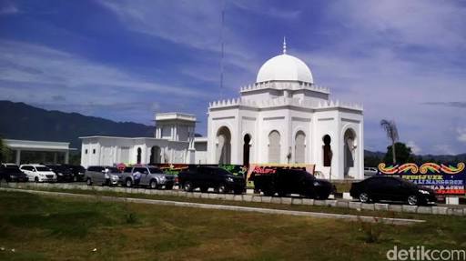
Mosque nearby Mushalla Al Azhar
Indonesia
Mosque nearby Mushalla Al Azhar
Mushalla Al Azhar
Peurada Indonesia
contacts phone
:
+62
Latitude:
5.5696972
, Longitude:
95.3467004
read more
nearest Mosque
472 m
Masjid Al Badar
Baru City
Mosque
read more
649 m
Mushala Kantor Gubernur
Jeulingke
Mosque
read more
1.068 km
Nurul Ikhlas
Ie Masen Kaye Adang
Mosque
read more
1.075 km
Mushalla Nurul Ikhlas
Ie Masen Kaye Adang
Mosque
read more
1.161 km
Musalla BPK RI
Ie Masen Kaye Adang
Mosque
read more
1.358 km
Musalla Gramedia
Ie Masen Kaye Adang
Mosque
read more
1.538 km
Masjid Sabili Jannah
Gampong Doy,, Doi
Mosque
read more
2.462 km
Masjid Ar Rahman, kompleks Budha Tzu Chi
Panteriek
Mosque
read more
2.497 km
Masjid Berkubah Tembaga
Jalan Mayjen T. Hamzah Bendahara, Kuta Alam
Mosque
read more
2.497 km
Masjid Babuttaqwa XXI (Masjid Aspol Kuta Alam)
Jalan Mayjen T. Hamzah Bendahara, Kuta Alam
Mosque
read more
2.501 km
Masjid Babuttaqwa XI
Asrama POLRI Kuta Alam, Jl Teuku Hasan Dek, Kuta Alam
Mosque
read more
2.503 km
Masjid Baitul Allam
Jalan Potemereuhom No.13, Kuta Alam
Mosque
read more
2.513 km
Masjid Baitul 'Alam
Jalan Sultan Al Kahar, Kuta Alam
Mosque
read more
2.738 km
Jami 'Darussalam
Kopelma Darussalam
Mosque
read more
2.746 km
Masjid Dusun Surabaya
Ateuk Pahlawan
Mosque
read more
2.772 km
Masjid Al-Azhar
Kuta Alam
Mosque
read more
3.094 km
Masjid Cut Meutia
Ateuk Pahlawan
Mosque
read more
3.121 km
Masjid Tgk Chik di Tiro
Ateuk Pahlawan
Mosque
read more
3.241 km
Masjid Kesdam
Peunayong
Mosque
read more
3.48 km
Masjid Lancok
Lancok, Peuniti
Mosque
read more
3.569 km
Masjid Baitussalam
Ateuk Pahlawan
Mosque
read more
3.856 km
Mesjid Komplek Meuligo Gubernur Aceh
Peuniti
Mosque
read more
3.901 km
Masjid Baitul'adhim
Peuniti
Mosque
read more
3.941 km
Masjid AL-Qadar
Peuniti
Mosque
read more
4.079 km
Masjid Alfitrah
JL Nyak Adam Kamil II, Baiturrahman, Peuniti
Mosque
read more
📑
all categories
Accounting
Administrative area level 1
Administrative area level 2
Airport
Amusement park
Aquarium
Art gallery
Atm
Bakery
Bank
Bar
Beauty salon
Bicycle store
Book store
Bowling alley
Bus station
Cafe
Campground
Car dealer
Car rental
Car repair
Car wash
Casino
Cemetery
Church
City hall
Clothing store
Colloquial area
Convenience store
Courthouse
Dentist
Department store
Doctor
Electrician
Electronics store
Embassy
Finance
Fire station
Florist
Food
Funeral home
Furniture store
Gas station
General contractor
Grocery or supermarket
Gym
Hair care
Hardware store
Health
Hindu Temple
Home goods store
Hospital
Insurance agency
Intersection
Jewelry store
Laundry
Lawyer
Library
Liquor store
Local government office
Locality
Locksmith
Lodging
Meal delivery
Meal takeaway
Mosque
Movie rental
Movie theater
Moving company
Museum
Natural feature
Neighborhood
Night club
Painter
Park
Parking
Pet store
Pharmacy
Physiotherapist
Place of worship
Plumber
Point of interest
Police
Political
Post office
Premise
Real estate agency
Restaurant
Roofing contractor
Route
Rv park, camping
School
Shoe store
Shopping mall
Spa
Stadium
Storage
Store
Subpremise
Supermarket
Synagogue
Taxi stand
Train station
Transit station
Travel agency
University
Veterinary care
Zoo
administrative area level 3
administrative area level 4
administrative area level 5
sublocality level 1
↑