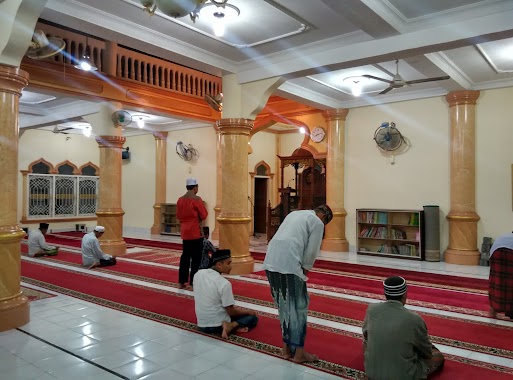
Mosque nearby Masjid Babuttaqwa XXI (Masjid Aspol Kuta Alam)
Indonesia
Mosque nearby Masjid Babuttaqwa XXI (Masjid Aspol Kuta Alam)
Masjid Babuttaqwa XXI (Masjid Aspol Kuta Alam)
Jalan Mayjen T. Hamzah Bendahara, Kuta Alam Indonesia
contacts phone
:
+62
Latitude:
5.5547327
, Longitude:
95.3298695
read more
nearest Mosque
2 m
Masjid Berkubah Tembaga
Jalan Mayjen T. Hamzah Bendahara, Kuta Alam
Mosque
read more
4 m
Masjid Babuttaqwa XI
Asrama POLRI Kuta Alam, Jl Teuku Hasan Dek, Kuta Alam
Mosque
read more
286 m
Masjid Baitul 'Alam
Jalan Sultan Al Kahar, Kuta Alam
Mosque
read more
287 m
Masjid Baitul Allam
Jalan Potemereuhom No.13, Kuta Alam
Mosque
read more
315 m
Masjid Dusun Surabaya
Ateuk Pahlawan
Mosque
read more
450 m
Musholla Dewan Perwakilan Rakyat Aceh
Kuta Alam
Mosque
read more
455 m
Masjid DPRA
Kuta Alam
Mosque
read more
468 m
Masjid Al-Azhar
Kuta Alam
Mosque
read more
494 m
Mushalla RS KESDAM
Kuta Alam
Mosque
read more
542 m
Masjid Baiturrahmah
Jalan Merpati No.17, Keuramat
Mosque
read more
598 m
Masjid Cut Meutia
Ateuk Pahlawan
Mosque
read more
626 m
Masjid Tgk Chik di Tiro
Ateuk Pahlawan
Mosque
read more
647 m
Mesjid As Syifa Kesdam Iskandar Muda
Kuta Alam
Mosque
read more
683 m
Masjid Al-Hayaat Labui
Dusun Labui Teladan, Gampong, Jalan Belibis, Ateuk Pahlawan
Mosque
read more
841 m
Masjid Al Huda
Jalan Mesjid Al Huda, Laksana
Mosque
read more
928 m
Masjid Baitul Kiram
Jalan Amaliah No.21, Peuniti
Mosque
read more
985 m
Masjid Lancok
Lancok, Peuniti
Mosque
read more
1.019 km
Masjid Raudhatul Jannah Pomdam IM
Peuniti
Mosque
read more
1.12 km
Masjid Baitussalam
Ateuk Pahlawan
Mosque
read more
1.163 km
Masjid Iskandar Muda
Mns. Mesjid Lamlhom, Lhoknga, Peuniti
Mosque
read more
1.167 km
Masjid Besar Pahlawan
Jalan TM Pahlawan, Peuniti
Mosque
read more
1.293 km
Masjid Al Anshar Kp. Mulia
Mulia
Mosque
read more
1.297 km
taman masjid raya baiturrahman
Kampung Baru
Mosque
read more
1.406 km
Masjid Al-Furqan
Jalan Tengku Abu Lam U No.5, Kampung Baru
Mosque
read more
1.528 km
Masjid Nurussalam
Peuniti
Mosque
read more
📑
all categories
Accounting
Administrative area level 1
Administrative area level 2
Airport
Amusement park
Aquarium
Art gallery
Atm
Bakery
Bank
Bar
Beauty salon
Bicycle store
Book store
Bowling alley
Bus station
Cafe
Campground
Car dealer
Car rental
Car repair
Car wash
Casino
Cemetery
Church
City hall
Clothing store
Colloquial area
Convenience store
Courthouse
Dentist
Department store
Doctor
Electrician
Electronics store
Embassy
Finance
Fire station
Florist
Food
Funeral home
Furniture store
Gas station
General contractor
Grocery or supermarket
Gym
Hair care
Hardware store
Health
Hindu Temple
Home goods store
Hospital
Insurance agency
Intersection
Jewelry store
Laundry
Lawyer
Library
Liquor store
Local government office
Locality
Locksmith
Lodging
Meal delivery
Meal takeaway
Mosque
Movie rental
Movie theater
Moving company
Museum
Natural feature
Neighborhood
Night club
Painter
Park
Parking
Pet store
Pharmacy
Physiotherapist
Place of worship
Plumber
Point of interest
Police
Political
Post office
Premise
Real estate agency
Restaurant
Roofing contractor
Route
Rv park, camping
School
Shoe store
Shopping mall
Spa
Stadium
Storage
Store
Subpremise
Supermarket
Synagogue
Taxi stand
Train station
Transit station
Travel agency
University
Veterinary care
Zoo
administrative area level 3
administrative area level 4
administrative area level 5
sublocality level 1
↑