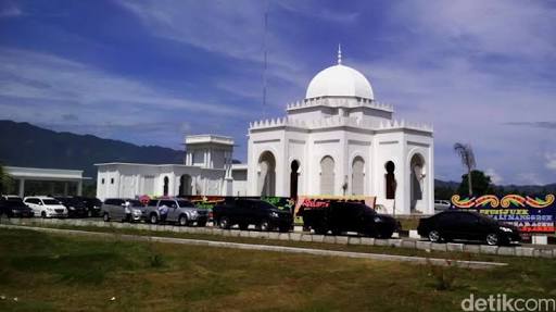
Mosque nearby Mushalla RS KESDAM
Indonesia
Mosque nearby Mushalla RS KESDAM
Mushalla RS KESDAM
Kuta Alam Indonesia
contacts phone
:
+62
Latitude:
5.5544457
, Longitude:
95.325419
read more
nearest Mosque
170 m
Masjid Al-Azhar
Kuta Alam
Mosque
read more
442 m
Masjid Tgk Chik di Tiro
Ateuk Pahlawan
Mosque
read more
490 m
Masjid Babuttaqwa XI
Asrama POLRI Kuta Alam, Jl Teuku Hasan Dek, Kuta Alam
Mosque
read more
805 m
taman masjid raya baiturrahman
Kampung Baru
Mosque
read more
873 m
Masjid Jami' Silang
Jalan Tengku Abu Lam U No.5, Kampung Baru
Mosque
read more
873 m
Masjid Bani Salim
Lampaseh Kota
Mosque
read more
873 m
Masjid Darul Falah
Jalan Tengku Abu Lam U No.5, Kampung Baru
Mosque
read more
932 m
Masjid Al-Furqan
Jalan Tengku Abu Lam U No.5, Kampung Baru
Mosque
read more
956 m
Masjid Madinatul Ilmi
Kampung Baru
Mosque
read more
959 m
Masjid Baitussalam
Ateuk Pahlawan
Mosque
read more
1.001 km
Mesjid Komplek Meuligo Gubernur Aceh
Peuniti
Mosque
read more
1.077 km
Masjid Baitul'adhim
Peuniti
Mosque
read more
1.087 km
Mesjid Kling
Kampung Baru
Mosque
read more
1.087 km
Masjid Darul Shalibin
Kampung Baru
Mosque
read more
1.087 km
Mushalla/Langgar Nurul Salami
Kampung Baru
Mosque
read more
1.087 km
Masjid Baitul Makbud
Kampung Baru
Mosque
read more
1.087 km
Masjid Al Faizzin
Kampung Baru
Mosque
read more
1.158 km
Masjid Asy-syifa
Peuniti
Mosque
read more
1.158 km
Masjid Darul Makmur
Peuniti
Mosque
read more
1.158 km
Masjid Babul Salamah
Peuniti
Mosque
read more
1.158 km
Masjid Jabal Nur
Peuniti
Mosque
read more
1.158 km
Masjid Babut Taqwa
Simpang Lhee, Manyak Prayed, Peuniti
Mosque
read more
1.158 km
Masjid Nurul Ikhlas
Peuniti
Mosque
read more
1.158 km
Masjid Nuruttarbiyah
Peuniti
Mosque
read more
1.158 km
Masjid Nurussalam
Peuniti
Mosque
read more
📑
all categories
Accounting
Administrative area level 1
Administrative area level 2
Airport
Amusement park
Aquarium
Art gallery
Atm
Bakery
Bank
Bar
Beauty salon
Bicycle store
Book store
Bowling alley
Bus station
Cafe
Campground
Car dealer
Car rental
Car repair
Car wash
Casino
Cemetery
Church
City hall
Clothing store
Colloquial area
Convenience store
Courthouse
Dentist
Department store
Doctor
Electrician
Electronics store
Embassy
Finance
Fire station
Florist
Food
Funeral home
Furniture store
Gas station
General contractor
Grocery or supermarket
Gym
Hair care
Hardware store
Health
Hindu Temple
Home goods store
Hospital
Insurance agency
Intersection
Jewelry store
Laundry
Lawyer
Library
Liquor store
Local government office
Locality
Locksmith
Lodging
Meal delivery
Meal takeaway
Mosque
Movie rental
Movie theater
Moving company
Museum
Natural feature
Neighborhood
Night club
Painter
Park
Parking
Pet store
Pharmacy
Physiotherapist
Place of worship
Plumber
Point of interest
Police
Political
Post office
Premise
Real estate agency
Restaurant
Roofing contractor
Route
Rv park, camping
School
Shoe store
Shopping mall
Spa
Stadium
Storage
Store
Subpremise
Supermarket
Synagogue
Taxi stand
Train station
Transit station
Travel agency
University
Veterinary care
Zoo
administrative area level 3
administrative area level 4
administrative area level 5
sublocality level 1
↑