Mosque nearby Masjid Pangkalan 2
Indonesia
Mosque nearby Masjid Pangkalan 2
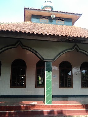
Masjid Pangkalan 2
Jalan Pangkalan 2 No.315, Cikiwul Indonesia
contacts phone
:
+62
Latitude:
-6.3320067
, Longitude:
106.9886801
read more
nearest Mosque
18 m
Masjid Nurul Amal
Jalan Pangkalan 2, Cikiwul
Mosque
read more
52 m
Ad-dyar
Jalan Pangkalan 2, Cikiwul
Mosque
read more
370 m
Mushola Al Kamilah
Cikiwul
Mosque
read more
544 m
Mushola Al-barkah
Unnamed Road, Cikiwul
Mosque
read more
624 m
Mushola At-taqwa
Jl. Kp. Padurenan baru Rt01/10, Padurenan
Mosque
read more
627 m
mushola At-Taqwa
Padurenan baru, RT.01/RW.10, Padurenan
Mosque
read more
674 m
masjid LDII adhiar
Jalan Raya Narogong No.91, Bantargebang
Mosque
read more
771 m
Mushola AL-AMANAH
Cikiwul
Mosque
read more
850 m
Masjid Al Wasilah
Jalan Kampung Cikiwul No.30, Cikiwul
Mosque
read more
861 m
Jami Masjid Nurul Hikmah
Jalan Rawa Tengah, Cikiwul
Mosque
read more
868 m
Masjid Alfajr
Jalan Raya Kota Wisata, Ciangsana
Mosque
read more
932 m
Masjid Nurul Falah
Blok Jambon No., Jalan Benda No.67, Padurenan
Mosque
read more
951 m
Masjid Jami Al Ikhlas
Jalan Raya Narogong, Bantargebang
Mosque
read more
975 m
Masjid Al- Ikhlas
Jalan Siliwangi No.79, RT.3/RW.5, Bantargebang
Mosque
read more
1.019 km
Masjid Al Wasilah
Jalan Cikiwul No.70, Cikiwul
Mosque
read more
1.019 km
Masjid Al Magfiroh
Jalan Cikiwul No.70, Cikiwul
Mosque
read more
1.036 km
Masjid Al Fudhola
Cikiwul, RT. 003 RW. 006, Bantargebang, Cikiwul
Mosque
read more
1.086 km
Mushola Miftahul Khair
Jalan Kampung Cikiwul No.105, Cikiwul
Mosque
read more
1.117 km
Mushola Miftahul Khoir
Jalan Kampung Cikiwul No.71, Cikiwul
Mosque
read more
1.261 km
Masjid ARMED
20,, Jalan Kampung Cikiwul No.19, Cikiwul
Mosque
read more
1.327 km
Masjid Al Fudhola
Jalan Gang Majlis Ta'lim No.46, Cikiwul
Mosque
read more
1.675 km
Mushola Daarul Mu'miniin
Bojong Kulur
Mosque
read more
1.926 km
masjid al-jihad
Jalan Pangkalan V No.7500, Ciketing Udik
Mosque
read more
2.005 km
Musholla Nurul Istiqomah
Jalan Kampung Ciketing Udik No.56, Ciketing Udik
Mosque
read more
2.659 km
Masjid Ta'lim Ar Ridwan
Jalan Caringin, Sumur Batu
Mosque
read more
📑
all categories
Accounting
Administrative area level 1
Administrative area level 2
Airport
Amusement park
Aquarium
Art gallery
Atm
Bakery
Bank
Bar
Beauty salon
Bicycle store
Book store
Bowling alley
Bus station
Cafe
Campground
Car dealer
Car rental
Car repair
Car wash
Casino
Cemetery
Church
City hall
Clothing store
Colloquial area
Convenience store
Courthouse
Dentist
Department store
Doctor
Electrician
Electronics store
Embassy
Finance
Fire station
Florist
Food
Funeral home
Furniture store
Gas station
General contractor
Grocery or supermarket
Gym
Hair care
Hardware store
Health
Hindu Temple
Home goods store
Hospital
Insurance agency
Intersection
Jewelry store
Laundry
Lawyer
Library
Liquor store
Local government office
Locality
Locksmith
Lodging
Meal delivery
Meal takeaway
Mosque
Movie rental
Movie theater
Moving company
Museum
Natural feature
Neighborhood
Night club
Painter
Park
Parking
Pet store
Pharmacy
Physiotherapist
Place of worship
Plumber
Point of interest
Police
Political
Post office
Premise
Real estate agency
Restaurant
Roofing contractor
Route
Rv park, camping
School
Shoe store
Shopping mall
Spa
Stadium
Storage
Store
Subpremise
Supermarket
Synagogue
Taxi stand
Train station
Transit station
Travel agency
University
Veterinary care
Zoo
administrative area level 3
administrative area level 4
administrative area level 5
sublocality level 1
↑