Mosque nearby Masjid Darul Arqom
Indonesia
Mosque nearby Masjid Darul Arqom
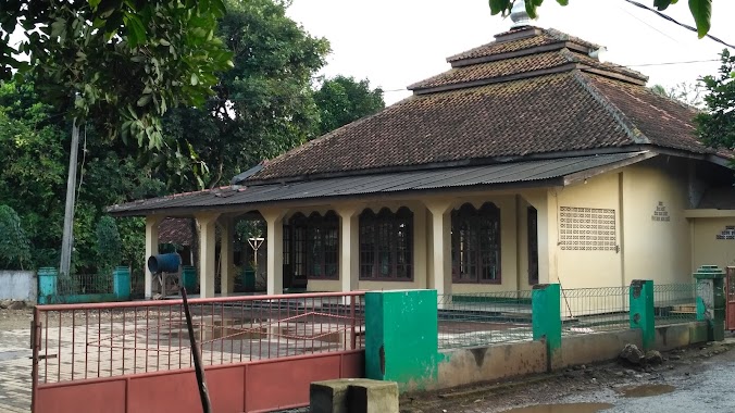
Masjid Darul Arqom
Jalan Cagak, 16710, Bogor, Jawa Barat, ID Indonesia
contacts phone
:
+62
Latitude:
-6.4405285
, Longitude:
106.9518413
larger map & directions
read more
nearest Mosque
316 m
Masjid Jami Al Isti'adah
Dayeuh
Mosque
read more
356 m
Masjid Daruttauhid
Klapanunggal
Mosque
read more
423 m
MUSHOLA AL-MUNAWARAH
Dayeuh
Mosque
read more
485 m
Masjid Jamie Al Hikmah
Jalan Raya Narogong, Klapanunggal
Mosque
read more
521 m
Masjid Jami Al Mubarokah
Klapanunggal
Mosque
read more
634 m
Masjid Jamie Al-Hidayah
Dayeuh
Mosque
read more
643 m
Mushola Al Ikhlash
Jalan Raya Klapanunggal, Klapanunggal
Mosque
read more
651 m
Mushola Al Wusto
Jalan Raya Klapanunggal, Klapanunggal
Mosque
read more
744 m
MASJID LDII KLAPANUNGGAL
Klp., Klapanunggal
Mosque
read more
780 m
Masjid Darusakinah
Jalan Raya Klapanunggal, Kembang Kuning
Mosque
read more
785 m
Mushola Darrut Taqwa
Klapanunggal
Mosque
read more
809 m
Masjid Al-Istiqomah
Jalan Raya Narogong No.438, Dayeuh
Mosque
read more
865 m
Musholla Nurul Iman
Klapanunggal
Mosque
read more
899 m
masjid Nurul Hidayah
Kembang Kuning
Mosque
read more
933 m
Masjid Jami Al-huda
jl kp sindanglengo rt 02 rw 03.. desa klapanunggal, kecamatan klapanunggal, Klapanunggal
Mosque
read more
952 m
Masjid Jami Al islah SindangLengo
Klp., Klapanunggal
Mosque
read more
963 m
Mushola Al Awabin Sindanglengo
Klapanunggal
Mosque
read more
1.087 km
Mushola Miftahul fallah
Jalan Raya Narogong No.438, Dayeuh
Mosque
read more
1.133 km
Masjid Jami' Nurul Amal
Unnamed Road, Klp. Nunggal, Kembang Kuning
Mosque
read more
1.147 km
Masjid Jami' Nurul Amal
Kp. Tegal, RT. 20 / 06, Kelapa Nunggal, Kembang Kuning
Mosque
read more
1.201 km
Masjid Al Barokah Ghoiru Jami' Cluster Bromo Klapanunggal
Dayeuh
Mosque
read more
1.201 km
Masjid Al Barokah Ghoiru Jami Grand Kahuripan Cluster Bromo X
Dayeuh
Mosque
read more
1.206 km
Musholla Nurul Hidayah
Klapanunggal
Mosque
read more
1.283 km
Masjid Al Muhajirin Cluster Kerinci
Klapanunggal
Mosque
read more
1.908 km
Masjid AT-TAQWA Coco Garden
Klapanunggal
Mosque
read more
📑
all categories
Accounting
Administrative area level 1
Administrative area level 2
Airport
Amusement park
Aquarium
Art gallery
Atm
Bakery
Bank
Bar
Beauty salon
Bicycle store
Book store
Bowling alley
Bus station
Cafe
Campground
Car dealer
Car rental
Car repair
Car wash
Casino
Cemetery
Church
City hall
Clothing store
Colloquial area
Convenience store
Courthouse
Dentist
Department store
Doctor
Electrician
Electronics store
Embassy
Finance
Fire station
Florist
Food
Funeral home
Furniture store
Gas station
General contractor
Grocery or supermarket
Gym
Hair care
Hardware store
Health
Hindu Temple
Home goods store
Hospital
Insurance agency
Intersection
Jewelry store
Laundry
Lawyer
Library
Liquor store
Local government office
Locality
Locksmith
Lodging
Meal delivery
Meal takeaway
Mosque
Movie rental
Movie theater
Moving company
Museum
Natural feature
Neighborhood
Night club
Painter
Park
Parking
Pet store
Pharmacy
Physiotherapist
Place of worship
Plumber
Point of interest
Police
Political
Post office
Premise
Real estate agency
Restaurant
Roofing contractor
Route
Rv park, camping
School
Shoe store
Shopping mall
Spa
Stadium
Storage
Store
Subpremise
Supermarket
Synagogue
Taxi stand
Train station
Transit station
Travel agency
University
Veterinary care
Zoo
administrative area level 3
administrative area level 4
administrative area level 5
sublocality level 1
↑