Local government office nearby Puskesmas Kelurahan Durentiga
Indonesia
Local government office nearby Puskesmas Kelurahan Durentiga
Puskesmas Kelurahan Durentiga
17, Jl Pancoran Tim 3 H Mahmud Raya, 12760, Kota Jakarta Selatan, Daerah Khusus Ibukota Jakarta, ID Indonesia
contacts phone
:
+62
Latitude:
-6.252544
, Longitude:
106.8468348
larger map & directions
read more
nearest Local government office
33 m
Puskesmas Dde Shakila
Jalan Pancoran Timur III No.19, RT.6, Duren Tiga
Local government office
read more
33 m
Puskesmas Dde Shakila
Jalan Pancoran Timur III No.19, RT.6/RW.4, Duren Tiga
Local government office
read more
301 m
SAMSAT KELILING STEKPI
Unnamed Road, RT.6/RW.4, Duren Tiga
Local government office
read more
329 m
Kantor Tupik Bia
Jalan Bina Harapan No.26, RT.5/RW.7, Duren Tiga
Local government office
read more
362 m
Sim Keliling Pos Kalibata
RT.6/RW.7, Duren Tiga
Local government office
read more
436 m
Cv. Sukses Berkah Mulia
# Gedung ILP Center 3rd Floor, Suite 307, Jln Raya Pasar Minggu 39A, RT.8/RW.9, Pancoran
Local government office
read more
516 m
Law Office Sapriyanto Refa & Associates
Ruko Grand Palace, Jalan Raya Pasar Minggu RT.4/RW.1, Pancoran
Local government office
read more
626 m
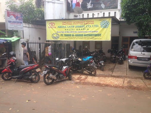
PT. Yanbu Al-Bahar
Jalan Pancoran Barat IV C No.22, RT.1/RW.6, Pancoran
Local government office
read more
627 m
PP.PBVSI
Ruko Graha Permata Pancoran Blok A10-D10 Kav.32, Jalan Raya Pasar Minggu RT.2/RW.4, Pancoran
Local government office
read more
732 m
sigit kusumawijaya | architect & urbandesigner
Jalan Raya Kalibata RT.9/RW.4, Rawajati
Local government office
read more
783 m
Kantor Kelurahan Pancoran
No., Jalan Pancoran Barat III No.55, RT.2/RW.4, Pancoran
Local government office
read more
791 m
M.SHOLIHIN TRAINER MENTOR BISNIS HNI HPAI ONLINE
Jl. Cikoko Barat Dalam I RT 001 RW 004 No. 12 Kelurahan Cikoko Kecamatan Pancoran 12770, RT.4/RW.3, Cikoko
Local government office
read more
796 m
Ragana Rajawali Siaga Bencana
Jalan Raya Pasar Minggu RT.1/RW.4, Pancoran
Local government office
read more
799 m
Syahputra Lubis SH & Associate
Jalan Rawajati Barat III No.34, RT.9/RW.4, Rawajati
Local government office
read more
871 m
Nasi Uduk Bang Djaru
Jalan Kalibata Timur IV No.2, RT.10/RW.8, Kalibata
Local government office
read more
881 m
Kelurahan Kalibata
Jalan Kalibata Timur IV No.19, RT.10/RW.8, Kalibata
Local government office
read more
905 m
PT Eraspasial Survey Teknologi
Jalan Raya Pasar Minggu No.28-c, RT.2/RW.RW
Local government office
read more
1.002 km
kantor sudin dpe
Jl. Letjen M.T. Haryono No.KAV52-53, Cikoko, Pancoran, Kota Jakarta Selatan, Daerah Khusus Ibukota Jakarta 12770, Jalan Letjen M.T. Haryono No.KAV52-53, RT.3/RW.4, Cikoko
Local government office
read more
1.045 km
IKAFE UNDIP (Ikatan Alumni Fakultas Ekonomi Universitas Diponegoro)
Blok, Jalan Pomad Blok Kko No.24, RT.1/RW.7, Kalibata
Local government office
read more
1.054 km
KUA Kec. Pancoran
Jalan Rawajati Barat No.5 Rt.6/Rw.4, Rawajati, Pancoran, RT.6/RW.4, Rawajati
Local government office
read more
1.157 km
DINAS PERHUBUNGAN JAKARTA SELATAN
RT.3/RW.3, Cikoko
Local government office
read more
1.164 km
Dept. of Transportation South Jakarta Administration City
Kavling 45-46, Mt Haryono RT.3/RW.3, Cikoko
Local government office
read more
1.266 km
Korlantas Polri SIM International
Jalan Letnan Jendral M.T. Haryono No.37-38, RT.8/RW.2, Cikoko
Local government office
read more
1.266 km
Korlantas Polri SIM International
Jalan Letnan Jendral M.T. Haryono No.37-38, Cikoko, Pancoran, RT.8/RW.2, Cikoko
Local government office
read more
1.301 km
puspitaherbal
Jl. MT Hayono, Kav. 52, cikoko, pancoran, RT.4/RW.2, Cikoko
Local government office
read more
📑
all categories
Accounting
Administrative area level 1
Administrative area level 2
Airport
Amusement park
Aquarium
Art gallery
Atm
Bakery
Bank
Bar
Beauty salon
Bicycle store
Book store
Bowling alley
Bus station
Cafe
Campground
Car dealer
Car rental
Car repair
Car wash
Casino
Cemetery
Church
City hall
Clothing store
Colloquial area
Convenience store
Courthouse
Dentist
Department store
Doctor
Electrician
Electronics store
Embassy
Finance
Fire station
Florist
Food
Funeral home
Furniture store
Gas station
General contractor
Grocery or supermarket
Gym
Hair care
Hardware store
Health
Hindu Temple
Home goods store
Hospital
Insurance agency
Intersection
Jewelry store
Laundry
Lawyer
Library
Liquor store
Local government office
Locality
Locksmith
Lodging
Meal delivery
Meal takeaway
Mosque
Movie rental
Movie theater
Moving company
Museum
Natural feature
Neighborhood
Night club
Painter
Park
Parking
Pet store
Pharmacy
Physiotherapist
Place of worship
Plumber
Point of interest
Police
Political
Post office
Premise
Real estate agency
Restaurant
Roofing contractor
Route
Rv park, camping
School
Shoe store
Shopping mall
Spa
Stadium
Storage
Store
Subpremise
Supermarket
Synagogue
Taxi stand
Train station
Transit station
Travel agency
University
Veterinary care
Zoo
administrative area level 3
administrative area level 4
administrative area level 5
sublocality level 1
↑