Local government office nearby Kantor Kelurahan Pancoran
Coronavirus disease (COVID-19) Situation
confirmed cases
6829221
deaths
162063
Indonesia
Local government office nearby Kantor Kelurahan Pancoran
Kantor Kelurahan Pancoran
55, Jalan Pancoran Barat III, 12780, Kota Jakarta Selatan, Daerah Khusus Ibukota Jakarta, ID Indonesien
contacts phone
:
+62
Latitude:
-6.2487333
, Longitude:
106.8408726
larger map & directions
read more
nearest Local government office
172 m
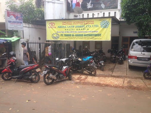
PT. Yanbu Al-Bahar
Jalan Pancoran Barat IV C No.22, RT.1/RW.6, Pancoran
Local government office
read more
181 m
PP.PBVSI
Ruko Graha Permata Pancoran Blok A10-D10 Kav.32, Jalan Raya Pasar Minggu RT.2/RW.4, Pancoran
Local government office
read more
264 m
Kantor BPJS Kesehatan
Jalan Raya Pasar Minggu No.17, RT.8/RW.9, Pancoran
Local government office
read more
269 m
Ragana Rajawali Siaga Bencana
Jalan Raya Pasar Minggu RT.1/RW.4, Pancoran
Local government office
read more
320 m
Law Office Sapriyanto Refa & Associates
Ruko Grand Palace, Jalan Raya Pasar Minggu RT.4/RW.1, Pancoran
Local government office
read more
365 m
Cv. Sukses Berkah Mulia
# Gedung ILP Center 3rd Floor, Suite 307, Jln Raya Pasar Minggu 39A, RT.8/RW.9, Pancoran
Local government office
read more
487 m
PT Eraspasial Survey Teknologi
Jalan Raya Pasar Minggu No.28-c, RT.2/RW.RW
Local government office
read more
685 m
Kantor Tupik Bia
Jalan Bina Harapan No.26, RT.5/RW.7, Duren Tiga
Local government office
read more
723 m
Puskesmas Kelurahan Tegal Parang
Jalan Mampang Prapatan XI No.28, RT.7/RW.4, Tegal Parang
Local government office
read more
723 m
Puskesmas Tegal Parang
Jalan Mampang Prapatan XI No.28, RT.7/RW.4, Tegal Parang
Local government office
read more
762 m
Puskesmas Dde Shakila
Jalan Pancoran Timur III No.19, RT.6/RW.4, Duren Tiga
Local government office
read more
762 m
Puskesmas Dde Shakila
Jalan Pancoran Timur III No.19, RT.6, Duren Tiga
Local government office
read more
783 m
Puskesmas Kelurahan Durentiga
Jl Pancoran Tim 3 H Mahmud Raya No.17, RT.8/RW.4, Duren Tiga
Local government office
read more
858 m
PLN
Gang H Asmawi No.40, RT.8/RW.1, Duren Tiga
Local government office
read more
903 m
Sim Keliling Pos Kalibata
RT.6/RW.7, Duren Tiga
Local government office
read more
918 m
Bidakara Tower
Jalan Rasamala Raya No.9, RT.10/RW.8, Menteng Dalam
Local government office
read more
929 m
Paviliun Provinsi
Lt. 12, Jl. Jend. Gatot Subroto Kav.94, Jakarta 12780, RT.11/RW.3, Pancoran
Local government office
read more
948 m
PT. Patendo Indonesia Internasional
SME Tower 10th Floor, Jalan Jend. Gatot Subroto Kav. 94, RT.11/RW.3, Pancoran
Local government office
read more
996 m
Paviliun Provinsi
Smesco Tower Kav. 94, Jalan Gatot Subroto RT.11/RW.3, Pancoran
Local government office
read more
1.004 km
Angkringan 843
RT.2/RW.5, Tegal Parang
Local government office
read more
1.083 km
SAMSAT KELILING STEKPI
Unnamed Road, RT.6/RW.4, Duren Tiga
Local government office
read more
1.085 km
PT. Boleh Net Indonesia Operation
Jalan Mampang Prapatan XVIII No.24, RT.8/RW.5, Duren Tiga
Local government office
read more
1.088 km
kantor sudin dpe
Jl. Letjen M.T. Haryono No.KAV52-53, Cikoko, Pancoran, Kota Jakarta Selatan, Daerah Khusus Ibukota Jakarta 12770, Jalan Letjen M.T. Haryono No.KAV52-53, RT.3/RW.4, Cikoko
Local government office
read more
1.095 km
kantor Sudin Perindustrian dan Energi Kab. Kep. Aeribu
Jalan Letjen M.T. Haryono No. Kav 52-53, Cikoko, Pancoran, RT.3/RW.4, Cikoko
Local government office
read more
1.206 km
Malahanum Ibrahim Dan Partners Law Firm
OH Centre No 69, Jalan Tebet Barat Dalam Raya RT.2/RW.5, Tebet Barat
Local government office
read more
📑
all categories
Accounting
Administrative area level 1
Administrative area level 2
Airport
Amusement park
Aquarium
Art gallery
Atm
Bakery
Bank
Bar
Beauty salon
Bicycle store
Book store
Bowling alley
Bus station
Cafe
Campground
Car dealer
Car rental
Car repair
Car wash
Casino
Cemetery
Church
City hall
Clothing store
Colloquial area
Convenience store
Courthouse
Dentist
Department store
Doctor
Electrician
Electronics store
Embassy
Finance
Fire station
Florist
Food
Funeral home
Furniture store
Gas station
General contractor
Grocery or supermarket
Gym
Hair care
Hardware store
Health
Hindu Temple
Home goods store
Hospital
Insurance agency
Intersection
Jewelry store
Laundry
Lawyer
Library
Liquor store
Local government office
Locality
Locksmith
Lodging
Meal delivery
Meal takeaway
Mosque
Movie rental
Movie theater
Moving company
Museum
Natural feature
Neighborhood
Night club
Painter
Park
Parking
Pet store
Pharmacy
Physiotherapist
Place of worship
Plumber
Point of interest
Police
Political
Post office
Premise
Real estate agency
Restaurant
Roofing contractor
Route
Rv park, camping
School
Shoe store
Shopping mall
Spa
Stadium
Storage
Store
Subpremise
Supermarket
Synagogue
Taxi stand
Train station
Transit station
Travel agency
University
Veterinary care
Zoo
administrative area level 3
administrative area level 4
administrative area level 5
sublocality level 1
↑