Cafe nearby Warung Seblak Teh Ratna
Indonesia
Cafe nearby Warung Seblak Teh Ratna
Warung Seblak Teh Ratna
Kembang Kuning Indonesien
contacts phone
:
+62
Latitude:
-6.4402503
, Longitude:
106.9418534
read more
nearest Cafe
258 m
Kedai Haikal
Jalan Raya Narogong, Kembang Kuning
Cafe
read more
458 m
warkop ABAH ONI
Kembang Kuning
Cafe
read more
465 m
Nitro's Cafe & Coffee Shop
Jalan Raya Narogong, Kembang Kuning
Cafe
read more
590 m
Ice Cappucino Cincau Barokah
Klapanunggal
Cafe
read more
610 m
Angkringan Om Ryan Klaten
Jalan Raya Klapanunggal No.2, Klapanunggal
Cafe
read more
706 m
warkop BERNARD
Jalan Pancasila V, Cicadas
Cafe
read more
714 m
Kedai Tugu
Unnamed Road, Klp. Nunggal, 16710, Kembang Kuning
Cafe
read more
716 m
Cafe Alam
Cicadas
Cafe
read more
717 m
Warung Babeh Roni
Cicadas
Cafe
read more
767 m
Warung Jambu Kuningan
Cicadas
Cafe
read more
772 m
Icha Gado"ketoprak Karedok
Klp., Kembang Kuning
Cafe
read more
819 m
Warkop Wahyu
Jalan Klapa Nunggal-Bojong, Cikahuripan, Kelapa Nunggal, Kembang Kuning
Cafe
read more
842 m
Warung Grab Jampang
Jalan Desa Cicadas No.65, Cicadas
Cafe
read more
932 m
Waroeng Naskun Bejjo
Jalan Desa Cicadas No.65, Cicadas
Cafe
read more
936 m
Warkop Kuningan
Unnamed Road, Cicadas
Cafe
read more
979 m
WARUNG MAMAH CREATIVITY
Cicadas
Cafe
read more
1.033 km
Kantin Mba Atun
Klp., Klapanunggal
Cafe
read more
1.086 km
Warung Teh Inggit
Klapanunggal
Cafe
read more
1.273 km
Cafe Mak Inem
Dayeuh
Cafe
read more
1.289 km
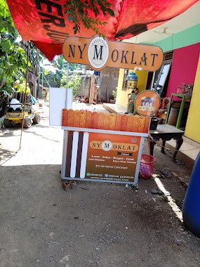
nyMoklat cabang parung Tanjung
Jalan Haji Muhidin, Cicadas
Cafe
read more
1.59 km
Warung Kopi Jail
Cicadas
Cafe
read more
1.597 km
Warung Seblak Ibu Alma
Klp., Kembang Kuning
Cafe
read more
1.861 km
mba mendoan wedang jahe
Cicadas
Cafe
read more
1.913 km
Nasi Kuning Aspek
Jalan Raya Narogong No.117, Dayeuh
Cafe
read more
2.09 km
Warung Pelangi
Cicadas
Cafe
read more
📑
all categories
Accounting
Administrative area level 1
Administrative area level 2
Airport
Amusement park
Aquarium
Art gallery
Atm
Bakery
Bank
Bar
Beauty salon
Bicycle store
Book store
Bowling alley
Bus station
Cafe
Campground
Car dealer
Car rental
Car repair
Car wash
Casino
Cemetery
Church
City hall
Clothing store
Colloquial area
Convenience store
Courthouse
Dentist
Department store
Doctor
Electrician
Electronics store
Embassy
Finance
Fire station
Florist
Food
Funeral home
Furniture store
Gas station
General contractor
Grocery or supermarket
Gym
Hair care
Hardware store
Health
Hindu Temple
Home goods store
Hospital
Insurance agency
Intersection
Jewelry store
Laundry
Lawyer
Library
Liquor store
Local government office
Locality
Locksmith
Lodging
Meal delivery
Meal takeaway
Mosque
Movie rental
Movie theater
Moving company
Museum
Natural feature
Neighborhood
Night club
Painter
Park
Parking
Pet store
Pharmacy
Physiotherapist
Place of worship
Plumber
Point of interest
Police
Political
Post office
Premise
Real estate agency
Restaurant
Roofing contractor
Route
Rv park, camping
School
Shoe store
Shopping mall
Spa
Stadium
Storage
Store
Subpremise
Supermarket
Synagogue
Taxi stand
Train station
Transit station
Travel agency
University
Veterinary care
Zoo
administrative area level 3
administrative area level 4
administrative area level 5
sublocality level 1
↑