Cafe nearby Waroeng Naskun Bejjo
Indonesia
Cafe nearby Waroeng Naskun Bejjo
Waroeng Naskun Bejjo
65, Jalan Desa Cicadas, 16964, Bogor, Jawa Barat, ID Indonesien
contacts phone
:
+62 896-8598-5014
Latitude:
-6.4377501
, Longitude:
106.9337987
larger map & directions
read more
nearest Cafe
91 m
Warung Grab Jampang
Jalan Desa Cicadas No.65, Cicadas
Cafe
read more
166 m
Warung Jambu Kuningan
Cicadas
Cafe
read more
293 m
WARUNG MAMAH CREATIVITY
Cicadas
Cafe
read more
295 m
Cafe Alam
Cicadas
Cafe
read more
298 m
Warung Babeh Roni
Cicadas
Cafe
read more
328 m
Warpas (Uduk Pagi)
Jalan Desa Cicadas No.59, Cicadas
Cafe
read more
368 m
Uduk Mang Nein
Cicadas
Cafe
read more
381 m
warkop BERNARD
Jalan Pancasila V, Cicadas
Cafe
read more
383 m
Warkop Kuningan
Unnamed Road, Cicadas
Cafe
read more
448 m
Angkringan Doni
Jalan Desa Cicadas No.17, Cicadas
Cafe
read more
521 m
Baso Unyil 05
Cicadas, Gunung Putri, Cicadas
Cafe
read more
552 m
Warkop Putra Tasik
Unnamed Road, Cicadas
Cafe
read more
563 m
Warung Desy
Unnamed Road, Cicadas
Cafe
read more
564 m
Bakso Rudal Bang Kodir ( Cafe Pita )
Cicadas
Cafe
read more
587 m
Mes Tritunggal Adipratama
Cicadas
Cafe
read more
628 m
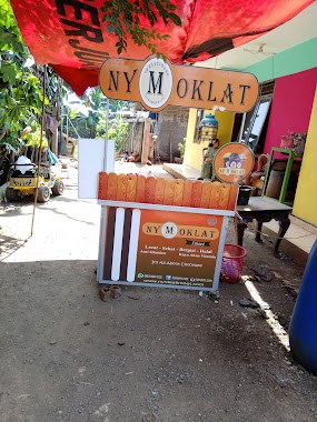
nyMoklat cabang parung Tanjung
Jalan Haji Muhidin, Cicadas
Cafe
read more
838 m
Kedai Haikal
Jalan Raya Narogong, Kembang Kuning
Cafe
read more
895 m
Susu Murni
Jalan Mercedes Benz No.23, Cicadas
Cafe
read more
910 m
WARMINDO (Warung Makan Indomie) Kuningan
Jalan Mercedes Benz No.22, Cicadas
Cafe
read more
929 m
Mendoan Wedang MBA
Cicadas
Cafe
read more
930 m
mba mendoan wedang jahe
Cicadas
Cafe
read more
932 m
Warung Seblak Teh Ratna
Kembang Kuning
Cafe
read more
982 m
Warkop Bu Earli Pt. Cii
Cicadas
Cafe
read more
982 m
Warkop Bu Earli Pt. Corinthian
Cicadas
Cafe
read more
1.101 km
Warkop Kabita
Cicadas
Cafe
read more
📑
all categories
Accounting
Administrative area level 1
Administrative area level 2
Airport
Amusement park
Aquarium
Art gallery
Atm
Bakery
Bank
Bar
Beauty salon
Bicycle store
Book store
Bowling alley
Bus station
Cafe
Campground
Car dealer
Car rental
Car repair
Car wash
Casino
Cemetery
Church
City hall
Clothing store
Colloquial area
Convenience store
Courthouse
Dentist
Department store
Doctor
Electrician
Electronics store
Embassy
Finance
Fire station
Florist
Food
Funeral home
Furniture store
Gas station
General contractor
Grocery or supermarket
Gym
Hair care
Hardware store
Health
Hindu Temple
Home goods store
Hospital
Insurance agency
Intersection
Jewelry store
Laundry
Lawyer
Library
Liquor store
Local government office
Locality
Locksmith
Lodging
Meal delivery
Meal takeaway
Mosque
Movie rental
Movie theater
Moving company
Museum
Natural feature
Neighborhood
Night club
Painter
Park
Parking
Pet store
Pharmacy
Physiotherapist
Place of worship
Plumber
Point of interest
Police
Political
Post office
Premise
Real estate agency
Restaurant
Roofing contractor
Route
Rv park, camping
School
Shoe store
Shopping mall
Spa
Stadium
Storage
Store
Subpremise
Supermarket
Synagogue
Taxi stand
Train station
Transit station
Travel agency
University
Veterinary care
Zoo
administrative area level 3
administrative area level 4
administrative area level 5
sublocality level 1
↑