Cafe nearby Warung RRI
Indonesia
Cafe nearby Warung RRI
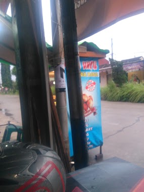
Warung RRI
Unnamed Road, Cikiwul, Bantargebang, Kota Bks, Jawa Barat 17152, Indonesia
contacts phone
:
+62
Latitude:
-6.3348428
, Longitude:
107.0009243
larger map & directions
read more
nearest Cafe
490 m
Waroeng Cipoh
Jalan Macem, Padurenan
Cafe
read more
500 m
Depot Capcin Kane
perum bhineka asri 1, Padurenan
Cafe
read more
541 m
Waroeng Santuy
Rt04 Rw03, Jalan Kampung Cikiwul, Cikiwul
Cafe
read more
587 m
Warkoo Ar Razzaq
Jalan Pangkalan 2 Rt 04 Rw 03 Bantar Gebang, Cikiwul
Cafe
read more
590 m
Warung Kopi Moga
dekat, Cikiwul
Cafe
read more
685 m
warung azril
Gang Ceria, Cikiwul
Cafe
read more
760 m
Warkop Pakde Aryono
BTR 5, Gang Bawang, Cimuning
Cafe
read more
763 m
Dapoer DIVA
cluster malachite BTR 3 M7, 8, Cimuning
Cafe
read more
769 m
Pancong Malibu
Jalan Pangkalan II, Cikiwul
Cafe
read more
817 m
Donut HIU
Sumur Batu
Cafe
read more
830 m
Pawon Mamah Ayra&Arsy
Jalan Malachite Raya, Cimuning
Cafe
read more
847 m
Mampir Mas
Jalan Pangkalan 2 No.36, Cikiwul
Cafe
read more
921 m
Kedai Seblak Teh Bohay
Cikiwul
Cafe
read more
946 m
Bakso Cak Tris Lumajang SAE
Padurenan
Cafe
read more
998 m
Seblak Teh Yeti
Cikiwul
Cafe
read more
1.017 km
Tempe Mendoan "Cah Slawi"
Jalan Pangkalan 2 No.45, Cikiwul
Cafe
read more
1.019 km
Sumurbatu Es kelapa
Jalan Pangkalan II No.4, Sumur Batu
Cafe
read more
1.063 km
Waroeng BIGPAPA
Jalan Alun-Alun Selatan No.48, Padurenan
Cafe
read more
1.11 km
Kiki & Ben Cafe
Kota Bekasi Blok No., Kota Bekasi Blok J3 No.53, Cimuning
Cafe
read more
1.162 km
Warung Mak Atam
Jalan Sakim, Padurenan
Cafe
read more
1.174 km
Seblak Hot Mamah Ainun
Jalan Benda No.88, Cikiwul
Cafe
read more
1.354 km
Fiorella Cassava Chips
Unnamed Road, Padurenan
Cafe
read more
1.69 km
Waroeng Wifi Baru
Jalan Cikiwul No.8, Cikiwul
Cafe
read more
1.815 km
Yagawa CAFE
Padurenan
Cafe
read more
2.22 km
Warkop Sadulur
Jalan Bekasi Timur Regensi Raya Blok b2 No.16, Cimuning
Cafe
read more
📑
all categories
Accounting
Administrative area level 1
Administrative area level 2
Airport
Amusement park
Aquarium
Art gallery
Atm
Bakery
Bank
Bar
Beauty salon
Bicycle store
Book store
Bowling alley
Bus station
Cafe
Campground
Car dealer
Car rental
Car repair
Car wash
Casino
Cemetery
Church
City hall
Clothing store
Colloquial area
Convenience store
Courthouse
Dentist
Department store
Doctor
Electrician
Electronics store
Embassy
Finance
Fire station
Florist
Food
Funeral home
Furniture store
Gas station
General contractor
Grocery or supermarket
Gym
Hair care
Hardware store
Health
Hindu Temple
Home goods store
Hospital
Insurance agency
Intersection
Jewelry store
Laundry
Lawyer
Library
Liquor store
Local government office
Locality
Locksmith
Lodging
Meal delivery
Meal takeaway
Mosque
Movie rental
Movie theater
Moving company
Museum
Natural feature
Neighborhood
Night club
Painter
Park
Parking
Pet store
Pharmacy
Physiotherapist
Place of worship
Plumber
Point of interest
Police
Political
Post office
Premise
Real estate agency
Restaurant
Roofing contractor
Route
Rv park, camping
School
Shoe store
Shopping mall
Spa
Stadium
Storage
Store
Subpremise
Supermarket
Synagogue
Taxi stand
Train station
Transit station
Travel agency
University
Veterinary care
Zoo
administrative area level 3
administrative area level 4
administrative area level 5
sublocality level 1
↑