Cafe nearby Warung Ato
Indonesia
Cafe nearby Warung Ato
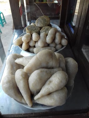
Warung Ato
Jalan Raya Pakuhaji, Sarakan Indonesia
contacts phone
:
+62
Latitude:
-6.1165942
, Longitude:
106.5845141
read more
nearest Cafe
434 m
Komeng Cafe
Pondok Jaya
Cafe
read more
547 m
Kedai Cihuy Paradise Park Sarakan
47, The Paradise Park Residence @ Sarakan Blok D, Sarakan
Cafe
read more
578 m
Cafe Noah
Gang Masjid Pisangan.Satu, Sarakan
Cafe
read more
672 m
Cafe Noah 3
paku aji sepatan, Jalan Raya Pakuhaji, Pisangan Jaya
Cafe
read more
684 m
Blue Paint iik House
Jl.Ojasikong No Berapa, gitu
Cafe
read more
746 m
Papeda Om Ares
km 1 sepatan kab., Jalan Kyai Haji Hasyim Ashari, Sepatan
Cafe
read more
837 m
warkop mia
Gang Veteran, Sepatan
Cafe
read more
853 m
Warung Gado Gado Mantap
Jalan Perum Villa Permata, Pondok Jaya
Cafe
read more
889 m
Kebab Buah
Jalan Raya Pakuhaji No.18, Sepatan
Cafe
read more
893 m
DADE.NET 3 (Warnet & Cafe)
Jalan Gatot Subroto No.172, Tanah Merah
Cafe
read more
902 m
MIE AYAM PO MAY
Sepatan
Cafe
read more
919 m
Martabak Telor & Bangka "A'laika Laka~Laka
Sepatan
Cafe
read more
919 m
Warung Mama Ayu
Jalan Raya Mauk No.90, Sepatan
Cafe
read more
943 m
Kedai Kopi COFFEE SPOT
Sepatan
Cafe
read more
945 m
Bakso Tulen Aa
Sepatan Residen Blok M No 02, RW.03, Sepatan
Cafe
read more
945 m
Bakso Tulen Aa
Sepatan Residen Blok M No 02, RW.03
Cafe
read more
950 m
trees vapor
Jalan Raya Mauk, Sepatan
Cafe
read more
988 m
Cafeketsu91
Unnamed Road, Sepatan
Cafe
read more
1.011 km
Pempek Palembang ABI Sepatan
Jalan Raya Mauk, Karet
Cafe
read more
1.016 km
Ds Cafe
Tim., Tanah Merah
Cafe
read more
1.038 km
TOKO BIMA
Blok H 17, Jalan Sukadiri, Kayu Bongkok
Cafe
read more
1.126 km
cafe sibual buali
Pondok Jaya
Cafe
read more
1.161 km
SUSU KEDELE MURNI,SKM
duta asri2, Pondok Jaya
Cafe
read more
1.166 km
Warung Lele.kremes.
Jalan Kebon Nangka, Pondok Jaya
Cafe
read more
1.304 km
Cafe Ladas
Unnamed Road, Pd. Jaya, 15520, Pondok Jaya
Cafe
read more
📑
all categories
Accounting
Administrative area level 1
Administrative area level 2
Airport
Amusement park
Aquarium
Art gallery
Atm
Bakery
Bank
Bar
Beauty salon
Bicycle store
Book store
Bowling alley
Bus station
Cafe
Campground
Car dealer
Car rental
Car repair
Car wash
Casino
Cemetery
Church
City hall
Clothing store
Colloquial area
Convenience store
Courthouse
Dentist
Department store
Doctor
Electrician
Electronics store
Embassy
Finance
Fire station
Florist
Food
Funeral home
Furniture store
Gas station
General contractor
Grocery or supermarket
Gym
Hair care
Hardware store
Health
Hindu Temple
Home goods store
Hospital
Insurance agency
Intersection
Jewelry store
Laundry
Lawyer
Library
Liquor store
Local government office
Locality
Locksmith
Lodging
Meal delivery
Meal takeaway
Mosque
Movie rental
Movie theater
Moving company
Museum
Natural feature
Neighborhood
Night club
Painter
Park
Parking
Pet store
Pharmacy
Physiotherapist
Place of worship
Plumber
Point of interest
Police
Political
Post office
Premise
Real estate agency
Restaurant
Roofing contractor
Route
Rv park, camping
School
Shoe store
Shopping mall
Spa
Stadium
Storage
Store
Subpremise
Supermarket
Synagogue
Taxi stand
Train station
Transit station
Travel agency
University
Veterinary care
Zoo
administrative area level 3
administrative area level 4
administrative area level 5
sublocality level 1
↑