Cafe nearby Cafeketsu91
Indonesia
Cafe nearby Cafeketsu91
Cafeketsu91
Unnamed Road, Sepatan, Tangerang, Banten 15520, Indonesien
contacts phone
:
+62 898-8184-046
Latitude:
-6.1183511
, Longitude:
106.5757497
larger map & directions
read more
nearest Cafe
30 m
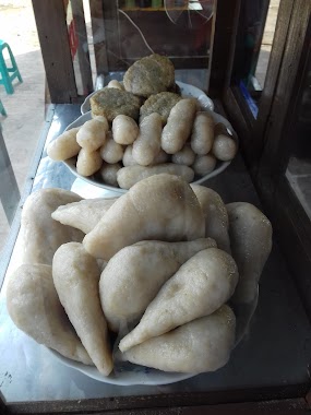
Pempek Palembang ABI Sepatan
Jalan Raya Mauk, Karet
Cafe
read more
38 m
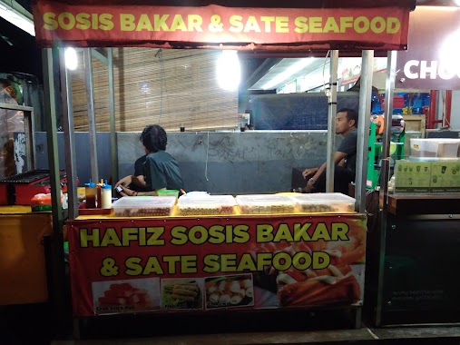
Hafiz Sosis Bakar Dan Sate Seafood
Jalan Raya Mauk No.428, Sepatan
Cafe
read more
55 m
Bakso Tulen Aa
Sepatan Residen Blok M No 02, RW.03, Sepatan
Cafe
read more
55 m
Bakso Tulen Aa
Sepatan Residen Blok M No 02, RW.03
Cafe
read more
115 m
Martabak Daffa
Sepatan
Cafe
read more
117 m
Kebab Buah
Jalan Raya Pakuhaji No.18, Sepatan
Cafe
read more
178 m
Kedai Kopi COFFEE SPOT
Sepatan
Cafe
read more
180 m
trees vapor
Jalan Raya Mauk, Sepatan
Cafe
read more
240 m
Pisang Nugget Boenda 2
Jl. Raya Mauk KM.11 No.12, Sepatan
Cafe
read more
440 m
TREES VAPOR
Jalan Raya Mauk No.22/23, Sepatan
Cafe
read more
552 m
warkop mia
Gang Veteran, Sepatan
Cafe
read more
733 m
POS POJOK
Pisangan Jaya
Cafe
read more
738 m
Kedai Debot
15520, Pisangan Jaya
Cafe
read more
747 m
Bubur Kacang Ijo Khas Madura
Pisangan Jaya
Cafe
read more
754 m
Auzka Motor Sports
Pisangan Jaya
Cafe
read more
823 m
Komeng Cafe
Pondok Jaya
Cafe
read more
980 m
Wisma OTNAY
Jalan Perum Villa Permata, Kuta Jaya
Cafe
read more
985 m
TOKO BIMA
Blok H 17, Jalan Sukadiri, Kayu Bongkok
Cafe
read more
988 m
Klimboys Fresh Milk
Jln. Permata Sepatan Raya Kelurahan Pisangan Jaya Kecamatan Sepatan Perumahan Permata Sepatan Blok B3 No.2
Cafe
read more
1.008 km
Warung Kangmas Waryo
15520, Pisangan Jaya
Cafe
read more
1.022 km
SOTO PERMATA TUNAS RASA
Jalan Ahmad Yani No.16, Pisangan Jaya
Cafe
read more
1.139 km
Warung Gado Gado Mantap
Jalan Perum Villa Permata, Pondok Jaya
Cafe
read more
1.203 km
Cafe Sleketep
Pisangan Jaya
Cafe
read more
1.239 km
Warbeck Coffee
Pisangan Jaya
Cafe
read more
1.259 km
Blue Paint iik House
Jl.Ojasikong No Berapa, gitu
Cafe
read more
📑
all categories
Accounting
Administrative area level 1
Administrative area level 2
Airport
Amusement park
Aquarium
Art gallery
Atm
Bakery
Bank
Bar
Beauty salon
Bicycle store
Book store
Bowling alley
Bus station
Cafe
Campground
Car dealer
Car rental
Car repair
Car wash
Casino
Cemetery
Church
City hall
Clothing store
Colloquial area
Convenience store
Courthouse
Dentist
Department store
Doctor
Electrician
Electronics store
Embassy
Finance
Fire station
Florist
Food
Funeral home
Furniture store
Gas station
General contractor
Grocery or supermarket
Gym
Hair care
Hardware store
Health
Hindu Temple
Home goods store
Hospital
Insurance agency
Intersection
Jewelry store
Laundry
Lawyer
Library
Liquor store
Local government office
Locality
Locksmith
Lodging
Meal delivery
Meal takeaway
Mosque
Movie rental
Movie theater
Moving company
Museum
Natural feature
Neighborhood
Night club
Painter
Park
Parking
Pet store
Pharmacy
Physiotherapist
Place of worship
Plumber
Point of interest
Police
Political
Post office
Premise
Real estate agency
Restaurant
Roofing contractor
Route
Rv park, camping
School
Shoe store
Shopping mall
Spa
Stadium
Storage
Store
Subpremise
Supermarket
Synagogue
Taxi stand
Train station
Transit station
Travel agency
University
Veterinary care
Zoo
administrative area level 3
administrative area level 4
administrative area level 5
sublocality level 1
↑