Cafe nearby Cafe Palanta Juice Rifki
Indonesia
Cafe nearby Cafe Palanta Juice Rifki
Cafe Palanta Juice Rifki
Sepatan Indonesia
contacts phone
:
+62
Latitude:
-6.124634
, Longitude:
106.5832709
read more
nearest Cafe
108 m
Warung Gado Gado Mantap
Jalan Perum Villa Permata, Pondok Jaya
Cafe
read more
240 m
TOKO BIMA
Blok H 17, Jalan Sukadiri, Kayu Bongkok
Cafe
read more
482 m
G - Arrow Cafe
Jalan Raya Mauk No.20, Sepatan
Cafe
read more
496 m
Komeng Cafe
Pondok Jaya
Cafe
read more
541 m
warkop mia
Gang Veteran, Sepatan
Cafe
read more
798 m
Martabak Telor & Bangka "A'laika Laka~Laka
Sepatan
Cafe
read more
870 m
Warung Lele.kremes.
Jalan Kebon Nangka, Pondok Jaya
Cafe
read more
899 m
Papeda Om Ares
km 1 sepatan kab., Jalan Kyai Haji Hasyim Ashari, Sepatan
Cafe
read more
919 m
Kedai Kopi COFFEE SPOT
Sepatan
Cafe
read more
920 m
trees vapor
Jalan Raya Mauk, Sepatan
Cafe
read more
978 m
Kebab Buah
Jalan Raya Pakuhaji No.18, Sepatan
Cafe
read more
1.001 km
cafe sibual buali
Pondok Jaya
Cafe
read more
1.048 km
Warung Oom
Mekar Jaya, Tangerang
Cafe
read more
1.056 km
Deni Melod
Mekar Jaya
Cafe
read more
1.085 km
Bakso Tulen Aa
Sepatan Residen Blok M No 02, RW.03
Cafe
read more
1.085 km
Bakso Tulen Aa
Sepatan Residen Blok M No 02, RW.03, Sepatan
Cafe
read more
1.085 km
Pempek Palembang ABI Sepatan
Jalan Raya Mauk, Karet
Cafe
read more
1.086 km
Cafeketsu91
Unnamed Road, Sepatan
Cafe
read more
1.098 km
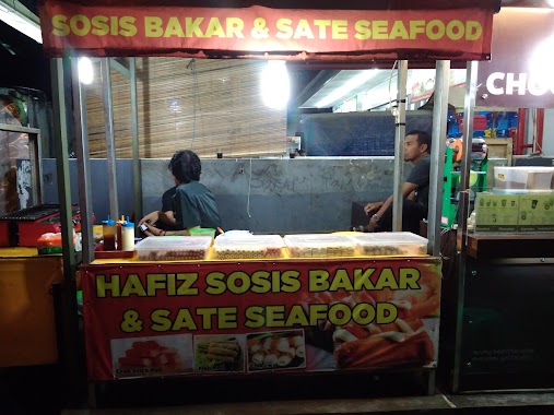
Hafiz Sosis Bakar Dan Sate Seafood
Jalan Raya Mauk No.428, Sepatan
Cafe
read more
1.159 km
Kuliner Lontong Sayur, Mie Ayam & Nasi Goreng
Sepatan
Cafe
read more
1.192 km
DADE.NET 3 (Warnet & Cafe)
Jalan Gatot Subroto No.172, Tanah Merah
Cafe
read more
1.2 km
Martabak Daffa
Sepatan
Cafe
read more
1.242 km
MIE AYAM PO MAY
Sepatan
Cafe
read more
1.267 km
Nasi Goreng Citar Tama
Sepatan
Cafe
read more
1.322 km
Pisang Nugget Boenda 2
Jl. Raya Mauk KM.11 No.12, Sepatan
Cafe
read more
📑
all categories
Accounting
Administrative area level 1
Administrative area level 2
Airport
Amusement park
Aquarium
Art gallery
Atm
Bakery
Bank
Bar
Beauty salon
Bicycle store
Book store
Bowling alley
Bus station
Cafe
Campground
Car dealer
Car rental
Car repair
Car wash
Casino
Cemetery
Church
City hall
Clothing store
Colloquial area
Convenience store
Courthouse
Dentist
Department store
Doctor
Electrician
Electronics store
Embassy
Finance
Fire station
Florist
Food
Funeral home
Furniture store
Gas station
General contractor
Grocery or supermarket
Gym
Hair care
Hardware store
Health
Hindu Temple
Home goods store
Hospital
Insurance agency
Intersection
Jewelry store
Laundry
Lawyer
Library
Liquor store
Local government office
Locality
Locksmith
Lodging
Meal delivery
Meal takeaway
Mosque
Movie rental
Movie theater
Moving company
Museum
Natural feature
Neighborhood
Night club
Painter
Park
Parking
Pet store
Pharmacy
Physiotherapist
Place of worship
Plumber
Point of interest
Police
Political
Post office
Premise
Real estate agency
Restaurant
Roofing contractor
Route
Rv park, camping
School
Shoe store
Shopping mall
Spa
Stadium
Storage
Store
Subpremise
Supermarket
Synagogue
Taxi stand
Train station
Transit station
Travel agency
University
Veterinary care
Zoo
administrative area level 3
administrative area level 4
administrative area level 5
sublocality level 1
↑