Bus station nearby Toko Crista
Indonesia
Bus station nearby Toko Crista
Toko Crista
Indonesia Indonesia
contacts phone
:
+62
Latitude:
-6.189426
, Longitude:
106.815593
read more
nearest Bus station
67 m
Halte Masjid Jami Al Ma'mur
Indonesia
Bus station
read more
160 m
Terminal Tanah Abang
Indonesia
Bus station
read more
314 m
Halte Rumah Susun
Indonesia
Bus station
read more
358 m
Halte Pasar Tanah Abang Blok G
Indonesia
Bus station
read more
364 m
Pasar Tanah Abang Blok F
Indonesia
Bus station
read more
551 m
Surya Jaya Hotel
Indonesia
Bus station
read more
573 m
Opposite Hotel Surya Jaya
Indonesia
Bus station
read more
634 m
Halte Daarul Aitam
Kb. Melati Sekertariat KS212), Jalan Kh. Mas Mansyur
Bus station
read more
639 m
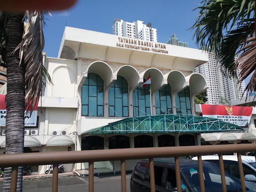
Yayasan Daarul Aitam Balai Pertemuan Yasmin- Perkantoran
Indonesia
Bus station
read more
719 m
Zacky Cell
Indonesia
Bus station
read more
772 m
CV. Surya Mas Express
Indonesia
Bus station
read more
801 m
Halte Bus SDN Kota Bambu
Jalan Ks. Tubun RT.4/RW.2, Kota Bambu Selatan
Bus station
read more
801 m
SD Negeri 3 Kota Bambu, Jl. Aipda KS Tubun
RT.4/RW.2, Kota Bambu Selatan
Bus station
read more
806 m
Halte Jatibaru Kapal Api
Indonesia
Bus station
read more
825 m
Halte PT. PLN Pusat Enjiniring Ketenagalistrikan
Indonesia
Bus station
read more
838 m
Pegadaian Petamburan
Indonesia
Bus station
read more
860 m
SMK Muhammadiyah 2 Jakarta
Indonesia
Bus station
read more
861 m
SPBU 34-10203
Indonesia
Bus station
read more
888 m
Opposite PLN Engineering, Jl.Kota Bambu
RT.1/RW.3, Kota Bambu Utara
Bus station
read more
937 m
Halte Jatibaru
Indonesia
Bus station
read more
976 m
Hyatt Indonesia, Jl. Mohammad Husni Thamrin
RT.9/RW.5, Gondangdia
Bus station
read more
1.101 km
Bank Indonesia
RT.11/RW.2, Gambir
Bus station
read more
1.173 km
Opposite Wisma Mandiri
Indonesia
Bus station
read more
1.246 km
Halte Imam Bonjol
Jalan Raya Imam Bonjol RT.1/RW.5, Menteng
Bus station
read more
1.289 km
Opposite UOB Plaza Thamrin, Jl. MH Thamrin
RT.11/RW.4, Menteng
Bus station
read more
📑
all categories
Accounting
Administrative area level 1
Administrative area level 2
Airport
Amusement park
Aquarium
Art gallery
Atm
Bakery
Bank
Bar
Beauty salon
Bicycle store
Book store
Bowling alley
Bus station
Cafe
Campground
Car dealer
Car rental
Car repair
Car wash
Casino
Cemetery
Church
City hall
Clothing store
Colloquial area
Convenience store
Courthouse
Dentist
Department store
Doctor
Electrician
Electronics store
Embassy
Finance
Fire station
Florist
Food
Funeral home
Furniture store
Gas station
General contractor
Grocery or supermarket
Gym
Hair care
Hardware store
Health
Hindu Temple
Home goods store
Hospital
Insurance agency
Intersection
Jewelry store
Laundry
Lawyer
Library
Liquor store
Local government office
Locality
Locksmith
Lodging
Meal delivery
Meal takeaway
Mosque
Movie rental
Movie theater
Moving company
Museum
Natural feature
Neighborhood
Night club
Painter
Park
Parking
Pet store
Pharmacy
Physiotherapist
Place of worship
Plumber
Point of interest
Police
Political
Post office
Premise
Real estate agency
Restaurant
Roofing contractor
Route
Rv park, camping
School
Shoe store
Shopping mall
Spa
Stadium
Storage
Store
Subpremise
Supermarket
Synagogue
Taxi stand
Train station
Transit station
Travel agency
University
Veterinary care
Zoo
administrative area level 3
administrative area level 4
administrative area level 5
sublocality level 1
↑