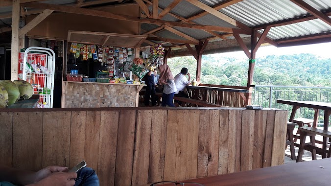
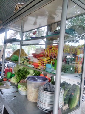
Cafe nearby Cafe & Karoke Bang YOS
Coronavirus disease (COVID-19) Situation
confirmed cases
6829221
deaths
162063
Indonesia
Cafe nearby Cafe & Karoke Bang YOS
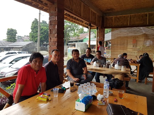
Cafe & Karoke Bang YOS
Jalan Bojongkoneng, 16810, Bogor, Jawa Barat, ID Indonezja
contacts phone
:
+62
Latitude:
-6.6069198
, Longitude:
106.9080562
larger map & directions
read more
nearest Cafe
566 m
cafe si bohay
Bojong Koneng
Cafe
read more
1.165 km
cafe CG
Jalan Gunung Batu, Bojong Koneng
Cafe
read more
1.228 km
cafe muskar
Jalan Sentul Paradise Park, Bojong Koneng
Cafe
read more
1.241 km
warung si manclik 1
Unnamed Road, Bojong Koneng
Cafe
read more
1.479 km
Warung Jurang 1
Jalan Raya Bojong Koneng, Bojong Koneng
Cafe
read more
1.488 km
warung kopi kita
Bojong Koneng
Cafe
read more
1.489 km
Warung Kita @lencob
warung kita @lencob bojong koneng, Bojong Koneng
Cafe
read more
1.489 km
Cafe Djawir
Bojong Koneng
Cafe
read more
1.504 km
Warkop Avatar
Jl. Lingkar Macan, Bojong Koneng
Cafe
read more
1.516 km
Contry Cafe
Jalan Airpanas, Karang Tengah
Cafe
read more
1.539 km
Waroeng ICELAND Sejati
Bojong Koneng
Cafe
read more
1.554 km
Warung Kebon Koneng Omah Mas Mbarep Sentul
Bojong Koneng
Cafe
read more
1.566 km
Green Caffe
Jalan Airpanas, Karang Tengah
Cafe
read more
1.573 km
HAMAREN Coffe Field 浜連コーヒー畑
Jalan Al Barokah, Megamendung
Cafe
read more
1.641 km
WARKOP #656#
Bojong Koneng
Cafe
read more
1.675 km
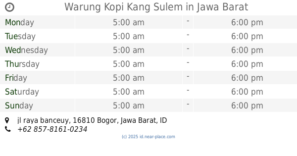
Warung Kopi Kang Sulem
jl raya banceuy, Bojong Koneng
Cafe
read more
1.799 km
Kedai Kopi Omah Omar Sentul
Jalan Gunung Batu, Cijayanti
Cafe
read more
1.799 km
"Kapsul Cafes"
Bojong Koneng
Cafe
read more
1.821 km
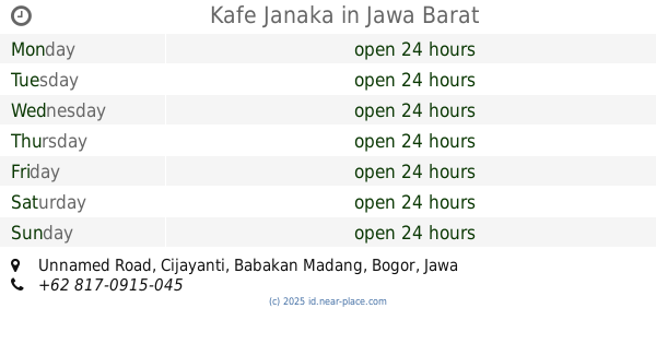
Kafe Janaka
Unnamed Road, Cijayanti
Cafe
read more
1.84 km
Warkop Amun
Jalan Sentul Paradise Park, Bojong Koneng
Cafe
read more
1.878 km
Kafe Bojong
Unnamed Road, Bojong Koneng
Cafe
read more
2.218 km
SIKUMANA
Unnamed Road, Cijayanti
Cafe
read more
2.587 km
Oji Pahroji
Bojong Koneng
Cafe
read more
2.595 km
Planet Noedle Cafe
Central Karang
Cafe
read more
2.683 km
Siboreg Butique & Coffee
Bojong Koneng
Cafe
read more
📑
all categories
Accounting
Administrative area level 1
Administrative area level 2
Airport
Amusement park
Aquarium
Art gallery
Atm
Bakery
Bank
Bar
Beauty salon
Bicycle store
Book store
Bowling alley
Bus station
Cafe
Campground
Car dealer
Car rental
Car repair
Car wash
Casino
Cemetery
Church
City hall
Clothing store
Colloquial area
Convenience store
Courthouse
Dentist
Department store
Doctor
Electrician
Electronics store
Embassy
Finance
Fire station
Florist
Food
Funeral home
Furniture store
Gas station
General contractor
Grocery or supermarket
Gym
Hair care
Hardware store
Health
Hindu Temple
Home goods store
Hospital
Insurance agency
Intersection
Jewelry store
Laundry
Lawyer
Library
Liquor store
Local government office
Locality
Locksmith
Lodging
Meal delivery
Meal takeaway
Mosque
Movie rental
Movie theater
Moving company
Museum
Natural feature
Neighborhood
Night club
Painter
Park
Parking
Pet store
Pharmacy
Physiotherapist
Place of worship
Plumber
Point of interest
Police
Political
Post office
Premise
Real estate agency
Restaurant
Roofing contractor
Route
Rv park, camping
School
Shoe store
Shopping mall
Spa
Stadium
Storage
Store
Subpremise
Supermarket
Synagogue
Taxi stand
Train station
Transit station
Travel agency
University
Veterinary care
Zoo
administrative area level 3
administrative area level 4
administrative area level 5
sublocality level 1
↑