Supermarket nearby Toko Ma Solih
Indonesia
Supermarket nearby Toko Ma Solih
Toko Ma Solih
Cipenjo, Cileungsi, Bogor, West Java 16820, Indonesia
contacts phone
:
+62
Latitude:
-6.3877668
, Longitude:
106.9937186
larger map & directions
read more
nearest Supermarket
310 m
Warung Mang Ape
Cipenjo
Supermarket
read more
353 m
Warung Ibnu Sina
Cipenjo
Supermarket
read more
406 m
Cuci Helm Syifa
Cipenjo
Supermarket
read more
432 m
Warung 24 Jam Kuningan .
Jalan Metland Cileungsi No.7, Cipenjo
Supermarket
read more
463 m
Toko Beras Mang Andi
Cipenjo
Supermarket
read more
479 m
Pangkas Rambut Berdikari
Jalan Metland Cileungsi No.8, Cipenjo
Supermarket
read more
488 m
Marsha Bakery
metland cileungsi sektor 6, blok fD 1 no 9,cipenjo, Kampung Parung Jambu, Cipenjo
Supermarket
read more
506 m
Toko Jaya Makmur
Unnamed Road, Cipenjo
Supermarket
read more
531 m
Waroeng Sembako Moerah
Cipenjo
Supermarket
read more
532 m
Toko Sembako Berkah Jaya
Jalan Metland Cileungsi No.4, Cipenjo
Supermarket
read more
551 m
DaviEgro.mart
Raya Blok CC2 No.39-40, Jalan Metland Cileungsi No.1, Cipenjo
Supermarket
read more
574 m
Tk Gp Jaya
Jalan Raya Kelapa Nunggal, Cipenjo
Supermarket
read more
579 m
Cuci Steam Mobil Hydraulic
Cipenjo
Supermarket
read more
583 m
Septiana Cookies
Cipenjo
Supermarket
read more
619 m
Tk Aulia Lubis
Cipenjo
Supermarket
read more
642 m
Agen Aqua Dan Gas Elpiji
Jalan Metland Cileungsi No.8, Cipenjo
Supermarket
read more
696 m
Toko Mm Raya
Cipenjo
Supermarket
read more
793 m
Pangkas garut cimora
Unnamed Road, Pasir Angin
Supermarket
read more
803 m
pangkas rambut garut cimora
Jalan Raya Cileungsi Setu, Pasir Angin
Supermarket
read more
887 m
AGAN GAS
Cipenjo
Supermarket
read more
974 m
Alfamart Harvest
Jalan Harvest City Boulevard, Cipenjo
Supermarket
read more
1.034 km
Alfamart
Jalan Metland Cileungsi, Cipenjo
Supermarket
read more
1.141 km
Pusat Kuota Internet Terlengkap
Jalan Mandor Senan, Cipenjo
Supermarket
read more
1.751 km
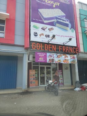
Golden France, Lapis Talas Bogor
Jalan Metland Transyogie, Cipenjo
Supermarket
read more
2.106 km
Toko Alamsyah
Unnamed Road, Pasir Angin
Supermarket
read more
📑
all categories
Accounting
Administrative area level 1
Administrative area level 2
Airport
Amusement park
Aquarium
Art gallery
Atm
Bakery
Bank
Bar
Beauty salon
Bicycle store
Book store
Bowling alley
Bus station
Cafe
Campground
Car dealer
Car rental
Car repair
Car wash
Casino
Cemetery
Church
City hall
Clothing store
Colloquial area
Convenience store
Courthouse
Dentist
Department store
Doctor
Electrician
Electronics store
Embassy
Finance
Fire station
Florist
Food
Funeral home
Furniture store
Gas station
General contractor
Grocery or supermarket
Gym
Hair care
Hardware store
Health
Hindu Temple
Home goods store
Hospital
Insurance agency
Intersection
Jewelry store
Laundry
Lawyer
Library
Liquor store
Local government office
Locality
Locksmith
Lodging
Meal delivery
Meal takeaway
Mosque
Movie rental
Movie theater
Moving company
Museum
Natural feature
Neighborhood
Night club
Painter
Park
Parking
Pet store
Pharmacy
Physiotherapist
Place of worship
Plumber
Point of interest
Police
Political
Post office
Premise
Real estate agency
Restaurant
Roofing contractor
Route
Rv park, camping
School
Shoe store
Shopping mall
Spa
Stadium
Storage
Store
Subpremise
Supermarket
Synagogue
Taxi stand
Train station
Transit station
Travel agency
University
Veterinary care
Zoo
administrative area level 3
administrative area level 4
administrative area level 5
sublocality level 1
↑