School nearby uswatun hasanah
Coronavirus disease (COVID-19) Situation
confirmed cases
6829221
deaths
162063
Indonesia
School nearby uswatun hasanah
uswatun hasanah
kp manceuri, Banyu Asih Indonesia
contacts phone
:
+62
Latitude:
-6.4898613
, Longitude:
106.5923
read more
nearest School
359 m
mis uswatun hasanah
Manceuri, Banyu Asih
School
read more
359 m
SD Manceuri
Banyu Asih
School
read more
866 m
MTs.SA
Banyu Asih
School
read more
1.042 km
SDN Banyuasih
Banyu Asih
School
read more
1.079 km
Sdn Cilangkap Cigudeg
Banyu Asih
School
read more
1.514 km
Yuen GLOBAL School
Unnamed Road, Tegalega
School
read more
1.514 km
Yuen GLOBAL School
Unnamed Road
School
read more
2.152 km
SDN Cijambe
Banyu Asih
School
read more
2.321 km
MIS uswatun hasanah
Unnamed Road, Banyu Asih
School
read more
2.436 km
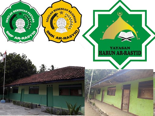
Yayasan Harun Ar-Rasyid PONDOK PESANTREN NURUL IMAN
Rabak
School
read more
2.537 km
Yayasan Harun Ar-Rasyid Rumpin
Jalan Muncang, Rabak
School
read more
2.748 km
MTS Insan Madani
Tegalega
School
read more
2.945 km
SD Handiwung
Rabak
School
read more
3.014 km
SDN Nunggaherang 01
Tegalega
School
read more
3.741 km
Madrasah Diniyah Miftahul Ula
Banyu Wangi
School
read more
3.751 km
Madrasah Ibtidaiyah Swasta Nurul Athfal ll
Kampung Cikasungka, Cigudeg, Desa Cigudeg, Banyu Wangi
School
read more
3.786 km
Madrasah Ibtidaiyah Swasta Mathlaul Anwar 04
Banyu Wangi
School
read more
3.904 km
Yayasan Harun Ar-Rasyid Rumpin Jl. muncang Kp. Palias Rabak Rumpin Bogor
Jalan Muncang, Rabak
School
read more
4.076 km
SDN Cikawung 02
Banyu Resmi
School
read more
4.209 km
PAUD BHAKTI ANANDA
Banyu Resmi
School
read more
4.516 km
Madrasah Ibtidaiyah Swasta (MIS) Mathlaul Anwar
Kampung Cilambur, Leuwibatu, Rumpin, Leuwibatu
School
read more
5.024 km
SDN kADUSEWU
Rabak
School
read more
5.173 km
SD NEGERI SAMPAY
Rabak
School
read more
5.775 km
Pondok Pesantren Ar-Riyadh Saung Habib
Kampung Sawah
School
read more
6.666 km
SD Negri 05 Kampung Sawah
Jl. Prada Samlawi Gg Haji Herdi Rt 005 Rw 003, Kampung Sawah
School
read more
📑
all categories
Accounting
Administrative area level 1
Administrative area level 2
Airport
Amusement park
Aquarium
Art gallery
Atm
Bakery
Bank
Bar
Beauty salon
Bicycle store
Book store
Bowling alley
Bus station
Cafe
Campground
Car dealer
Car rental
Car repair
Car wash
Casino
Cemetery
Church
City hall
Clothing store
Colloquial area
Convenience store
Courthouse
Dentist
Department store
Doctor
Electrician
Electronics store
Embassy
Finance
Fire station
Florist
Food
Funeral home
Furniture store
Gas station
General contractor
Grocery or supermarket
Gym
Hair care
Hardware store
Health
Hindu Temple
Home goods store
Hospital
Insurance agency
Intersection
Jewelry store
Laundry
Lawyer
Library
Liquor store
Local government office
Locality
Locksmith
Lodging
Meal delivery
Meal takeaway
Mosque
Movie rental
Movie theater
Moving company
Museum
Natural feature
Neighborhood
Night club
Painter
Park
Parking
Pet store
Pharmacy
Physiotherapist
Place of worship
Plumber
Point of interest
Police
Political
Post office
Premise
Real estate agency
Restaurant
Roofing contractor
Route
Rv park, camping
School
Shoe store
Shopping mall
Spa
Stadium
Storage
Store
Subpremise
Supermarket
Synagogue
Taxi stand
Train station
Transit station
Travel agency
University
Veterinary care
Zoo
administrative area level 3
administrative area level 4
administrative area level 5
sublocality level 1
↑