School nearby SDN Rajeg II
Indonesia
School nearby SDN Rajeg II
SDN Rajeg II
Rajeg, Tangerang, Banten 15540, Indonesia
contacts phone
:
+62
Latitude:
-6.10699
, Longitude:
106.5181
larger map & directions
read more
nearest School
11 m
SD RAJEG 1
Rajeg
School
read more
77 m
SMPN 2 Rajeg
Rajeg
School
read more
163 m
Paud Rajeg Rajawali
Jalan Raya Rajeg No.12, Rajeg Mulya
School
read more
197 m
Bimbel Delta Prima
Peum Rajeg Asri Blok A 7 No 02,, Rajeg
School
read more
210 m
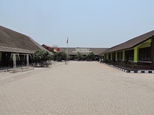
SDN Rajeg V
Rajeg
School
read more
381 m
Tk An Nuur
perum rajeg asri blok, Rajeg
School
read more
397 m
SD Negeri Tanjakan 1
JL Rajeg - Mauk, RT 08 RW 03, Kp. Tanjakan, Rajeg, Rajeg Mulya
School
read more
412 m
TK Indra Kemala
JL Raya Rajek Mauk, Rajek, Perumahan Puri Rajek Blok D2 No. 1, Rajeg
School
read more
459 m
PAUD Vania Islamic School
Perum Rajeg Asri Blok E4 No. 08, Rajeg
School
read more
473 m
TKQ AL-HUDA RAJEG
Jalan Raya Rajeg, Lembangsari
School
read more
477 m
BIMBEL UMMI
Asri B15/28,, Rajeg
School
read more
665 m
Kelompok Bermain Sofa Marwah
JL Siuntung, No. 88, Pesurungan Kidul, Lembangsari
School
read more
674 m
Lapangan Sepakbola Rajeg Asri
blok g4, rt.20, perum rajegasri, Rajeg
School
read more
674 m
Lapangan Sepak Bola
perum rajegasri blok g4 rt.20, Rajeg
School
read more
682 m
PONPES DARUL ARKHAM
Tanjakan
School
read more
729 m
LTQ KHOIRU MU'IN
Kavling Rajeg V Desa Rajeg RT 04/03, Rajeg
School
read more
782 m
MI Al Falahiyyah Rajeg
Jl Raya Ps. Mauk-Rajep No.01, Rajeg
School
read more
784 m
MI AL FALAHIYYAH RAJEG
Rajeg
School
read more
869 m
Majlis Ta'lim Alfalahiyah Rajeg
Jalan Raya Rajeg No.1, Sukamanah
School
read more
896 m
Pondok Pesantren Darussalam Abd.rohman Rajeg
Rajeg
School
read more
921 m
PAUD. Basar
Rajeg
School
read more
1.068 km
MAS AL-ITTIHADUL MUBAROK
Rajeg
School
read more
1.077 km
PONDOK PESANTREN AL-ITTIHADUL MUBAROK RAJEG
Kp. Rajeg tegal RT 03/03, Rajeg
School
read more
1.101 km
TK Citra Berkat
Ruko Vaporrete Blok A-4/9, JL. Taman Raya, Rajeg Mulya
School
read more
1.26 km
YPI Raudlatul 'Ulum
Lembangsari
School
read more
📑
all categories
Accounting
Administrative area level 1
Administrative area level 2
Airport
Amusement park
Aquarium
Art gallery
Atm
Bakery
Bank
Bar
Beauty salon
Bicycle store
Book store
Bowling alley
Bus station
Cafe
Campground
Car dealer
Car rental
Car repair
Car wash
Casino
Cemetery
Church
City hall
Clothing store
Colloquial area
Convenience store
Courthouse
Dentist
Department store
Doctor
Electrician
Electronics store
Embassy
Finance
Fire station
Florist
Food
Funeral home
Furniture store
Gas station
General contractor
Grocery or supermarket
Gym
Hair care
Hardware store
Health
Hindu Temple
Home goods store
Hospital
Insurance agency
Intersection
Jewelry store
Laundry
Lawyer
Library
Liquor store
Local government office
Locality
Locksmith
Lodging
Meal delivery
Meal takeaway
Mosque
Movie rental
Movie theater
Moving company
Museum
Natural feature
Neighborhood
Night club
Painter
Park
Parking
Pet store
Pharmacy
Physiotherapist
Place of worship
Plumber
Point of interest
Police
Political
Post office
Premise
Real estate agency
Restaurant
Roofing contractor
Route
Rv park, camping
School
Shoe store
Shopping mall
Spa
Stadium
Storage
Store
Subpremise
Supermarket
Synagogue
Taxi stand
Train station
Transit station
Travel agency
University
Veterinary care
Zoo
administrative area level 3
administrative area level 4
administrative area level 5
sublocality level 1
↑