School nearby SDN CIPARI
Indonesia
School nearby SDN CIPARI
SDN CIPARI
Jalan Babakan, 16710, Bogor, Jawa Barat, ID Indonesien
contacts phone
:
+62
Latitude:
-6.4411381
, Longitude:
106.976306
larger map & directions
read more
nearest School
22 m
SDN Cipari
Indonesia
School
read more
22 m
SDN Cipari
Indonesien
School
read more
243 m
Al Ikhlas Dermawan
Kahuripan mas
School
read more
263 m
al ikhlas dermawan
Cikahuripan
School
read more
515 m
Musola Merapi
Klp. 16710, Cikahuripan
School
read more
566 m
SMP Cikal Cendekia Islamic Fullday School
Jalan Mampir, Dayeuh
School
read more
589 m
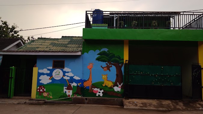
TK Az Zahra
Jl. Alternatif Perum Cikahuripan Mas - Perum Gren, Cikahuripan
School
read more
644 m
TKQ Plus Cahaya Mughni
Cikahuripan
School
read more
694 m
SDN Cikahuripan 01
Cikahuripan
School
read more
708 m
TK , PAUD , TPQ ATTamim
Dayeuh
School
read more
743 m
MTs ANNUR KLAPANUNGGAL
Cikahuripan
School
read more
830 m
Tk Anandita
perum bumi kahuripan indah, Cikahuripan
School
read more
868 m
SMK An-Nur Klapanunggal
Cikahuripan
School
read more
899 m
pesantren an nurriah
School
read more
944 m
MI.Annur Cikahuripan
Jalan Raya Klapanunggal RT. 14/ RW. 06, Cikahuripan, Kelapa Nunggal, Klapanunggal
School
read more
947 m
Paud An-Najwa
Jl. Raya Kelapa Nunggal, Kampung Cibeber RT 14 / RW 06, Kelapa Nunggal, Cikahuripan
School
read more
1.014 km
Majelis Dzikir RLA
Dayeuh
School
read more
1.124 km
TPQ BAITUSSALAM
cluster pangrango perumahan Grand Kahuripan, Dayeuh
School
read more
1.158 km
MIS. Yatalatop
Setu Sari
School
read more
1.225 km
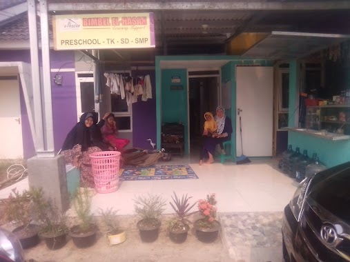
BIMBEL EL HASAN (TK,SD & SMP)
Jl. Raya Klapanunggal, Klapanunggal, Perumahan Puri Harmoni 9 Blok F3, Cikahuripan
School
read more
1.879 km
Pondok Pesantren Tahfidz Al-Husna
Cikahuripan
School
read more
1.891 km
Pondok Viga
Jalan Raya Klapanunggal No.69, Cikahuripan
School
read more
1.934 km
ponpes alfath
Cikahuripan
School
read more
1.95 km
MD Darussa'adah
Jalan Palasari - Bojong Sentul, Mampir
School
read more
2.101 km
SMAN 01 Klapanunggal
Jl. Terusan Bojong, RT 01 / RW 04, Klapanunggal
School
read more
📑
all categories
Accounting
Administrative area level 1
Administrative area level 2
Airport
Amusement park
Aquarium
Art gallery
Atm
Bakery
Bank
Bar
Beauty salon
Bicycle store
Book store
Bowling alley
Bus station
Cafe
Campground
Car dealer
Car rental
Car repair
Car wash
Casino
Cemetery
Church
City hall
Clothing store
Colloquial area
Convenience store
Courthouse
Dentist
Department store
Doctor
Electrician
Electronics store
Embassy
Finance
Fire station
Florist
Food
Funeral home
Furniture store
Gas station
General contractor
Grocery or supermarket
Gym
Hair care
Hardware store
Health
Hindu Temple
Home goods store
Hospital
Insurance agency
Intersection
Jewelry store
Laundry
Lawyer
Library
Liquor store
Local government office
Locality
Locksmith
Lodging
Meal delivery
Meal takeaway
Mosque
Movie rental
Movie theater
Moving company
Museum
Natural feature
Neighborhood
Night club
Painter
Park
Parking
Pet store
Pharmacy
Physiotherapist
Place of worship
Plumber
Point of interest
Police
Political
Post office
Premise
Real estate agency
Restaurant
Roofing contractor
Route
Rv park, camping
School
Shoe store
Shopping mall
Spa
Stadium
Storage
Store
Subpremise
Supermarket
Synagogue
Taxi stand
Train station
Transit station
Travel agency
University
Veterinary care
Zoo
administrative area level 3
administrative area level 4
administrative area level 5
sublocality level 1
↑