School nearby SD Neg 11
Indonesia
School nearby SD Neg 11
SD Neg 11
Jalan Kompleks Timah, 12430, Kota Jakarta Selatan, Daerah Khusus Ibukota Jakarta, ID Indonesia
contacts phone
:
+62
Latitude:
-6.3002264
, Longitude:
106.793265
larger map & directions
read more
nearest School
95 m
TK Cartapillar
Unnamed Road, RT.8/RW.4, Cilandak Barat
School
read more
143 m
Pre-School Raudah Ar-Radiah
Jalan Gunung Balong Raya No.13, RT.8/RW.4, Cilandak Barat
School
read more
383 m
KAPH
Jl. Lb. Bulus III, Lapak 12430, Gunung Balong RT.8/RW.4, Lebak Bulus
School
read more
385 m
Politeknik Kesehatan Perawatan Gigi
Jalan Gunung Balong Raya No.88, RT.8/RW.4, Cilandak Barat
School
read more
463 m
TK NEGERI CILANDAK 01
Jalan Pondok Labu IA No.40, RT.2/RW.7, Pondok Labu
School
read more
466 m
SDN Pondok Labu 16 Pagi
Jalan Pondok Labu IA, RT.2/RW.7, Pondok Labu, Cilandak
School
read more
468 m
TK SATU ATAP MELATI
Jalan Pondok Labu IA RT.2/RW.7, Pondok Labu
School
read more
547 m
Smp 12PGRI Pop
Jalan Pondok Labu I No.49, RT.2/RW.7, Pondok Labu
School
read more
626 m
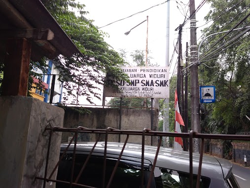
SLTP Keluarga Widuri
Jalan Gunung Balong I No.15, RT.9/RW.4, Lebak Bulus
School
read more
634 m
Suar Art Space
No., Jalan Lebak Bulus I No.55, RT.3/RW.4, Cilandak Barat
School
read more
718 m
Politeknik Kesehatan Kemenkes Jakarta I
Jalan Wijaya Kusuma No.47, RT.2/RW.4, Pondok Labu
School
read more
746 m
Taman Kanak - Kanak Keluarga Widuri
Jalan Gunung Balong I No.34, RT.9/RW.4, Lebak Bulus
School
read more
754 m
Sekolah Dasar Neger Pondok Labu
Jalan Rumah Sakit Fatmawati No.2, RT.4/RW.10, Pondok Labu
School
read more
762 m
Politeknik Kesehatan Jakarta I
Jalan Gunung Balong Raya No.1, RT.11/RW.4, Lebak Bulus
School
read more
765 m
SMK Family thistle
Jalan Gunung Balong I No.2, RT.9/RW.4, Lebak Bulus
School
read more
817 m
Madrasah Guru Somad
Jalan Haji Kamang No.24, RT.8/RW.10, Pondok Labu
School
read more
824 m
SD NEGERI 08
V, Jalan Taman Wijaya Kusuma RT.8/RW.4, Cilandak Barat
School
read more
838 m
BKB Lebah Madu
JL. Argaria, RW. 04, Pondok Labu, Komplek DDN-I, RT.4/RW.4, Pondok Labu
School
read more
874 m
Sekolah Dasar Negeri Pondok Labu 02 Pagi
Jalan Swakarya Bawah RT.3/RW.9, Pondok Labu
School
read more
902 m
Sekolah Widuri
Jalan Haji Kamang No.23, RT.8/RW.10, Pondok Labu
School
read more
973 m
Kinderland Pre-School - Bonavista
Jalan Bona Vista Raya Blok B. 5 No.52, RT.8/RW.6, Lebak Bulus
School
read more
982 m
Yayasan Al-Mahbubiyah
RT.4/RW.9, Cilandak Barat
School
read more
986 m
JAMZ SESSIONS
Jalan Haji Mandor RT.4/RW.2, Cilandak Barat
School
read more
1.042 km
Kampus Prasmul
Jalan Prasetiya Mulya Cilandak, Cilandak Barat, Cilandak, RT.14/RW.6, Cilandak Barat
School
read more
1.047 km
Flying Star Daycare & Preschool
Jalan Manunggal Jaya No.30, RT.7/RW.4, Lebak Bulus
School
read more
📑
all categories
Accounting
Administrative area level 1
Administrative area level 2
Airport
Amusement park
Aquarium
Art gallery
Atm
Bakery
Bank
Bar
Beauty salon
Bicycle store
Book store
Bowling alley
Bus station
Cafe
Campground
Car dealer
Car rental
Car repair
Car wash
Casino
Cemetery
Church
City hall
Clothing store
Colloquial area
Convenience store
Courthouse
Dentist
Department store
Doctor
Electrician
Electronics store
Embassy
Finance
Fire station
Florist
Food
Funeral home
Furniture store
Gas station
General contractor
Grocery or supermarket
Gym
Hair care
Hardware store
Health
Hindu Temple
Home goods store
Hospital
Insurance agency
Intersection
Jewelry store
Laundry
Lawyer
Library
Liquor store
Local government office
Locality
Locksmith
Lodging
Meal delivery
Meal takeaway
Mosque
Movie rental
Movie theater
Moving company
Museum
Natural feature
Neighborhood
Night club
Painter
Park
Parking
Pet store
Pharmacy
Physiotherapist
Place of worship
Plumber
Point of interest
Police
Political
Post office
Premise
Real estate agency
Restaurant
Roofing contractor
Route
Rv park, camping
School
Shoe store
Shopping mall
Spa
Stadium
Storage
Store
Subpremise
Supermarket
Synagogue
Taxi stand
Train station
Transit station
Travel agency
University
Veterinary care
Zoo
administrative area level 3
administrative area level 4
administrative area level 5
sublocality level 1
↑