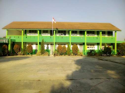
School nearby Saung Meditasi ARAMA
Indonesia
School nearby Saung Meditasi ARAMA
Saung Meditasi ARAMA
Lemo Indonesia
contacts phone
:
+62
Latitude:
-6.0439502
, Longitude:
106.6728919
read more
nearest School
57 m
Sekolah Dhammasekha Karuna
Gang Lemo, Lemo
School
read more
502 m
SDN 1 LEMO, TELUKNAG,TANGERANG
Lemo
School
read more
594 m
SMPS. Wahana Harapan
Tegal Angus
School
read more
786 m
Beksi Cahaya Tunggal
Unnamed Road, Tegal Angus
School
read more
835 m
SDN TEGALANGUS
SDN TEGALANGUS DESA TEGALANGUS KEC. KAB. POS 15510, Tegal Angus
School
read more
851 m
Madrasah Darur Ibtida
Gang.Kp.Tengah, Lemo
School
read more
854 m
SMP PGRI PANTURA TELUKNAGA
Jalan Raya Tanjung Pasir No.5, Tegal Angus
School
read more
895 m
BEKSI CAHAYA TUNGGAL
Jl. Tj. Pasir No No.5, sukamulya
School
read more
956 m
YPI Hidayaturrohman (MI, MTs, SMA Hiro)
Jalan Raya Tanjung Pasir No.5, Tegal Angus, Teluknaga, Tegal Angus
School
read more
979 m
SDN Muara 1
Muara
School
read more
986 m
mts hidayaturrohman
Jalan Raya Tanjung Pasir, Tegal Angus
School
read more
991 m
SD NEGERI MUARA 1
Gang Lemo, Lemo
School
read more
997 m
Ponpes Darussukri
Tegal Angus
School
read more
1.021 km
YAYASAN PENDIDIKAN ISLAM HIDAYATURROHMAN
Jalan Raya Tanjung Pasir No.32, Tegal Angus
School
read more
1.064 km
Sma HIRO Tanjung Pasir
Jalan Raya Tanjung Pasir No.5, Tegal Angus
School
read more
1.117 km
SD Negeri Gebang Raya 3
Jalan Pondok Makhur, Tegal Angus
School
read more
1.449 km
PONPES DAARUL MUKHTAR
Ketapang/KB.Kecap, Kampung Besar
School
read more
1.462 km
Kelompok Bermain Jamiatul Ulum
JL. Raya Kampung Besar, Tegal Angus
School
read more
1.586 km
SDN Kampung Besar III
Jalan Raya Kyai Haji Mushonif, Kampung Besar
School
read more
1.852 km
Smp Islam Bilingual Nihaayatuzzein
Jalan Raya Tanjung Pasir No.72, Tegal Angus
School
read more
1.896 km
PAUD/KB. AR-ROFI'IYYAH
006, Jalan Raya Kyai Haji Mushonif RT.12, Kampung Besar
School
read more
1.904 km
Sd Kampung Besar 2
Jalan Raya Kyai Haji Mushonif No.4, Kampung Besar
School
read more
2.033 km
Ypi Nurul Athfal
Kampung Besar
School
read more
2.262 km
SDN Kampung Besar I Dan II
Jalan Raya Kyai Haji Mushonif No.4, Kampung Besar
School
read more
2.262 km
SDN Kampung Besar I (Satu)
Jalan Raya Kyai Haji Mushonif No.4, Kampung Besar
School
read more
📑
all categories
Accounting
Administrative area level 1
Administrative area level 2
Airport
Amusement park
Aquarium
Art gallery
Atm
Bakery
Bank
Bar
Beauty salon
Bicycle store
Book store
Bowling alley
Bus station
Cafe
Campground
Car dealer
Car rental
Car repair
Car wash
Casino
Cemetery
Church
City hall
Clothing store
Colloquial area
Convenience store
Courthouse
Dentist
Department store
Doctor
Electrician
Electronics store
Embassy
Finance
Fire station
Florist
Food
Funeral home
Furniture store
Gas station
General contractor
Grocery or supermarket
Gym
Hair care
Hardware store
Health
Hindu Temple
Home goods store
Hospital
Insurance agency
Intersection
Jewelry store
Laundry
Lawyer
Library
Liquor store
Local government office
Locality
Locksmith
Lodging
Meal delivery
Meal takeaway
Mosque
Movie rental
Movie theater
Moving company
Museum
Natural feature
Neighborhood
Night club
Painter
Park
Parking
Pet store
Pharmacy
Physiotherapist
Place of worship
Plumber
Point of interest
Police
Political
Post office
Premise
Real estate agency
Restaurant
Roofing contractor
Route
Rv park, camping
School
Shoe store
Shopping mall
Spa
Stadium
Storage
Store
Subpremise
Supermarket
Synagogue
Taxi stand
Train station
Transit station
Travel agency
University
Veterinary care
Zoo
administrative area level 3
administrative area level 4
administrative area level 5
sublocality level 1
↑