School nearby MSUTQ Imam Syafi'i
Indonesia
School nearby MSUTQ Imam Syafi'i
MSUTQ Imam Syafi'i
jl. desa ciakar kampung cipari rt. 01/002 kel, Ciakar Indonesia
contacts phone
:
+62
Latitude:
-6.2666193
, Longitude:
106.5337687
read more
nearest School
135 m
MAJLIS TA'LIM NURUL JILAN
KP.CIPARI RT.01/02 DS, Ciakar
School
read more
476 m
Sekolah Lentera Harapan Permata Hati
Jalan Kayu Goen No.1, Ciakar
School
read more
528 m
TK Annisa 2
Ciakar
School
read more
590 m
Yayasan Cahaya Insani
Ciakar
School
read more
610 m
Sekolah Atis Dipamkara
Ciakar
School
read more
680 m
Sekolah Atisa Dipamkara - Baru
Jalan Raya Haji Mirza Cinde Lakoni, Ciakar
School
read more
729 m
biMBA AIUEO CIAKAR
Citra Raya Ruko Fiorenza Blok P17 NO, RT.03/RW.04, Ciakar
School
read more
745 m
KH Tigaraksa
Ciakar
School
read more
761 m
Paud,TK,Daycare AL-HIDAYAH
Green Sevilla V16/16, Citra Raya, Panongan, Ciakar
School
read more
774 m
SD Negeri Ciakar 1
Ciakar
School
read more
806 m
TK.Lentera Harapan
Jl.Segovia VI Blok S 6 No.1-6, Ciakar
School
read more
930 m
Daarut Tahfizh Ar Rohman
Ciakar
School
read more
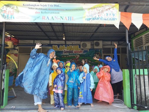
931 m
Ra An Nahl Segovia
Ciakar
School
read more
957 m
Sekolah Citra Bhakti Luhur
Indonesien
School
read more
966 m
Kursus Tangerang
Citra Raya Blvd, Ciakar
School
read more
999 m
Sekolah Citra Berkat
Jalan Akademia Raya Blok O - 03 No. 01, Citra Raya, Cikupa, Ciakar
School
read more
1.003 km
SITI AISAH BIMBEL (Pusat Bimbingan Belajar)
School
read more
1.01 km
School
Ciakar
School
read more
1.018 km
Kursus Pajak Tangerang
Ciakar
School
read more
1.033 km
Kursus Brevet AB Tangerang
Ciakar
School
read more
1.038 km
Kursus Komputer Tangerang
Ciakar
School
read more
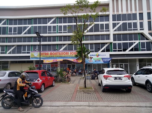
1.043 km
Citra Montessori School
Ciakar
School
read more
1.114 km
SMA Citra Berkat
Ciakar
School
read more
1.263 km
Cordova School
Panongan
School
read more
1.309 km
SDIT CORDOVA 2, SMPIT SMAIT
Jalan Pertamina No. 46, Desa Panongan, Kec. Panongan, Panongan
School
read more
📑
all categories
Accounting
Administrative area level 1
Administrative area level 2
Airport
Amusement park
Aquarium
Art gallery
Atm
Bakery
Bank
Bar
Beauty salon
Bicycle store
Book store
Bowling alley
Bus station
Cafe
Campground
Car dealer
Car rental
Car repair
Car wash
Casino
Cemetery
Church
City hall
Clothing store
Colloquial area
Convenience store
Courthouse
Dentist
Department store
Doctor
Electrician
Electronics store
Embassy
Finance
Fire station
Florist
Food
Funeral home
Furniture store
Gas station
General contractor
Grocery or supermarket
Gym
Hair care
Hardware store
Health
Hindu Temple
Home goods store
Hospital
Insurance agency
Intersection
Jewelry store
Laundry
Lawyer
Library
Liquor store
Local government office
Locality
Locksmith
Lodging
Meal delivery
Meal takeaway
Mosque
Movie rental
Movie theater
Moving company
Museum
Natural feature
Neighborhood
Night club
Painter
Park
Parking
Pet store
Pharmacy
Physiotherapist
Place of worship
Plumber
Point of interest
Police
Political
Post office
Premise
Real estate agency
Restaurant
Roofing contractor
Route
Rv park, camping
School
Shoe store
Shopping mall
Spa
Stadium
Storage
Store
Subpremise
Supermarket
Synagogue
Taxi stand
Train station
Transit station
Travel agency
University
Veterinary care
Zoo
administrative area level 3
administrative area level 4
administrative area level 5
sublocality level 1
↑