School nearby MDTA ISTIQOMATUL HUDA
Indonesia
School nearby MDTA ISTIQOMATUL HUDA
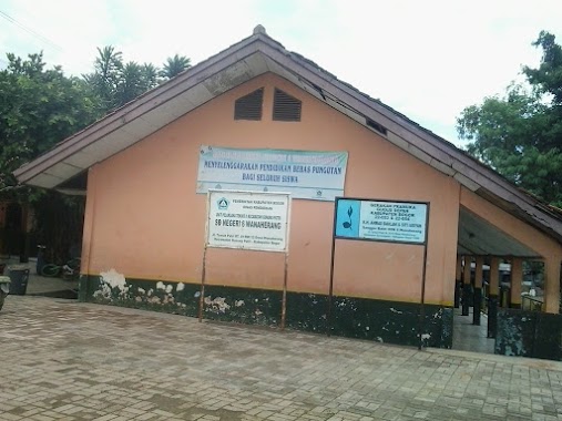
MDTA ISTIQOMATUL HUDA
Wanaherang, Gunung Putri, Bogor, West Java, Indonesien
contacts phone
:
+62
Latitude:
-6.4288342
, Longitude:
106.9468174
larger map & directions
read more
nearest School
22 m
RA Istiqomatul Huda
Dengdek Wanaherang Putri, Wanaherang
School
read more
40 m
TK.ISTIKOMATUL HUDA
Wanaherang
School
read more
243 m
MI Sirojul Athfal
dengdek, Wanaheranh, Gn. Putri, Wanaherang
School
read more
547 m
TKA Al-khoeriyah
Wanaherang
School
read more
759 m
PAUD ASSYIFA
kp parung dengdek, Jalan Barokah, Wanaherang
School
read more
915 m
Avicena Pharmacy SMKS Cileungsi
Dayeuh
School
read more
977 m
SD Negeri 2 Wanaherang
Jalan Melati Kampung Baru Rt 1 Rw 8, Wanaherang
School
read more
1.019 km
SMA Plus Darussalam Koposari
Wanaherang
School
read more
1.064 km
SMP Negeri 1 Gunung Putri
Jl. Melati VIII 34 RT 001 RW 08 Wanaherang Gunung Putri Kabupaten Bogor Jawa Barat, Tapos
School
read more
1.083 km
SMP Negeri 1 Gunung Putri
Wanaherang
School
read more
1.106 km
SMP NEGERI 1 GUNUNGPUTRI
Jalan Melati No.34, Wanaherang, Gunung Putri, Wanaherang
School
read more
1.199 km
Smp Al Furqon
Dayeuh
School
read more
1.225 km
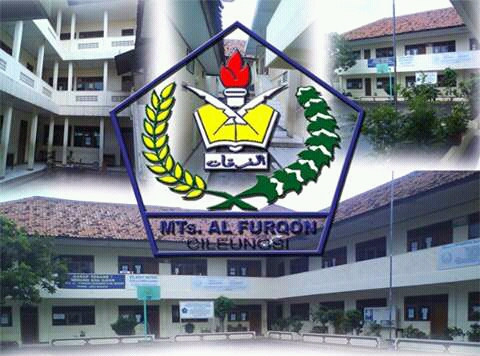
MTs. AL-FURQON KEC. CILEUNGSI
Dayeuh
School
read more
1.24 km
Ponpes Saadatuddaroen
Klp. Nunggal,, Jalan Raya Narogong No.117, Dayeuh
School
read more
1.251 km
MTS An Nizhamiyyah
Wanaherang
School
read more
1.279 km
TK AS SYIFA KLAPANUNGGAL
Ds. Klapanunggal rt 01/01 no.76
School
read more
1.279 km
TKA PLUS ASY-SYIFA
Klapanunggal
School
read more
1.291 km
SMK Bina Teknika
Dayeuh
School
read more
1.37 km
TKA TPA PLUS IKHWANI
Jalan Kampung Cicadas No.1, Cicadas
School
read more
1.397 km
Raudhatul Athfal (RA) Nurus Saadah
Kampung Dayeuh, RT. 04 RW. 01, Cileungsi, Dayeuh
School
read more
1.979 km
sdn wanaherang 6
Unnamed Road, Gn. Putri, 16965, Wanaherang
School
read more
2.092 km
SMP Ibnu Syina Cileungsi
Jalan cikadu, Dayeuh, Bogor
School
read more
2.117 km
TK. BINA AGAPE
Jalan Raya Narogong No.34, Cileungsi Kidul
School
read more
2.48 km
Musholla Al Mujahidin Haji Rahman Cikeas
PB pos one, jln mtz attosiah, Cikeas Udik
School
read more
2.622 km
sekolah sentra bagus
Jalan Adenium 2, Pasir Angin
School
read more
📑
all categories
Accounting
Administrative area level 1
Administrative area level 2
Airport
Amusement park
Aquarium
Art gallery
Atm
Bakery
Bank
Bar
Beauty salon
Bicycle store
Book store
Bowling alley
Bus station
Cafe
Campground
Car dealer
Car rental
Car repair
Car wash
Casino
Cemetery
Church
City hall
Clothing store
Colloquial area
Convenience store
Courthouse
Dentist
Department store
Doctor
Electrician
Electronics store
Embassy
Finance
Fire station
Florist
Food
Funeral home
Furniture store
Gas station
General contractor
Grocery or supermarket
Gym
Hair care
Hardware store
Health
Hindu Temple
Home goods store
Hospital
Insurance agency
Intersection
Jewelry store
Laundry
Lawyer
Library
Liquor store
Local government office
Locality
Locksmith
Lodging
Meal delivery
Meal takeaway
Mosque
Movie rental
Movie theater
Moving company
Museum
Natural feature
Neighborhood
Night club
Painter
Park
Parking
Pet store
Pharmacy
Physiotherapist
Place of worship
Plumber
Point of interest
Police
Political
Post office
Premise
Real estate agency
Restaurant
Roofing contractor
Route
Rv park, camping
School
Shoe store
Shopping mall
Spa
Stadium
Storage
Store
Subpremise
Supermarket
Synagogue
Taxi stand
Train station
Transit station
Travel agency
University
Veterinary care
Zoo
administrative area level 3
administrative area level 4
administrative area level 5
sublocality level 1
↑