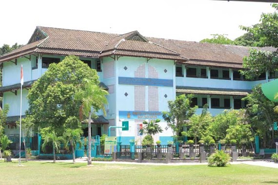
School nearby Ma'had Baitussunnah
Coronavirus disease (COVID-19) Situation
confirmed cases
6829221
deaths
162063
Indonesia
School nearby Ma'had Baitussunnah
Ma'had Baitussunnah
Jalan Gunung Steling, Gunung Samarinda Indonesia
contacts phone
:
+62
Latitude:
-1.2295429
, Longitude:
116.8515623
read more
nearest School
403 m
SD Negeri 30
JL Gunung Seteling, RT 033, Gunung Samarinda
School
read more
504 m
TK Happy Holy KIds
JL. Indra Killa, Rt. 032/06, Gn. Samarinda, Gunung Samarinda
School
read more
506 m
Star Education Center
Jalan Indrakila No.79, Gunung Samarinda
School
read more
533 m
Sekolah Dasar Negeri 022
Jalan Padat Karya RT.33, Gunung Samarinda
School
read more
607 m
PAUD GURINDA
Gang Wonomulyo No.Kel, RT.33/RW.No. 47, Gunung Samarinda
School
read more
685 m
KB Anak Kreatif
Jalan Gunung Steling, Gunung Samarinda
School
read more
832 m
Rumah Penitipan Anak Kusuma
JL. Indra Killa Gang Arjuna, RT. 13 RW. 053, Gunung Samarinda, Gunung Samarinda
School
read more
872 m
SDN 023
JL. Soekarno Hatta Straat VI RT.42, No.36, Batu Ampar
School
read more
923 m
SMA Patra Dharma
Unnamed Road, Gunung Samarinda
School
read more
934 m
Madrasah Ibtidaiyah Swasta Khoiru Ummah
Komplek Ramayana, Batu Ampar
School
read more
943 m
SMP ISLAM ISTIQAMAH
City, Gunung Samarinda
School
read more
958 m
Bintang Siswa Balikpapan 3
Jalan Soekarno Hatta No.25, Batu Ampar
School
read more
960 m
Smp 006 Balikpapan
Jalan Di Panjaitan, Gunung Samarinda
School
read more
967 m
Foreign Language Academy (Aba)
Jalan Indrakila, Gunung Samarinda
School
read more
970 m
SDN 023 Gunung Samarinda
Gunung Samarinda
School
read more
1000 m
Sekolah Menengah Kejuruan Nusantara Balikpapan
Jalan Gurinda IV Jalan Soekarno Hatta No.34, Gunung Samarinda
School
read more
1.025 km
School SMK Negeri 2 Balikpapan
Jl. Soekarno Hatta, Gunung Samarinda III, Gunung Samarinda, Balikpapan Utara, Gunung Samarinda
School
read more
1.048 km
Sekolah Kesehatan Nusantara Balikpapan
Jalan Gurinda IV, Gunung Samarinda
School
read more
1.05 km
Kelompok Bermain Fikri
Jalan Kapten Pattimura No.39, Batu Ampar
School
read more
1.056 km
SDN 030
JL. Tiga Dalam RT.36, No.01, Gunung Samarinda
School
read more
1.093 km
Sekolah Dasar Negeri 001 Balikpapan Utara
Jalan Indrakila RT.25, Gunung Samarinda
School
read more
1.097 km
SMPN 6 Balikpapan
Jalan Strat I, Gunung Samarinda
School
read more
1.113 km
SDN 019
Jalan Dua, Gunung Samarinda
School
read more
1.216 km
Elementary School 007 North Balikpapan
Jalan Staart 1 No.15, RT.56, Gunung Samarinda
School
read more
1.231 km
Sdn 031
JL. AW. Syahrani rt.2, No.53, Balikapapan, Batu Ampar
School
read more
📑
all categories
Accounting
Administrative area level 1
Administrative area level 2
Airport
Amusement park
Aquarium
Art gallery
Atm
Bakery
Bank
Bar
Beauty salon
Bicycle store
Book store
Bowling alley
Bus station
Cafe
Campground
Car dealer
Car rental
Car repair
Car wash
Casino
Cemetery
Church
City hall
Clothing store
Colloquial area
Convenience store
Courthouse
Dentist
Department store
Doctor
Electrician
Electronics store
Embassy
Finance
Fire station
Florist
Food
Funeral home
Furniture store
Gas station
General contractor
Grocery or supermarket
Gym
Hair care
Hardware store
Health
Hindu Temple
Home goods store
Hospital
Insurance agency
Intersection
Jewelry store
Laundry
Lawyer
Library
Liquor store
Local government office
Locality
Locksmith
Lodging
Meal delivery
Meal takeaway
Mosque
Movie rental
Movie theater
Moving company
Museum
Natural feature
Neighborhood
Night club
Painter
Park
Parking
Pet store
Pharmacy
Physiotherapist
Place of worship
Plumber
Point of interest
Police
Political
Post office
Premise
Real estate agency
Restaurant
Roofing contractor
Route
Rv park, camping
School
Shoe store
Shopping mall
Spa
Stadium
Storage
Store
Subpremise
Supermarket
Synagogue
Taxi stand
Train station
Transit station
Travel agency
University
Veterinary care
Zoo
administrative area level 3
administrative area level 4
administrative area level 5
sublocality level 1
↑