School nearby KB N.M.S
Indonesia
School nearby KB N.M.S
KB N.M.S
Paku Alam, Pakuhaji, Tangerang, Banten 15570, Indonesia
contacts phone
:
+62 896-1583-1003
Latitude:
-6.0738753
, Longitude:
106.5887645
larger map & directions
read more
nearest School
3 m
Paud National Modern School
Jalan Raya Pakuhaji, Paku Alam
School
read more
3 m
NATIONAL MODREN SCHOOL
Paku Alam
School
read more
66 m
ponpes nurussa'adah
Jalan Raya Pakuhaji, Pakuhaji
School
read more
66 m
ponpes nurussa'adah
Jalan Raya Pakuhaji
School
read more
110 m
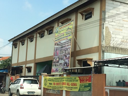
Yayasan Pendidikan Islam KH. Sa'adullah (SMK)
JL KH. Sa'adullah Km. 5, RT 001 RW 04, Pondok Lor, Pakualam, Pakuhaji, Paku Alam
School
read more
148 m
Yayasan Pendididikan Islam Bani Sya'i
Jalan Kh. Saadulah, Pakuhaji
School
read more
165 m
YPI Hidayatusshibyan
Jalan Kh. Saadulah No.88, Pakuhaji
School
read more
210 m
TKIT & SDIT SULTAN Al -FATIH
Jalan Kh. Saadulah No.88, Pakuhaji
School
read more
266 m
SDN Pakuhaji II
Pakuhaji
School
read more
324 m
SDN Pakuhaji 3
Jalan Kh. Saadulah, Paku Alam
School
read more
417 m
YAYASAN BUSTANUL WILDAN
Paku Alam
School
read more
419 m
Ponpes Assyifa
Jalan KH. Sadullah, Pakuhaji
School
read more
446 m
Rumah Belajar Bintang Utara
Pakuhaji
School
read more
478 m
SMPN 1 PAKUHAJI
Jalan Raya Pakuhaji No.88, Pakuhaji
School
read more
483 m
SD Negeri 01
JL KH. Sa'Adullah, Km. 1 RT 001 RW 01, Pakuhaji, Paku Alam
School
read more
583 m
Paud As-safa
jl kh.saadullah kp.pondok kidul rt004/002 kec.pakuhji kab., Pakuhaji
School
read more
644 m
SDN PAKUHAJI 4
Unnamed Road, Pakuhaji
School
read more
658 m
SDN Pakuhaji 1
Jalan Raya Pakuhaji No.10
School
read more
699 m
Pondok Pesantren Daarul-Huda
JL. Pondok Kulon, Paku Alam
School
read more
850 m
SDIT BANI SYA'I
Paku Alam
School
read more
852 m
RA & SDIT BANI SYA'I
Paku Alam
School
read more
883 m
Pon-Pes Daarul Anshor
Kp Rawa Kepuh Desa Paku Alam, Pakuhaji
School
read more
892 m
SMA Parahiyangan
JL Pakuhaji, RT 02 RW 02, Pakuhaji, Buaran Bambu
School
read more
908 m
Yayasan Pendidikan Islam Bani Sya'i
Paku Alam
School
read more
926 m
SDN Buaran Bambu V
Buaran Bambu
School
read more
📑
all categories
Accounting
Administrative area level 1
Administrative area level 2
Airport
Amusement park
Aquarium
Art gallery
Atm
Bakery
Bank
Bar
Beauty salon
Bicycle store
Book store
Bowling alley
Bus station
Cafe
Campground
Car dealer
Car rental
Car repair
Car wash
Casino
Cemetery
Church
City hall
Clothing store
Colloquial area
Convenience store
Courthouse
Dentist
Department store
Doctor
Electrician
Electronics store
Embassy
Finance
Fire station
Florist
Food
Funeral home
Furniture store
Gas station
General contractor
Grocery or supermarket
Gym
Hair care
Hardware store
Health
Hindu Temple
Home goods store
Hospital
Insurance agency
Intersection
Jewelry store
Laundry
Lawyer
Library
Liquor store
Local government office
Locality
Locksmith
Lodging
Meal delivery
Meal takeaway
Mosque
Movie rental
Movie theater
Moving company
Museum
Natural feature
Neighborhood
Night club
Painter
Park
Parking
Pet store
Pharmacy
Physiotherapist
Place of worship
Plumber
Point of interest
Police
Political
Post office
Premise
Real estate agency
Restaurant
Roofing contractor
Route
Rv park, camping
School
Shoe store
Shopping mall
Spa
Stadium
Storage
Store
Subpremise
Supermarket
Synagogue
Taxi stand
Train station
Transit station
Travel agency
University
Veterinary care
Zoo
administrative area level 3
administrative area level 4
administrative area level 5
sublocality level 1
↑