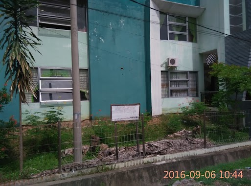
School nearby Bimbel Teknos Genius Banda Aceh
Indonesia
School nearby Bimbel Teknos Genius Banda Aceh
Bimbel Teknos Genius Banda Aceh
Blang Cut Indonesia
contacts phone
:
+62
Latitude:
5.5451227
, Longitude:
95.3303325
read more
nearest School
371 m
TK Latifa
Ateuk Pahlawan
School
read more
420 m
Kost Biru Putri
Sukadamai
School
read more
468 m
Muharram Jounalism College (MJC) Banda Aceh
Jalan Angsa No.23, Batoh
School
read more
581 m
SD Negeri 3 Banda Aceh
Lamseupeung
School
read more
613 m
SD N 43 Banda Aceh
Ateuk Pahlawan
School
read more
622 m
SD N 30
Ateuk Pahlawan
School
read more
635 m
Sekolah Dasar Negeri 43 Banda Aceh
Ateuk Pahlawan
School
read more
658 m
Pengembangan TK AL-QURAN
Ateuk Pahlawan
School
read more
681 m
SMA Unggul Fajar Harapan
Ateuk Pahlawan
School
read more
686 m
TK Cut Meutia
Teuku Cik Ditiro, Ateuk Pahlawan
School
read more
769 m
TPA AR _RISALAH
Jalan TM Pahlawan No.20, Ateuk Pahlawan
School
read more
774 m
Paud Griya Ceria
JL. Taman Makam Pahlawan II, No. 2, Peuniti B, Peuniti
School
read more
802 m
Pondok Pesantren Sulaimaniyah
Peuniti
School
read more
809 m
Prima Citra Computer (PC²)
Peuniti
School
read more
826 m
SD Negeri 23
Jalan TM Pahlawan No.20, Ateuk Pahlawan
School
read more
829 m
Sekolah Dasar Negeri 12 Banda Aceh
Peuniti
School
read more
852 m
Bimbel Al 'Alim
Peuniti
School
read more
866 m
Akademi Teknik Iskandar Muda
Peuniti
School
read more
881 m
SMA Cut Meutia
Teuku Cik Ditiro, Ateuk Pahlawan
School
read more
902 m
Balai Pengajian Darul Mukarramah Peuniti
Jalan Aladin Mansyursyah, Peuniti
School
read more
1.065 km
Markaz al-Ishlah al-Aziziyah
Lueng Bata
School
read more
1.073 km
SMP Islam Ibnu Khaldun Banda Aceh
Jalan Tengku Muhammad Hasan, Lueng Bata
School
read more
1.208 km
SD Negeri 3
Jalan Jenderal Sudirman, Peuniti
School
read more
1.212 km
Madrasah Diniyah Bahrul Ulum
Lambhuk
School
read more
1.236 km
MAKTABAH HAMZAH_Gudang Ilmu Bermanfaat
Lambhuk
School
read more
📑
all categories
Accounting
Administrative area level 1
Administrative area level 2
Airport
Amusement park
Aquarium
Art gallery
Atm
Bakery
Bank
Bar
Beauty salon
Bicycle store
Book store
Bowling alley
Bus station
Cafe
Campground
Car dealer
Car rental
Car repair
Car wash
Casino
Cemetery
Church
City hall
Clothing store
Colloquial area
Convenience store
Courthouse
Dentist
Department store
Doctor
Electrician
Electronics store
Embassy
Finance
Fire station
Florist
Food
Funeral home
Furniture store
Gas station
General contractor
Grocery or supermarket
Gym
Hair care
Hardware store
Health
Hindu Temple
Home goods store
Hospital
Insurance agency
Intersection
Jewelry store
Laundry
Lawyer
Library
Liquor store
Local government office
Locality
Locksmith
Lodging
Meal delivery
Meal takeaway
Mosque
Movie rental
Movie theater
Moving company
Museum
Natural feature
Neighborhood
Night club
Painter
Park
Parking
Pet store
Pharmacy
Physiotherapist
Place of worship
Plumber
Point of interest
Police
Political
Post office
Premise
Real estate agency
Restaurant
Roofing contractor
Route
Rv park, camping
School
Shoe store
Shopping mall
Spa
Stadium
Storage
Store
Subpremise
Supermarket
Synagogue
Taxi stand
Train station
Transit station
Travel agency
University
Veterinary care
Zoo
administrative area level 3
administrative area level 4
administrative area level 5
sublocality level 1
↑