Police nearby Satlantas Wilayah, Pos IV Jakarta Utara
Coronavirus disease (COVID-19) Situation
confirmed cases
6829221
deaths
162063
Indonesia
Police nearby Satlantas Wilayah, Pos IV Jakarta Utara
Satlantas Wilayah, Pos IV Jakarta Utara
Jalan Yos Sudarso RT.10/RW.11, Kelapa Gading Barat Indonesia
contacts phone
:
+62
Latitude:
-6.1506003
, Longitude:
106.8887822
read more
nearest Police
963 m
Satlantas Wilayah, Pos V Jakarta Utara
Jalan Yos Sudarso No.30, RT.10/RW.11, Sunter Jaya
Police
read more
1.924 km
Pospol Kelapa Gading Timur
Jl. Kelapa Gading Timur, RW.5, Kelapa Gading Timur
Police
read more
2.118 km
Pos Polisi
A No., Jalan Letjen Suprapto No.17-18, RT.10/RW.7, Sumur Batu
Police
read more
2.296 km
Pos Polisi Pasar Ular
RT.5/RW.2, Rawabadak Selatan
Police
read more
2.484 km
Pos Polisi
Jalan Raya Plumpang No.22, RT.8/RW.2, Rawabadak Selatan
Police
read more
2.497 km
Polsek Kelapa Gading
Jalan Gading Indah Utara I No.12A, RT.21/RW.12, Pegangsaan Dua
Police
read more
2.726 km
Polsub Sektor Sumur Batu
Jalan Let. Jen. Suprapto-Kramat Bunder RT.10/RW.7, Cempaka Putih Timur
Police
read more
2.745 km
Polsub Sektor Sumur Batu
Jalan Letjen Suprapto No. 5, RT.10/RW.7, Cempaka Putih Timur, Cempaka Putih
Police
read more
2.844 km
Pospol Pulomas
Jalan Pulo Mas RT.4/RW.14, Kayu Putih
Police
read more
2.879 km
Pos Lantas Polsek Kelapa Gading
Pertokoan Pulo Mas, Blok, Jalan Perintis Kemerdekaan Blok 1, RT.8/RW.8, Pulo Gadung
Police
read more
2.99 km
Pospol Sumur Batu
Jl. Letjen Suprapto, RT.8/RW.7, Cempaka Baru
Police
read more
3.072 km
North Jakarta Police Service Units
Jalan Danau Sunter Utara No.12C, RT.16/RW.11, Sunter Agung
Police
read more
3.107 km
Pospol Plumpang
Jl. Plumpang, RT.6/RW.12, Tugu Utara
Police
read more
3.859 km
Polsek Bendungan Jago
Jalan Tnh Tinggi Barat RT.12/RW.5, Kebon Kosong
Police
read more
3.895 km
Pos Polantas Unit Koja
Jalan Raya Plumpang No.25, RT.2/RW.3, Tugu Selatan
Police
read more
3.933 km
Police Cempaka Putih
Jalan Letnan Jendral R. Suprapto, RT.4/RW.3, Cempaka Putih Barat
Police
read more
3.955 km
Kantor Polisi Subsektor Ahmad Yani Jaktim
Jalan Jendral Ahmad Yani RT.1/RW.2, Cempaka Putih Timur
Police
read more
4.056 km
Polsek Kemayoran
Jalan Landasan Pacu Selatan Ruas A5 No. 1, RT.13/RW.6, Kebon Kosong
Police
read more
4.225 km
Pos Polisi Volker
RT.3/RW.15, Tanjung Priok
Police
read more
4.636 km
POS PANTAU RAMADHAN POLSEK CEMPAKA PUTIH
Jalan Mardani Raya No.72, RT.2/RW.5, Cempaka Putih Barat
Police
read more
4.84 km
Pos Polisi Sub Sektor Pasar Nangka
Jalan Kalibaru Timur Dalam RT.1/RW.9, Bungur
Police
read more
4.84 km
Pos Polisi Sub Sektor Pasar Nangka
Jalan Kalibaru Timur Dalam, RT.1/RW.9, Bungur, Senen
Police
read more
4.861 km
Pos polisi
Blok A1, Jalan Angkasa No.32, RT.1/RW.9, Gunung Sahari Selatan
Police
read more
6.228 km
Kepolisian Resor Metro Jakarta Pusat
Jalan Kramat Raya No 61, Kramat, Senen, RT.8/RW.8, RT.8/RW.8, Kramat
Police
read more
6.578 km
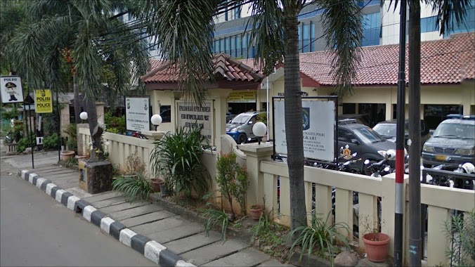
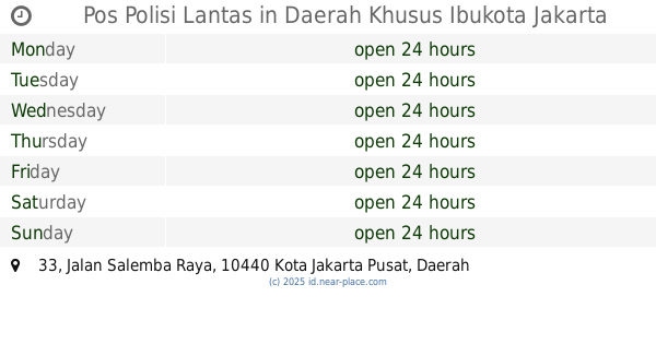
Pos Polisi Lantas
Jalan Salemba Raya No.33, RT.3/RW.5, Paseban
Police
read more
📑
all categories
Accounting
Administrative area level 1
Administrative area level 2
Airport
Amusement park
Aquarium
Art gallery
Atm
Bakery
Bank
Bar
Beauty salon
Bicycle store
Book store
Bowling alley
Bus station
Cafe
Campground
Car dealer
Car rental
Car repair
Car wash
Casino
Cemetery
Church
City hall
Clothing store
Colloquial area
Convenience store
Courthouse
Dentist
Department store
Doctor
Electrician
Electronics store
Embassy
Finance
Fire station
Florist
Food
Funeral home
Furniture store
Gas station
General contractor
Grocery or supermarket
Gym
Hair care
Hardware store
Health
Hindu Temple
Home goods store
Hospital
Insurance agency
Intersection
Jewelry store
Laundry
Lawyer
Library
Liquor store
Local government office
Locality
Locksmith
Lodging
Meal delivery
Meal takeaway
Mosque
Movie rental
Movie theater
Moving company
Museum
Natural feature
Neighborhood
Night club
Painter
Park
Parking
Pet store
Pharmacy
Physiotherapist
Place of worship
Plumber
Point of interest
Police
Political
Post office
Premise
Real estate agency
Restaurant
Roofing contractor
Route
Rv park, camping
School
Shoe store
Shopping mall
Spa
Stadium
Storage
Store
Subpremise
Supermarket
Synagogue
Taxi stand
Train station
Transit station
Travel agency
University
Veterinary care
Zoo
administrative area level 3
administrative area level 4
administrative area level 5
sublocality level 1
↑