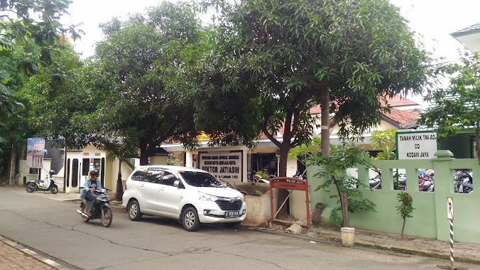
Police nearby Pos Keamanan BTR
Indonesia
Police nearby Pos Keamanan BTR
Pos Keamanan BTR
Cimuning Indonesia
contacts phone
:
+62
Latitude:
-6.3316105
, Longitude:
107.0073395
read more
nearest Police
1.385 km
PolsubSektor Sumur Batu
Jalan Raya Sumurbatu No.10, Bantar Gebang, Sumur Batu
Police
read more
1.698 km
Pos Polisi Kel. Padurenan
Jalan Raya Bantar Gebang - Setu, Padurenan
Police
read more
2.452 km
Pos Polisi Kel. Cimuning
Jalan Raya Bantar Gebang - Setu, Cimuning
Police
read more
2.954 km
Polsek Jati Rahayu
Jalan Jati, Burangkeng
Police
read more
3.036 km
Polsek Bantargebang
Jalan Raya Narogong No.508, Bantargebang
Police
read more
3.037 km
Kepolisian Sektor Bantar Gebang
Jalan Siliwangi Km. 10 No.27, Bantargebang
Police
read more
3.858 km
Polsek Setu
Jl. Raya Cijengkol-Setu, Cijengkol
Police
read more
4.143 km
Pos Polisi
Jalan Setia Darma II Tambun Selatan, Mustika Jaya
Police
read more
4.469 km
Pos Polisi
Jalan Raya Bojong Kulur No.8, Bojong Kulur
Police
read more
4.905 km
Pos Polisi Sektor Setu 2 Bekasi
Jl. Pos Polisi, Cengkareng
Police
read more
4.907 km
Pos Polisi Desa Cikarageman
Perumahan Griya Pratama Mas, Setu, Cikarageman
Police
read more
5.556 km
Pos Polisi Mustikajaya
Mustika Jaya, Mustikajaya, Mustika Jaya
Police
read more
6.206 km
Pos Polisi Jati Asih
Jalan Raya Jati Asih No.43, Jatirasa
Police
read more
6.453 km
Polsek Jatiasih
Jalan Swatantra lV No.1, Jatiasih, Bekasi, Jatiasih
Police
read more
7.008 km
POSPAM Polsek Jati Asih
Jalan Raya Jati Asih No.05, Jatiasih, Jatimekar
Police
read more
11.049 km
Pos Polisi Kayu ringin
Jalan Guntur Raya, Kayuringin Jaya
Police
read more
12.151 km
Police Cipayung - East Jakarta
Jalan Raya Mabes Hankam No.1, RT.7/RW.2, Bambu Apus
Police
read more
12.155 km
Polsek Cipayung Grab Order
Jl. Raya Mabes Hankam, RT.10/RW.2, Bambu Kuning Utara, Cipayung, RT.10/RW.2, Bambu Apus
Police
read more
13.224 km
Pos FBR Jaticempaka
Jalan Unkris No.42, Jaticempaka
Police
read more
13.304 km
Police Gunung Putri
Jl. Mercedes Benz, Cicadas, Gunung Putri, Cicadas
Police
read more
13.634 km
Police Duren Sawit
Jalan Raya Kalimalang RT.3/RW.16, Duren Sawit
Police
read more
14.301 km
Polsektro Makasar
Jalan Raya Pondok Gede No.25, RT.5/RW.2, Pinang Ranti
Police
read more
14.432 km
Police Station Kebalen
Jalan Raya Babelan, Teluk Pucung
Police
read more
14.464 km
Posko SKYFALL
Jalan Dukuh V No.85, RT.6/RW.5, Dukuh
Police
read more
16.9 km
Pospol Tapos
Jalan Mayor Idrus No.1, Tapos
Police
read more
📑
all categories
Accounting
Administrative area level 1
Administrative area level 2
Airport
Amusement park
Aquarium
Art gallery
Atm
Bakery
Bank
Bar
Beauty salon
Bicycle store
Book store
Bowling alley
Bus station
Cafe
Campground
Car dealer
Car rental
Car repair
Car wash
Casino
Cemetery
Church
City hall
Clothing store
Colloquial area
Convenience store
Courthouse
Dentist
Department store
Doctor
Electrician
Electronics store
Embassy
Finance
Fire station
Florist
Food
Funeral home
Furniture store
Gas station
General contractor
Grocery or supermarket
Gym
Hair care
Hardware store
Health
Hindu Temple
Home goods store
Hospital
Insurance agency
Intersection
Jewelry store
Laundry
Lawyer
Library
Liquor store
Local government office
Locality
Locksmith
Lodging
Meal delivery
Meal takeaway
Mosque
Movie rental
Movie theater
Moving company
Museum
Natural feature
Neighborhood
Night club
Painter
Park
Parking
Pet store
Pharmacy
Physiotherapist
Place of worship
Plumber
Point of interest
Police
Political
Post office
Premise
Real estate agency
Restaurant
Roofing contractor
Route
Rv park, camping
School
Shoe store
Shopping mall
Spa
Stadium
Storage
Store
Subpremise
Supermarket
Synagogue
Taxi stand
Train station
Transit station
Travel agency
University
Veterinary care
Zoo
administrative area level 3
administrative area level 4
administrative area level 5
sublocality level 1
↑