Police nearby Polsek Jaya Baru
Indonesia
Police nearby Polsek Jaya Baru
Polsek Jaya Baru
Lamjamee Indonesia
contacts phone
:
+62
Latitude:
5.5353604
, Longitude:
95.2858306
read more
nearest Police
1.443 km
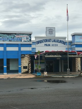
Dirlantas Polda Aceh
Jalan Cut Nyak Dhien No.25, Lamtemen Barat
Police
read more
2.644 km
Polsek Ulee Lheu
Ulee Lheue
Police
read more
3.271 km
Polsek Alasan
Jl. Alasan, Neusu Aceh
Police
read more
3.346 km
Polsek Baiturrahman Banda Aceh
Lam Lagang
Police
read more
3.436 km
Polsek Ruko Darussalam
Jl. Ruko Darussalam, Neusu Aceh
Police
read more
3.903 km
Polsek Banda Raya
Lhong Raya
Police
read more
4.195 km
Mobil Perpanjang SIM
Jalan Tengku Chik Pante Kulu No.82, Kampung Baru
Police
read more
4.197 km
SAT LANTAS POLTABES
Jalan Tengku Chik Pante Kulu No.82, Kampung Baru
Police
read more
4.199 km
Poltabes Banda Aceh
JL Teungku M. Daud Beureu`eh, No. 71, Kampung Baru
Police
read more
4.207 km
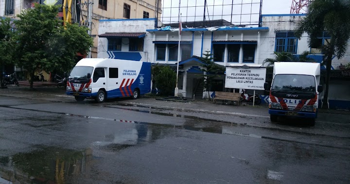
Kantor Pelayanan Terpadu Penanganan Kecelakaan Lalu Lintas
Kampung Baru
Police
read more
4.214 km
Police Banda Aceh
Kampung Baru, Baiturrahman, Banda Aceh
Police
read more
4.215 km
Simpang Kodim
Jalan Jenderal Sudirman, Kampung Baru
Police
read more
5.21 km
Polsek Lueng Bata
Jalan Angsa, Dusun Mesjid, Lueng Bata, Batoh
Police
read more
5.343 km
Polsek Darul Imarah
Jl. Biluei, Pasie Lamgarot
Police
read more
5.343 km
POLICE DEPARTMENT DARUL IMARAH
Jl. Biluei, Pasie Lamgarot
Police
read more
5.402 km
Polsek Kuta Alam
Jalan Tgk Di Blang, Lampulo
Police
read more
5.529 km
Brimob Polda Aceh
Keuramat
Police
read more
6.192 km
Dit Pol Air Polda Aceh
Jalan Indra Budiman, Lampulo
Police
read more
7.956 km
Polsek Ulee Kareng
Jalan Jurong Dagang, Ceurih
Police
read more
8.155 km
Polsek Ingin Jaya
Lambaro
Police
read more
8.327 km
SPKT POLDA ACEH
Jeulingke
Police
read more
8.456 km
Polda Aceh
Jalan Cut Meutia No.25, Jeulingke, Syiah Kuala, Jeulingke
Police
read more
8.554 km
Mako Detasemen Gegana Satbrimob Polda Aceh
Lamgugob
Police
read more
9.307 km
Polsek Krueng Barona Jaya
Cot Irie, Aceh Besar, Gla Deyah
Police
read more
📑
all categories
Accounting
Administrative area level 1
Administrative area level 2
Airport
Amusement park
Aquarium
Art gallery
Atm
Bakery
Bank
Bar
Beauty salon
Bicycle store
Book store
Bowling alley
Bus station
Cafe
Campground
Car dealer
Car rental
Car repair
Car wash
Casino
Cemetery
Church
City hall
Clothing store
Colloquial area
Convenience store
Courthouse
Dentist
Department store
Doctor
Electrician
Electronics store
Embassy
Finance
Fire station
Florist
Food
Funeral home
Furniture store
Gas station
General contractor
Grocery or supermarket
Gym
Hair care
Hardware store
Health
Hindu Temple
Home goods store
Hospital
Insurance agency
Intersection
Jewelry store
Laundry
Lawyer
Library
Liquor store
Local government office
Locality
Locksmith
Lodging
Meal delivery
Meal takeaway
Mosque
Movie rental
Movie theater
Moving company
Museum
Natural feature
Neighborhood
Night club
Painter
Park
Parking
Pet store
Pharmacy
Physiotherapist
Place of worship
Plumber
Point of interest
Police
Political
Post office
Premise
Real estate agency
Restaurant
Roofing contractor
Route
Rv park, camping
School
Shoe store
Shopping mall
Spa
Stadium
Storage
Store
Subpremise
Supermarket
Synagogue
Taxi stand
Train station
Transit station
Travel agency
University
Veterinary care
Zoo
administrative area level 3
administrative area level 4
administrative area level 5
sublocality level 1
↑