Police nearby Lampu Merah Ceger Taman Mini
Coronavirus disease (COVID-19) Situation
confirmed cases
6829221
deaths
162063
Indonesia
Police nearby Lampu Merah Ceger Taman Mini
Lampu Merah Ceger Taman Mini
Jalan Raya Mabes Hankam, 13820, Kota Jakarta Timur, Daerah Khusus Ibukota Jakarta, ID Indonesia
contacts phone
:
+62
Latitude:
-6.3062573
, Longitude:
106.8894045
larger map & directions
read more
nearest Police
105 m
Pos
Jalan Hankam Raya No.119, RT.1/RW.2, Ceger
Police
read more
332 m
Pos Polisi Keong Mas Taman Mini
Jl. Rw. Segaran No.35-81, RT.3/RW.2, Ceger, Kota Jakarta Timur
Police
read more
332 m
Pos Polisi Keong Mas Taman Mini
Jalan Rawa Segaran No.35-81, RT.3/RW.2, Ceger
Police
read more
731 m
Pospol Terminal Kampung Rambutan
Jl. Terminal Bus Kampung Rambutan, RT.11/RW.3, Rambutan, Ciracas, RT.11/RW.6, Rambutan
Police
read more
1.055 km
Pos Polisi Gempol
Jalan Bambu Apus, Bambu Apus, Cipayung, RT.1/RW.2, Bambu Apus
Police
read more
1.165 km
Police Cipayung - East Jakarta
Jalan Mabes Hankam No. 1, RT. 4 / RW. 2, Bambu Apus, Cipayung, RT.7/RW.2, Bambu Apus
Police
read more
1.182 km
Police Cipayung - East Jakarta
Jalan Raya Mabes Hankam No.1, RT.7/RW.2, Bambu Apus
Police
read more
1.187 km
Polsek Cipayung Grab Order
Jl. Raya Mabes Hankam, RT.10/RW.2, Bambu Kuning Utara, Cipayung, RT.10/RW.2, Bambu Apus
Police
read more
1.268 km
Posko SKYFALL
Jalan Dukuh V No.85, RT.6/RW.5, Dukuh
Police
read more
1.406 km
Polsek Makasar Pinang Ranti
Jalan Pinang Ranti No.16, RT.12/RW.2, Pinang Ranti
Police
read more
1.491 km
Induk PJR Tol Jagorawi
RT.4/RW.2, Pinang Ranti
Police
read more
1.772 km
Polsektro Makasar
Jalan Raya Pondok Gede No.25, RT.5/RW.2, Pinang Ranti
Police
read more
1.779 km
Kepolistan Negara Republik Indonesia
Jalan Raya Pondok Gede RT.5/RW.2, Pinang Ranti
Police
read more
2.619 km
Kantor Polisi Kelapa Dua Wetan
Jalan Raya Ciracas No.17, RT.3/RW.4, Ciracas
Police
read more
2.629 km
Polsek Ciracas - Jakarta Timur
Jalan Bogor Raya RT.7/RW.1, Rambutan
Police
read more
2.671 km
Pos Polisi Gedong
Blok Haji Taiman Jl. Trikora Blok, Jalan Haji Taiman No.3, RT.4/RW.2, Gedong
Police
read more
2.792 km
Pol Sub Sektor
Jalan Lubang Buaya RT.5/RW.9, Lubang Buaya
Police
read more
2.875 km
Polsek Kramat Jati
Jl. Merpati No. 1, Kampung Tengah, Kramatjati, RT.2/RW.2, Kampung Tengah
Police
read more
3.688 km
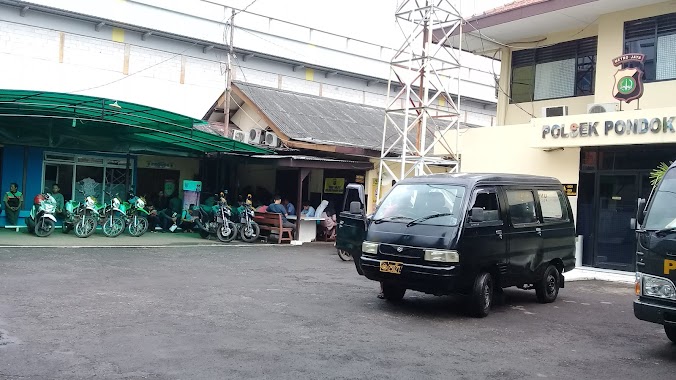
Polsek Pondok Gede
Jalan Jatiwaringin Raya No.108, Jatiwaringin
Police
read more
3.933 km
Pos Polisi Tol Jatiwarna
RT.7/RW.2, Jatimelati
Police
read more
4.693 km
Kantor PJR Cililita
Dekat pintu tol RW.3, Cililitan
Police
read more
4.957 km
Pospol Halim PK
Jalan Halim Perdana Kusuma Rt. 1 Rw. 9, Halim Perdana Kusumah, RT.4/RW.10, Halim Perdana Kusumah
Police
read more
5.149 km
Pos FBR Jaticempaka
Jalan Unkris No.42, Jaticempaka
Police
read more
5.404 km
Polsub Sektor Cililitan
Jalan Cililitan Besar Blok G No.1, RT.4/RW.1, Kramat Jati
Police
read more
5.45 km
Polsubsektor Gandaria
Jalan Raya Bogor KM. 28, RT.4/RW.7, Pekayon
Police
read more
📑
all categories
Accounting
Administrative area level 1
Administrative area level 2
Airport
Amusement park
Aquarium
Art gallery
Atm
Bakery
Bank
Bar
Beauty salon
Bicycle store
Book store
Bowling alley
Bus station
Cafe
Campground
Car dealer
Car rental
Car repair
Car wash
Casino
Cemetery
Church
City hall
Clothing store
Colloquial area
Convenience store
Courthouse
Dentist
Department store
Doctor
Electrician
Electronics store
Embassy
Finance
Fire station
Florist
Food
Funeral home
Furniture store
Gas station
General contractor
Grocery or supermarket
Gym
Hair care
Hardware store
Health
Hindu Temple
Home goods store
Hospital
Insurance agency
Intersection
Jewelry store
Laundry
Lawyer
Library
Liquor store
Local government office
Locality
Locksmith
Lodging
Meal delivery
Meal takeaway
Mosque
Movie rental
Movie theater
Moving company
Museum
Natural feature
Neighborhood
Night club
Painter
Park
Parking
Pet store
Pharmacy
Physiotherapist
Place of worship
Plumber
Point of interest
Police
Political
Post office
Premise
Real estate agency
Restaurant
Roofing contractor
Route
Rv park, camping
School
Shoe store
Shopping mall
Spa
Stadium
Storage
Store
Subpremise
Supermarket
Synagogue
Taxi stand
Train station
Transit station
Travel agency
University
Veterinary care
Zoo
administrative area level 3
administrative area level 4
administrative area level 5
sublocality level 1
↑