Place of worship nearby Masjid Al Barokah
Indonesia
Place of worship nearby Masjid Al Barokah
Masjid Al Barokah
28, Jalan SMP Mabad, 15412, Kota Tangerang Selatan, Banten, ID Indonesien
contacts phone
:
+62
Latitude:
-6.2967403
, Longitude:
106.7532009
larger map & directions
read more
nearest Place of worship
362 m
El Muzzammil
JL Jambu, No. 128, RT 004 RW 05, Cempaka Putih, Ciputat Timur, Cempaka Putih
Place of worship
read more
364 m
Musholla Asy Syifaa
Jalan Jambu No.12B, RT.4/RW.5, Cempaka Putih
Place of worship
read more
426 m
Mushala Al Amsar
no, Jalan Sukun No.85, Cempaka Putih
Place of worship
read more
515 m
Musola Almukhlishiin
No., Jalan Gotong Royong No.88, Rempoa
Place of worship
read more
519 m
Masjid Jami Al Falah
Jalan Nuri No.61, Rempoa
Place of worship
read more
521 m
Masjid Cempaka Putih
Cempaka Putih , Ciputat Timur , Tangerang , Banten, Rempoa
Place of worship
read more
558 m
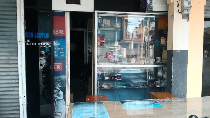
EMJ Production
Jalan WR Supratman No. 40, RT. 05 / RW. 06, Cempaka Putih, Kecamatan Ciputat Timur, Cempaka Putih
Place of worship
read more
595 m
Masjid Al-istiqomah
Cempaka Putih
Place of worship
read more
601 m
Yayasan Pendidikan Dua Mei
Jalan H Abd Gani No.135, Pondok Ranji
Place of worship
read more
603 m
Musholla Alfath
Jalan Haji Isa RT.003/RW.09, Cempaka Putih
Place of worship
read more
651 m
Gg.mesjid Ar-Rammah
Jalan Pahlawan No.90, RT.3/RW.1, Rempoa
Place of worship
read more
730 m
Musholla Al Istiqomah
Jalan Pesona Gintung No.3C, Cempaka Putih
Place of worship
read more
751 m
BBMKG Wilayah 2 Ciputat, Mushalla
raya/abdhul ghani blok C No., Jalan Kampung Bulak RT.6, Cempaka Putih
Place of worship
read more
793 m
Mushalla Al-Fadhil
Cempaka Putih
Place of worship
read more
873 m
Masjid Al-Ikhlas
Jalan Al-Ikhlas, Cempaka Putih
Place of worship
read more
946 m
Masjid Jami Al Barkah
Sawah Lama
Place of worship
read more
976 m
Yayasan Pendidikan Harapan Ayahanda
Jl. Boulevard Pondok Aren Pondok Aren Karawang Jawa Barat, Rempoa
Place of worship
read more
991 m
GSJA Ciputat
Jaln Bulak Raya/Abdul Ghani No.7, Cempaka Putih
Place of worship
read more
1.256 km
Ohm Fotografia Wedding & Commercial Photography
Jalan W R Supratman No.15, Pondok Ranji
Place of worship
read more
1.29 km
Mushola Al-Fallah
Jalan Al Falah, Ciputat
Place of worship
read more
1.691 km
Masjid At-Taqwa UMJ
Jalan Poncol Indah No.7, Cireundeu
Place of worship
read more
1.732 km
Musholah Nurul Islam
Jalan Ki Hajar Dewantara, Sawah Lama
Place of worship
read more
1.903 km
Taman Pendidikan Al-Qur'an (TPA/TPQ) Baitur Rahman
Jalan Nasabah 5 No.8, RT.5/RW.3, Kedaung
Place of worship
read more
2.145 km
Masjid As-Samii Komplek Sespimma Polri
RT.3/RW.9, Pondok Pinang
Place of worship
read more
2.684 km
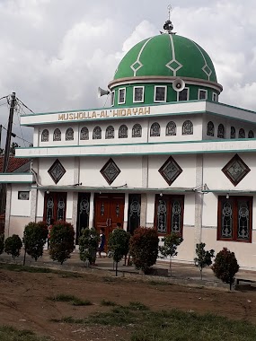
Musholla AL Hidayah
Jalan Mushola An Nur No.31, Kedaung
Place of worship
read more
📑
all categories
Accounting
Administrative area level 1
Administrative area level 2
Airport
Amusement park
Aquarium
Art gallery
Atm
Bakery
Bank
Bar
Beauty salon
Bicycle store
Book store
Bowling alley
Bus station
Cafe
Campground
Car dealer
Car rental
Car repair
Car wash
Casino
Cemetery
Church
City hall
Clothing store
Colloquial area
Convenience store
Courthouse
Dentist
Department store
Doctor
Electrician
Electronics store
Embassy
Finance
Fire station
Florist
Food
Funeral home
Furniture store
Gas station
General contractor
Grocery or supermarket
Gym
Hair care
Hardware store
Health
Hindu Temple
Home goods store
Hospital
Insurance agency
Intersection
Jewelry store
Laundry
Lawyer
Library
Liquor store
Local government office
Locality
Locksmith
Lodging
Meal delivery
Meal takeaway
Mosque
Movie rental
Movie theater
Moving company
Museum
Natural feature
Neighborhood
Night club
Painter
Park
Parking
Pet store
Pharmacy
Physiotherapist
Place of worship
Plumber
Point of interest
Police
Political
Post office
Premise
Real estate agency
Restaurant
Roofing contractor
Route
Rv park, camping
School
Shoe store
Shopping mall
Spa
Stadium
Storage
Store
Subpremise
Supermarket
Synagogue
Taxi stand
Train station
Transit station
Travel agency
University
Veterinary care
Zoo
administrative area level 3
administrative area level 4
administrative area level 5
sublocality level 1
↑