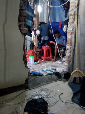
Night club nearby ZincHouse
Coronavirus disease (COVID-19) Situation
confirmed cases
6829221
deaths
162063
Indonesia
Night club nearby ZincHouse
ZincHouse
Jalan Paraji, Kalibaru Indonesia
contacts phone
:
+62
Latitude:
-6.4255602
, Longitude:
106.8339838
read more
nearest Night club
810 m
Mutolong Nyongnyong Bawah Tanaah
Sukmajaya
Night club
read more
1.189 km
Warung Remang-Remang
Sukmajaya
Night club
read more
1.502 km
Babakan Wakas
Jalan Tugu Jaya No.32, Tirtajaya
Night club
read more
1.827 km
K2c004
Jalan Kampung Bendungan No.67, Cilodong
Night club
read more
1.863 km
Freedom Zone
Blok Mesjid Al-Falah, Jalan Kampung Ratu Jaya Blok Mesjid Al-Falah No.94, Ratu Jaya
Night club
read more
1.897 km
Yamaha Mio Modification Zona Depok
Tirtajaya
Night club
read more
1.909 km
bale Males
Jalan Masjid RT.9/RW.5, no 123
Night club
read more
2.046 km
Markas Pepeng
Unnamed Road, Kalibaru
Night club
read more
2.095 km
Warkop Pak Harun
Jalan Kampung Ratu Jaya No.47A, Ratu Jaya
Night club
read more
2.202 km
Heaven Dreams
Ratu Jaya
Night club
read more
2.249 km
kopdar ULJ depok
Tirtajaya
Night club
read more
2.309 km
Marcell HomeStay
Jatimulya
Night club
read more
2.35 km
HOTEL RODEO 77
Jalan Rawa Geni Raya No.87, Ratu Jaya
Night club
read more
2.373 km
Enjoy kidoel official
Jalan Ibu Nyai, Sukamaju
Night club
read more
2.471 km
Taman Segitiga Blok edelweiss Bellacasa Residence
Depok
Night club
read more
2.664 km
GGU Banteng Bersatu
Sukamaju
Night club
read more
2.791 km
BUKAAN MAIN
Jalan Program Raya IV B Blok Dalam No.21, Pancoran MAS
Night club
read more
2.927 km
Yowisto Music
Jalan Lembah Asri Raya No.Blok E4/17, Mekar Jaya
Night club
read more
2.965 km
BC UBER AKAR DEPOK
Jalan Kenanga No.14-15, Depok
Night club
read more
3.131 km
sion barbershop
Jalan Raya Citayam, Ratu Jaya
Night club
read more
3.232 km
Pt Portal Terpadu/PORTAL
Jalan Haji Dul, Bojong Pondok Terong
Night club
read more
3.286 km
BMLS Depok
Jalan Kartini No.80, Depok
Night club
read more
3.29 km
Kopdaran COSMO Depok
Jalan Margonda Raya No.20, Depok
Night club
read more
3.591 km
AHAY
Jalan Raya Cagar Alam No.5, Pancoran MAS
Night club
read more
3.602 km
Febry pholog
Jalan Arafat, Cilangkap
Night club
read more
📑
all categories
Accounting
Administrative area level 1
Administrative area level 2
Airport
Amusement park
Aquarium
Art gallery
Atm
Bakery
Bank
Bar
Beauty salon
Bicycle store
Book store
Bowling alley
Bus station
Cafe
Campground
Car dealer
Car rental
Car repair
Car wash
Casino
Cemetery
Church
City hall
Clothing store
Colloquial area
Convenience store
Courthouse
Dentist
Department store
Doctor
Electrician
Electronics store
Embassy
Finance
Fire station
Florist
Food
Funeral home
Furniture store
Gas station
General contractor
Grocery or supermarket
Gym
Hair care
Hardware store
Health
Hindu Temple
Home goods store
Hospital
Insurance agency
Intersection
Jewelry store
Laundry
Lawyer
Library
Liquor store
Local government office
Locality
Locksmith
Lodging
Meal delivery
Meal takeaway
Mosque
Movie rental
Movie theater
Moving company
Museum
Natural feature
Neighborhood
Night club
Painter
Park
Parking
Pet store
Pharmacy
Physiotherapist
Place of worship
Plumber
Point of interest
Police
Political
Post office
Premise
Real estate agency
Restaurant
Roofing contractor
Route
Rv park, camping
School
Shoe store
Shopping mall
Spa
Stadium
Storage
Store
Subpremise
Supermarket
Synagogue
Taxi stand
Train station
Transit station
Travel agency
University
Veterinary care
Zoo
administrative area level 3
administrative area level 4
administrative area level 5
sublocality level 1
↑