Night club nearby Sahabat Taman Mandiri BC Lapiazza
Indonesia
Night club nearby Sahabat Taman Mandiri BC Lapiazza
Sahabat Taman Mandiri BC Lapiazza
Jalan Mandiri Tengah, 14240, Kota Jakarta Utara, Daerah Khusus Ibukota Jakarta, ID Indonesia
contacts phone
:
+62
Latitude:
-6.1609886
, Longitude:
106.9069354
larger map & directions
read more
nearest Night club
68 m
Club 300
Komplek Kelapa Gading Permai Blok NB-1/46-47, JL. Boulevard Timur Raya, Jakarta, 14240, RT.13/RW.18, East Kelapa Gading
Night club
read more
128 m
Warung Kopi Pak Lili
Jalan Kelapa Puan Raya No.30, RW.13, Kelapa Gading Timur
Night club
read more
135 m
GOTAGGING 2
Jalan Kelapa Puan Raya Blok FU1 No.30, RW.13, Kelapa Gading Timur
Night club
read more
143 m
warung "Pak DE" Jawa Timur
RW No.13, RW.13, Kelapa Gading Timur
Night club
read more
143 m
warung "Pak DE" Jawa Timur
RW No.13, Kelapa Gading Timur
Night club
read more
292 m
Nav Karaoke Keluarga - Kelapa Gading 3
Jalan Boulevard Raya Blok LA 6 No. 8 - 9, Kelapa Gading, RT.11/RW.18, Kelapa Gading Timur
Night club
read more
320 m
R & R Family Karaoke
JL. Boulevard Raya, Blok TB 2/33, Jakarta, RT.11/RW.18, East Kelapa Gading
Night club
read more
363 m
Ayu Tingting Karaoke Keluarga
Jl. Boulevard Barat Blok LA-1 No.19-20, RT.1 / RW.18, Kelapa Gading Timur, Kelapa Gading, RT.1/RW.18, Kelapa Gading Timur
Night club
read more
509 m
AMO Family Karaoke
Jalan Boulevard Raya Kelapa Gading Blok WB2 No.24, RT.11/RW.16, Kelapa Gading Timur
Night club
read more
509 m
AMO Family Karaoke
Jalan Boulevard Raya Blok WB2 No.24, RT.11/RW.16, Kelapa Gading Timur
Night club
read more
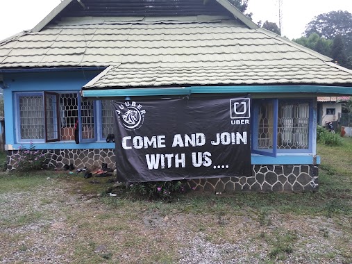
580 m
BC. JUUBER ( Jakarat Utara Uber)
Jalan Janur Indah XI RT.12/RW.18, Kelapa Gading Timur
Night club
read more
582 m
WARUNG KOPI NYENDER
Jalan Ultra Violet RT.3/RW.10, Kelapa Gading Timur
Night club
read more
598 m
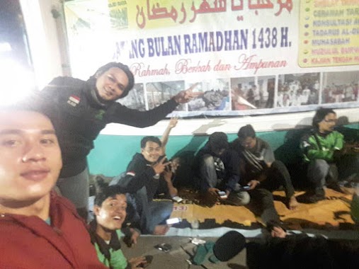
Shelter JUUBER
Blok, Jalan Boulevard Barat Raya Blok Xb No.7, RW.5, West Kelapa Gading
Night club
read more
603 m
Mulia International Executive Club
Boulevard Barat Blok LC6 No.7-9, Jalan Boulevard Barat Raya, Kelapa Gading Barat, Kelapa Gading, RT.13/RW.7, Kelapa Gading Barat
Night club
read more
604 m
STUDIO KARAOKE KELAPA GADING
Ruko Graha Boulevard Timur ND1 No. 33 - 35, KELAPA GADING, RT.8/RW.12, Pegangsaan Dua
Night club
read more
604 m
STUDIO KARAOKE KELAPA GADING
Ruko Graha Boulevard Timur ND1 No. 33 - 35, KELAPA GADING
Night club
read more
662 m
Shelter MKG (DR.KO) sebrang MKG
Jl. Boulevard Raya Blok LB 3 No.10 RT.12/RW18 Kelapa Gading - Jakarta 13930, RT.12/RW.18, Kelapa Gading Timur
Night club
read more
706 m
Happy Puppy
Jalan Boulevard Raya, Blok LB 3 #27-28, Kelapa Gading Timur, RT.12/RW.18, RT.12/RW.18, Kelapa Gading Timur
Night club
read more
714 m
Shelter Gojek JU Gading (Al-musyawarah)
Jalan Boulevard Raya Blok LB3 No.32, RT.13/RW.18, Kelapa Gading Timur
Night club
read more
714 m
Shelter Gojek JU Gading (Al-musyawarah)
Jalan Boulevard Raya Kelapa Gading Blok LB3 No.32, RT.13/RW.18, Kelapa Gading Timur
Night club
read more
749 m
Voice Family Karaoke
Jl. Gading Indah Utara I Pegangsaan Dua Kelapa Gading Jakarta Utara DKI Jakarta, RT.4/RW.7, Kelapa Gading Barat
Night club
read more
840 m
Amo Karaoke Keluarga
AMO Lantai 2 & 3, Jalan Boulevard Raya, RT.10/RW.15, Kelapa Gading Timur, Kelapa Gading, RT.10/RW.15, Kelapa Gading Timur
Night club
read more
932 m
S PURBA SUITE
RT.28/RW.12, Pegangsaan Dua
Night club
read more
1.125 km
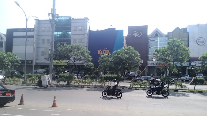
Inul Vizta Kelapa Gading
Jalan Boulevard Barat Raya Blok LC7 No.33, RT.18/RW.8, Kelapa Gading Barat
Night club
read more
1.295 km
NAV Karaoke Keluarga Kelapa Gading 1
Jl. Boulevard Raya Blok TB-2 No. 36-38, Kelapa Gading Timur, Kelapa Gading, RW.1, Kelapa Gading Timur
Night club
read more
📑
all categories
Accounting
Administrative area level 1
Administrative area level 2
Airport
Amusement park
Aquarium
Art gallery
Atm
Bakery
Bank
Bar
Beauty salon
Bicycle store
Book store
Bowling alley
Bus station
Cafe
Campground
Car dealer
Car rental
Car repair
Car wash
Casino
Cemetery
Church
City hall
Clothing store
Colloquial area
Convenience store
Courthouse
Dentist
Department store
Doctor
Electrician
Electronics store
Embassy
Finance
Fire station
Florist
Food
Funeral home
Furniture store
Gas station
General contractor
Grocery or supermarket
Gym
Hair care
Hardware store
Health
Hindu Temple
Home goods store
Hospital
Insurance agency
Intersection
Jewelry store
Laundry
Lawyer
Library
Liquor store
Local government office
Locality
Locksmith
Lodging
Meal delivery
Meal takeaway
Mosque
Movie rental
Movie theater
Moving company
Museum
Natural feature
Neighborhood
Night club
Painter
Park
Parking
Pet store
Pharmacy
Physiotherapist
Place of worship
Plumber
Point of interest
Police
Political
Post office
Premise
Real estate agency
Restaurant
Roofing contractor
Route
Rv park, camping
School
Shoe store
Shopping mall
Spa
Stadium
Storage
Store
Subpremise
Supermarket
Synagogue
Taxi stand
Train station
Transit station
Travel agency
University
Veterinary care
Zoo
administrative area level 3
administrative area level 4
administrative area level 5
sublocality level 1
↑