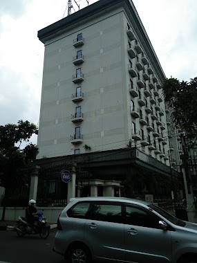
Night club nearby Kalcit Indobit
Coronavirus disease (COVID-19) Situation
confirmed cases
6829221
deaths
162063
Indonesia
Night club nearby Kalcit Indobit
Kalcit Indobit
1, Jalan Raya Kalibata, 12750, Kota Jakarta Selatan, Daerah Khusus Ibukota Jakarta, ID Indonesia
contacts phone
:
+62 857-5021-3569
Latitude:
-6.2566028
, Longitude:
106.851881
larger map & directions
read more
nearest Night club
234 m
BC Kalong XBata City GEMBEL KALCIT
RT.9/RW.4, Rawajati
Night club
read more
407 m
Teuku Taufiqulhadi
Blok D-1 No., Indonesia, Jalan Kompleks Dpr 1 No.264, RT.12/RW.5, Rawajati
Night club
read more
469 m
Taman 34
RT.12/RW.5, Rawajati
Night club
read more
766 m
Jakarta Selatan Polda
A,, Jalan Pancoran Timur III RT.11/RW.4, Duren Tiga
Night club
read more
1.157 km
Betons kalibata
South Jakarta, RT.12/RW.6, Rawajati
Night club
read more
1.166 km
ochitnews
Jalan Raya Kalibata RT.12/RW.5, Cawang
Night club
read more
1.191 km
Dangdut Cafe Zeus Karaoke
Hotel Kaisar No. 1, Jalan Duren Tiga Raya RT.1/RW.1, Pancoran
Night club
read more
1.65 km
Karoke Revolution
L3A , Pusat Grosir Cililitan (PGC) , JL. Mayjen Sutoyo, Cililitan , 76 , Kramat Jati , 13640 Jakarta Timur , DKI Jakarta, RW.11, Cililitan
Night club
read more
1.654 km
Fun Karaoke
Pusat Grosir Cililitan Lantai 3A No. 86, JL Mayjend. Sutoyo, No. 76, Cililitan, Kramat Jati, RW.11, Cililitan
Night club
read more
1.666 km
Starbox
PGC Lantai 3A No. 87-90, Jalan Mayjen Sutoyo RW.11, Cililitan
Night club
read more
1.684 km
Tamrok (TR)
Jalan Tebet Barat Dalam XD RT.12/RW.5, Tebet Barat
Night club
read more
1.694 km
Kos Pak Taufik
Jalan Haji Noor No.22, RT.7/RW.1, Pejaten Barat
Night club
read more
1.738 km
PS POS DADAKAN
Jalan Mayjen Sutoyo Blok Ali Sarbi 2 No.29, RT.1/RW.14, Cililitan
Night club
read more
1.772 km
Jalan Prof. DR. Soepomo
Indonesia
Night club
read more
1.807 km
Warko - Warung Maseko
Blok No., Jalan Triloka VIII Blok j No.12, RT.5/RW.2, Pancoran
Night club
read more
1.873 km
Samali Race
Jalan Haji Samali No.78, RT.8/RW.4, Kalibata
Night club
read more
1.927 km
sirma cafe
Jalan Mayor Jendral Sutoyo No.10, RT.9/RW.9, Cililitan
Night club
read more
1.972 km
Hotel Pudisia
No.67,, Jalan Munggang No.66, RT.4/RW.1, Balekambang
Night club
read more
1.993 km
bace camp KmK
Jl Kp Dalam 4 No.20, RT.6/RW.14, Kebon Baru
Night club
read more
2.015 km
Condet Batu Ampar 05
Condet Batu Ampar, Jalan Raya Condet RT.13/RW.4, Balekambang
Night club
read more
2.024 km
Rama Fotocopy
No., Jalan Dewi Sartika No.355, RT.5/RW.4, Cawang
Night club
read more
2.122 km
Venus Karaoke
Jl. Jend Gatot Subroto Kav 71-73 Menteng Dalam Tebet Jakarta Selatan DKI Jakarta, RT.8/RW.8, Menteng Dalam
Night club
read more
2.215 km
warung sai
Jalan Rs. Polri RW.4, Kramat Jati
Night club
read more
2.47 km
Inul Vizta
Lippo Plaza Kramat Jati Lantai 3, Jalan Raya Bogor Km.19, Kramat Jati, RT.14/RW.6, Kramat Jati
Night club
read more
2.669 km
BoatFams
Jalan Amil VII RW.4, Pejaten Barat
Night club
read more
📑
all categories
Accounting
Administrative area level 1
Administrative area level 2
Airport
Amusement park
Aquarium
Art gallery
Atm
Bakery
Bank
Bar
Beauty salon
Bicycle store
Book store
Bowling alley
Bus station
Cafe
Campground
Car dealer
Car rental
Car repair
Car wash
Casino
Cemetery
Church
City hall
Clothing store
Colloquial area
Convenience store
Courthouse
Dentist
Department store
Doctor
Electrician
Electronics store
Embassy
Finance
Fire station
Florist
Food
Funeral home
Furniture store
Gas station
General contractor
Grocery or supermarket
Gym
Hair care
Hardware store
Health
Hindu Temple
Home goods store
Hospital
Insurance agency
Intersection
Jewelry store
Laundry
Lawyer
Library
Liquor store
Local government office
Locality
Locksmith
Lodging
Meal delivery
Meal takeaway
Mosque
Movie rental
Movie theater
Moving company
Museum
Natural feature
Neighborhood
Night club
Painter
Park
Parking
Pet store
Pharmacy
Physiotherapist
Place of worship
Plumber
Point of interest
Police
Political
Post office
Premise
Real estate agency
Restaurant
Roofing contractor
Route
Rv park, camping
School
Shoe store
Shopping mall
Spa
Stadium
Storage
Store
Subpremise
Supermarket
Synagogue
Taxi stand
Train station
Transit station
Travel agency
University
Veterinary care
Zoo
administrative area level 3
administrative area level 4
administrative area level 5
sublocality level 1
↑