Night club nearby Happy Puppy New
Coronavirus disease (COVID-19) Situation
confirmed cases
6829221
deaths
162063
Indonesia
Night club nearby Happy Puppy New
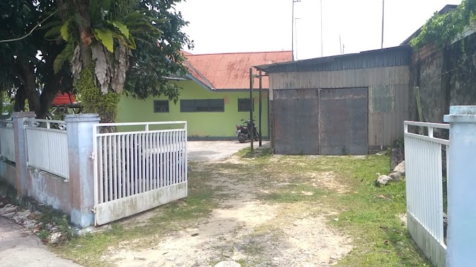
Happy Puppy New
Klandasan Ulu Indonesia
contacts phone
:
+62
Latitude:
-1.2774139
, Longitude:
116.8348021
read more
nearest Night club
65 m
Happy Puppy
Komplek Ruko Bandar, Blok C No. 33, Jalan Jend. Sudirman, Klandasan Ulu, Balikpapan Selatan
Night club
read more
125 m
Pub Ozon
Klandasan Ulu
Night club
read more
214 m
O2 Lounge
Novotel Balikpapan, Jalan Brigjen Ery Suparjan No. 2, Klandasan Ulu
Night club
read more
329 m
Inul Vista
Jl. Jend. Sudirman No. 331-332, Damai, Klandasan Ilir
Night club
read more
493 m
Popy Karaoke
JL. KH Agus Salim, No. 24 RT. 23, Klandasan Ulu
Night club
read more
901 m
Pisang Gapit Ozy
Telaga Sari
Night club
read more
1.064 km
Mitra Surya Abadi. PT
JL. Jend. Sudirman, Klandasan Ilir
Night club
read more
1.235 km
Club Rumah Bernyanyi
JL. Jendral Sudirman, No. 7A /7 B, Klandasan Ilir
Night club
read more
1.358 km
Geisha Executive Club
Horison Sagita, Jl. Mayjend Sutoyo No. 69 RT 061, Klandasan Ilir, Balikpapan Kota, Klandasan Ilir
Night club
read more
1.398 km
To start connecting please log in first. You can also create an account. Nama pengguna Kata Sandi I
Jalan Mayjend Sutoyo No.69, Klandasan Ilir
Night club
read more
1.521 km
Epicentrum
Jalan Markoni Dalam, Klandasan Ilir
Night club
read more
1.532 km
Embassy Cabang PDAM
Unnamed Road, Gunungsari Ilir
Night club
read more
1.549 km
Mpub Markoni
JL. Jend Sudirman, No. 524, RT 004/01, Damai, Balikpapan, Damai
Night club
read more
1.746 km
QQ KTV Balikpapan
Jalan Mayjend Sutoyo No. 67, Klandasan Ilir, Balikpapan Tengah, Gunungsari Ulu
Night club
read more
2.006 km
V-Gaz
Jalan Jenderal Sudirman, Balikpapan Permai H2, Damai
Night club
read more
2.013 km
Jazz
Jalan Jenderal Sudirman, Kompleks Balikpapan Permai, Damai
Night club
read more
2.106 km
Le Centro Club
Jalan Jenderal Sudirman, Damai
Night club
read more
2.38 km
Kunang Kunang Karaoke
JL. Jederal Sudirman, Karang Jati, Komplek Balikpapan Permai Blok D3 No. 128, Damai
Night club
read more
2.394 km
Base PantiCoreSquad
Jalan Re Martadinata No.2, Kalimantan Timur, Karang Jati, Balikpapan Tengah, Karang Jati
Night club
read more
2.686 km
Anak Gaul Simpang 3 BJMS
Gunungsari Ulu
Night club
read more
2.75 km
Boulevard Karaoke
Hotel Tirta Plaza, JL. Jend A Yani 08, Balikpapan, 76121, Karang Jati
Night club
read more
2.795 km
BSB Karaoke
E-Walk Superblock Lt. GF, Jl. Jenderal Sudirman No. 47, Gunung Bahagia, Balikpapan Selatan, Gunung Bahagia
Night club
read more
2.874 km
Dclub 89
Jl MT Haryono Kav 8 Square Blok C 8 11, Damai
Night club
read more
3.041 km
Ketoprak Jakarta
jl antasarigunung kawi, Sumber Rejo
Night club
read more
3.179 km
Gedung Gundala
Gunungsari Ulu
Night club
read more
📑
all categories
Accounting
Administrative area level 1
Administrative area level 2
Airport
Amusement park
Aquarium
Art gallery
Atm
Bakery
Bank
Bar
Beauty salon
Bicycle store
Book store
Bowling alley
Bus station
Cafe
Campground
Car dealer
Car rental
Car repair
Car wash
Casino
Cemetery
Church
City hall
Clothing store
Colloquial area
Convenience store
Courthouse
Dentist
Department store
Doctor
Electrician
Electronics store
Embassy
Finance
Fire station
Florist
Food
Funeral home
Furniture store
Gas station
General contractor
Grocery or supermarket
Gym
Hair care
Hardware store
Health
Hindu Temple
Home goods store
Hospital
Insurance agency
Intersection
Jewelry store
Laundry
Lawyer
Library
Liquor store
Local government office
Locality
Locksmith
Lodging
Meal delivery
Meal takeaway
Mosque
Movie rental
Movie theater
Moving company
Museum
Natural feature
Neighborhood
Night club
Painter
Park
Parking
Pet store
Pharmacy
Physiotherapist
Place of worship
Plumber
Point of interest
Police
Political
Post office
Premise
Real estate agency
Restaurant
Roofing contractor
Route
Rv park, camping
School
Shoe store
Shopping mall
Spa
Stadium
Storage
Store
Subpremise
Supermarket
Synagogue
Taxi stand
Train station
Transit station
Travel agency
University
Veterinary care
Zoo
administrative area level 3
administrative area level 4
administrative area level 5
sublocality level 1
↑