Mosque nearby Musholla An Nur
Indonesia
Mosque nearby Musholla An Nur
Musholla An Nur
Grogol Indonesien
contacts phone
:
+62
Latitude:
-6.3765352
, Longitude:
106.7948419
read more
nearest Mosque
223 m
Masjid As-syuhada
Jalan Rawakalong, Grogol
Mosque
read more
253 m
Musholla Nurul Iman
Grogol
Mosque
read more
280 m
Masjid SMK Nasional
Jalan Kampung Rawa Kalong No.5, RT.1/RW.9, Grogol
Mosque
read more
476 m
Mushalla Al Insan DGC
Grogol
Mosque
read more
513 m
Masjid Al - Barkah
Jalan RM Zakaria RT 04/12, Tanah Baru, Beji, Tanah Baru
Mosque
read more
559 m
Masjid Al Kautsar
Grogol
Mosque
read more
583 m
Musholla Al-Kautsar
Tanah Baru
Mosque
read more
623 m
Masjid Al - Muhajirin Wal - Anshar
Indonesia
Mosque
read more
668 m
Masjid Baitussab'ah
Tanah Baru
Mosque
read more
679 m
Musholla NURUL IMAN
Jalan Rawakalong No.20, Grogol
Mosque
read more
704 m
Lapangan Bumi Indah Grogol (BIG)
No., Jalan Masjid No.17, Grogol
Mosque
read more
745 m
Masjid Al Mukhlasin
Jalan Kampung Utan Jaya No.19, Tanah Baru
Mosque
read more
751 m
Nurul Iman Mosque
Jalan R. Sanim, Tanah Baru
Mosque
read more
772 m
Masjid Al Hidayah
Raden Sanim Rt. 02/11, Beji, Jalan R. Sanim, Tanah Baru
Mosque
read more
806 m
Musholah Amaliah
Jalan Kampung Utan Jaya, Tanah Baru
Mosque
read more
850 m
Musholla Baiturrahman
Jalan Raya Pulo Mangga, Grogol
Mosque
read more
851 m
Masjid Darul Izzah
Jalan Pala Kali No.45, Tanah Baru
Mosque
read more
865 m
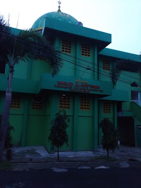
Masjid Al - Bayyinah
Tanah Baru
Mosque
read more
872 m
Musala Al-Urwatul Wutsqa
Komplek Taman Ventura Indah 2, Tanah Baru
Mosque
read more
912 m
Masjid Al Ikhlas
Jalan Masjid I No.51, Mampang
Mosque
read more
920 m
Masjid AL MUQARRABIN
Mampang
Mosque
read more
941 m
Masjid Jami Al-Mujahidin
Jalan Kampung Grogol No.27, Grogol
Mosque
read more
972 m
Masjid "Al-Andalus"
Jalan R. Sanim No.100, Tanah Baru
Mosque
read more
1.04 km
Musholla Nurul Iman
Mampang
Mosque
read more
1.279 km
Masjid Al Mahmudiyah
Jalan Kampung Baru Raya, Grogol
Mosque
read more
📑
all categories
Accounting
Administrative area level 1
Administrative area level 2
Airport
Amusement park
Aquarium
Art gallery
Atm
Bakery
Bank
Bar
Beauty salon
Bicycle store
Book store
Bowling alley
Bus station
Cafe
Campground
Car dealer
Car rental
Car repair
Car wash
Casino
Cemetery
Church
City hall
Clothing store
Colloquial area
Convenience store
Courthouse
Dentist
Department store
Doctor
Electrician
Electronics store
Embassy
Finance
Fire station
Florist
Food
Funeral home
Furniture store
Gas station
General contractor
Grocery or supermarket
Gym
Hair care
Hardware store
Health
Hindu Temple
Home goods store
Hospital
Insurance agency
Intersection
Jewelry store
Laundry
Lawyer
Library
Liquor store
Local government office
Locality
Locksmith
Lodging
Meal delivery
Meal takeaway
Mosque
Movie rental
Movie theater
Moving company
Museum
Natural feature
Neighborhood
Night club
Painter
Park
Parking
Pet store
Pharmacy
Physiotherapist
Place of worship
Plumber
Point of interest
Police
Political
Post office
Premise
Real estate agency
Restaurant
Roofing contractor
Route
Rv park, camping
School
Shoe store
Shopping mall
Spa
Stadium
Storage
Store
Subpremise
Supermarket
Synagogue
Taxi stand
Train station
Transit station
Travel agency
University
Veterinary care
Zoo
administrative area level 3
administrative area level 4
administrative area level 5
sublocality level 1
↑