Mosque nearby Musholla Al-Muttaqin
Coronavirus disease (COVID-19) Situation
confirmed cases
6829221
deaths
162063
Indonesia
Mosque nearby Musholla Al-Muttaqin
Musholla Al-Muttaqin
Perumahan Taman Raya, Mekarsari, Rajeg, Tangerang, Banten 15540, Indonesia
contacts phone
:
+62
Latitude:
-6.1210516
, Longitude:
106.5356808
larger map & directions
read more
nearest Mosque
131 m
Mushola Nurul Ilmi
Mekarsari
Mosque
read more
170 m
Musholah An'nur
perum taman raya rajeg block K.05 RT 008 RW 007, Mekarsari
Mosque
read more
301 m
Jami Fakihah
Mekarsari
Mosque
read more
328 m
Mushola Istiqomah
Mekarsari
Mosque
read more
423 m
Masjid Nurul Muslim
Mekarsari
Mosque
read more
518 m
Musholla Assaniah
Mekarsari
Mosque
read more
537 m
MUSHOLA NURUL FATTAH
Mekarsari
Mosque
read more
541 m
Masjid (Alm) Hamad Anwar Al-Houwaysyil
Mekarsari
Mosque
read more
654 m
Masjid Jami Baitul Falah
griya artha rajeg No.blok H, utama
Mosque
read more
655 m
Masjid Baitul Falah
Rajeg Mulya
Mosque
read more
676 m
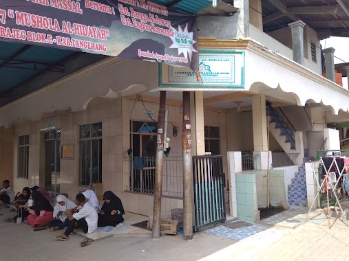
Musholla Alhidayah
Mekarsari
Mosque
read more
681 m
MUSHOLLA AL BAROKAH
Blok F, Taman Raya Rajeg, Mekarsari
Mosque
read more
686 m
Majlis Ta'lim Khoirul Huda PC & PAC LDII Rajeg
prm.taman raya rajeg blok E 5/01 Rt 12 Rw 05, Mekarsari
Mosque
read more
690 m
Mushola Al-wustho
Mekarsari
Mosque
read more
691 m
Mushola khoirul huda
Jalan Jambu Raya, Mekarsari
Mosque
read more
704 m
مسجد حمد انوار الهويشل
Mekarsari
Mosque
read more
741 m
Mushola An-Nur
Mekarsari
Mosque
read more
762 m
Mushola Al Hidayah
Jalan Nanas 2, Mekarsari
Mosque
read more
812 m
Masjid Hamad Abdullah almutyi
Mekarsari
Mosque
read more
839 m
Umar Bin Khottob
Mekarsari
Mosque
read more
968 m
Musholla Al_Hamsyir
Rajeg Mulya
Mosque
read more
1.035 km
Masjid Almuhajirin
Perum Nuansa Mekarsari 2, Blok i-3, Rajeg Mulya
Mosque
read more
1.036 km
Mushola Alhijrah
Rajeg Mulya
Mosque
read more
1.08 km
mushola nurul huda
Rajeg Mulya
Mosque
read more
1.152 km
Masjid Assyifa
Jalan Perum Purimekar No.1, Mekarsari
Mosque
read more
📑
all categories
Accounting
Administrative area level 1
Administrative area level 2
Airport
Amusement park
Aquarium
Art gallery
Atm
Bakery
Bank
Bar
Beauty salon
Bicycle store
Book store
Bowling alley
Bus station
Cafe
Campground
Car dealer
Car rental
Car repair
Car wash
Casino
Cemetery
Church
City hall
Clothing store
Colloquial area
Convenience store
Courthouse
Dentist
Department store
Doctor
Electrician
Electronics store
Embassy
Finance
Fire station
Florist
Food
Funeral home
Furniture store
Gas station
General contractor
Grocery or supermarket
Gym
Hair care
Hardware store
Health
Hindu Temple
Home goods store
Hospital
Insurance agency
Intersection
Jewelry store
Laundry
Lawyer
Library
Liquor store
Local government office
Locality
Locksmith
Lodging
Meal delivery
Meal takeaway
Mosque
Movie rental
Movie theater
Moving company
Museum
Natural feature
Neighborhood
Night club
Painter
Park
Parking
Pet store
Pharmacy
Physiotherapist
Place of worship
Plumber
Point of interest
Police
Political
Post office
Premise
Real estate agency
Restaurant
Roofing contractor
Route
Rv park, camping
School
Shoe store
Shopping mall
Spa
Stadium
Storage
Store
Subpremise
Supermarket
Synagogue
Taxi stand
Train station
Transit station
Travel agency
University
Veterinary care
Zoo
administrative area level 3
administrative area level 4
administrative area level 5
sublocality level 1
↑