Mosque nearby Musholla AL AMIN
Indonesia
Mosque nearby Musholla AL AMIN
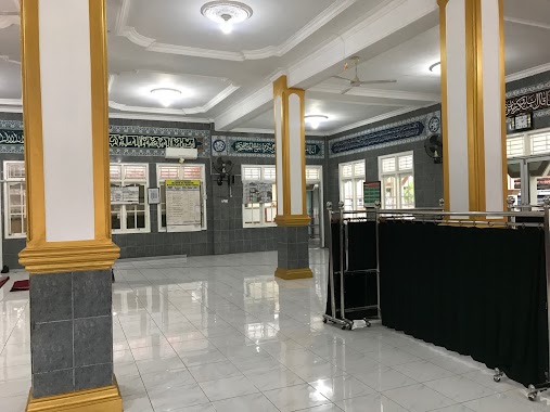
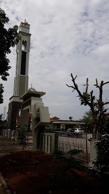
Musholla AL AMIN
Jagabaya II, Sukabumi Sub-District, Bandar Lampung City, Lampung 35122, Indonesia
contacts phone
:
+62
Latitude:
-5.4008202
, Longitude:
105.2677562
larger map & directions
read more
nearest Mosque
97 m
Masjid At Taubah
Jalan Tomat No.6, Jagabaya II
Mosque
read more
100 m
Masjid At- Taubah
Jalan Tomat No.31, RW.1, Jagabaya II
Mosque
read more
190 m
Masjid Khoirul Huda
Jalan Pulau Bacan No.14, Jagabaya II
Mosque
read more
269 m
Musholla Baiturahman
Jagabaya II
Mosque
read more
289 m
Masjid Khoirul Karim
Gang Hi. Karim Jalan Pulau Bacan, Jagabaya 3
Mosque
read more
345 m
Masjid Thoriqussalam
Jalan Narada, Jagabaya II
Mosque
read more
423 m
Masjid Baiturrohim
perum korpri blok C, Jagabaya II
Mosque
read more
447 m
Jami' Miftahul Jannah
Jalan Pajajaran No.4, Jaga Baya I
Mosque
read more
486 m
Masjid Al-Hikmah
Jalan Pajajaran, Jagabaya II
Mosque
read more
491 m
Albarokah Masjid
Gang Bukit 2, Jaga Baya I
Mosque
read more
538 m
Masjid Darun Nafis
Jalan GN.Kancil No.2, Jagabaya II, Way Halim, Jagabaya II
Mosque
read more
689 m
Masjid Al - Firdaus
Jalan Danau Jepara, Surabaya
Mosque
read more
700 m
Masjid Nur Sa'id
Jalan NARADA, Jagabaya III
Mosque
read more
791 m
Masjid Nurohman
Jl. Pulau buton dalam kelurahan jagabaya III RT 01 LK 01 kec, Way Halim
Mosque
read more
810 m
Musolla Darul Mukhlisin
Jalan Dasamuko No.26, Sawah Brebes
Mosque
read more
865 m
Mushola Nurul Amal
Jalan Dr. Sutomo No.8, Penengahan
Mosque
read more
890 m
Masjid Miftahul Islam
Gang Saburai No.34, Gunung Sulah
Mosque
read more
939 m
Musholla Assa 'Adah
Jalan Merpati, Tanjung Karang
Mosque
read more
941 m
Masjid Darul Ulum
Jalan Raden Pemuka, Gunung Sulah
Mosque
read more
943 m
Masjid Miftahul Khairat
Jalan Badak, Sidodadi
Mosque
read more
962 m
Masjid Darussalam
Jalan Teuku Umar Lorong Darussalam, Surabaya
Mosque
read more
982 m
Musholla Nurul Iman
Jalan SADEWA No.21, Sawah Lama
Mosque
read more
1.024 km
Masjid An-Nur
Gang Bukit 1 Jalan Hayam Wuruk, Kebon Jeruk
Mosque
read more
1.036 km
Masjid Al Fitrah
Kebon Jeruk
Mosque
read more
1.129 km
Masjid Lailatul Qodar
Jalan Kiwi, Sidodadi
Mosque
read more
📑
all categories
Accounting
Administrative area level 1
Administrative area level 2
Airport
Amusement park
Aquarium
Art gallery
Atm
Bakery
Bank
Bar
Beauty salon
Bicycle store
Book store
Bowling alley
Bus station
Cafe
Campground
Car dealer
Car rental
Car repair
Car wash
Casino
Cemetery
Church
City hall
Clothing store
Colloquial area
Convenience store
Courthouse
Dentist
Department store
Doctor
Electrician
Electronics store
Embassy
Finance
Fire station
Florist
Food
Funeral home
Furniture store
Gas station
General contractor
Grocery or supermarket
Gym
Hair care
Hardware store
Health
Hindu Temple
Home goods store
Hospital
Insurance agency
Intersection
Jewelry store
Laundry
Lawyer
Library
Liquor store
Local government office
Locality
Locksmith
Lodging
Meal delivery
Meal takeaway
Mosque
Movie rental
Movie theater
Moving company
Museum
Natural feature
Neighborhood
Night club
Painter
Park
Parking
Pet store
Pharmacy
Physiotherapist
Place of worship
Plumber
Point of interest
Police
Political
Post office
Premise
Real estate agency
Restaurant
Roofing contractor
Route
Rv park, camping
School
Shoe store
Shopping mall
Spa
Stadium
Storage
Store
Subpremise
Supermarket
Synagogue
Taxi stand
Train station
Transit station
Travel agency
University
Veterinary care
Zoo
administrative area level 3
administrative area level 4
administrative area level 5
sublocality level 1
↑