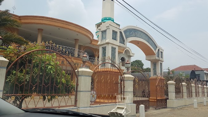
Mosque nearby Mushola H. Roif
Indonesia
Mosque nearby Mushola H. Roif
Mushola H. Roif
Blok Tanah Koja, RT02/03,, Leuwinanggung Indonesia
contacts phone
:
+62
Latitude:
-6.4071111
, Longitude:
106.9027361
read more
nearest Mosque
91 m
Masjid Al-Makmur Leuwinanggung
Jl. Raya Leuwinanggung Rt. 001 Rw. 003, Leuwinanggung
Mosque
read more
91 m
Masjid Al-Makmur Leuwinanggung
Jl. Raya Leuwinanggung Riverside Rt. 004 Rw. 001, Leuwinanggung
Mosque
read more
151 m
Masjid Jami Al Makmur
Jalan Leuwinanggung, Leuwinanggung
Mosque
read more
253 m
Mushola SPBU 34 - 16937
Jalan Leuwinanggung, Leuwinanggung
Mosque
read more
434 m
Musholla Nurul Iman
Leuwinanggung
Mosque
read more
447 m
MUSHOLLAH NURUL IMAN
Leuwinanggung
Mosque
read more
591 m
Masjid Nurul Jami
Jalan Campedak, Leuwinanggung
Mosque
read more
772 m
Masjid Jami' Riyadhush Sholihin
Jalan Leuwinanggung, Tapos
Mosque
read more
816 m
Musholla Al Fitrah
Leuwinanggung
Mosque
read more
896 m
Mushola Nurul Huda
Jalan Leuwinanggung, Tapos
Mosque
read more
970 m
Mushola Puluh Resto
Jalan Leuwinanggung, Tapos
Mosque
read more
1.022 km
Masjid Ar Rayyan - The Address
Boulevard The Address at Cibubur,, Leuwinanggung
Mosque
read more
1.089 km
Masjid Jami Alamsyir
Jalan Leuwinanggung RT.02/RW.06, Leuwinanggung
Mosque
read more
1.366 km
Masjid Baitul A'laa
Jalan Perumahan Rafles Hills, Sukatani
Mosque
read more
1.45 km
Masjid Al Ikhlas
Ruko City Walk, Sukatani
Mosque
read more
1.505 km
Masjid Al Hidayah Ciherang
Jalan Masjid No.34, Sukatani
Mosque
read more
1.737 km
Masjid Al Hidayah
Jalan Kopassus Sukatani, Sukatani
Mosque
read more
1.784 km
Masjid Jami' Nurul Falah
Jalan Sukatani Raya RT.001/RW.06, Sukatani
Mosque
read more
1.84 km
Mushola M.C
Jalan Kopassus Sukatani, Sukatani
Mosque
read more
1.972 km
Masjid Nurul Khoirot
Jalan Kopassus Sukatani No.20, Sukatani
Mosque
read more
2.031 km
Mushola Nurul Shabah
Kp. Sanding 2, RT. 08/04, Bojong Nangka, Gunung Putri
Mosque
read more
2.089 km
Mushola Attaqwa
Jalan Durian, Sukatani
Mosque
read more
2.432 km
Mushalla Al Madani
Sukatani
Mosque
read more
2.444 km
Masjid Al Hidayah
Sukatani
Mosque
read more
2.68 km
Masjid Jami' Al Kholid
Bojong Nangka
Mosque
read more
📑
all categories
Accounting
Administrative area level 1
Administrative area level 2
Airport
Amusement park
Aquarium
Art gallery
Atm
Bakery
Bank
Bar
Beauty salon
Bicycle store
Book store
Bowling alley
Bus station
Cafe
Campground
Car dealer
Car rental
Car repair
Car wash
Casino
Cemetery
Church
City hall
Clothing store
Colloquial area
Convenience store
Courthouse
Dentist
Department store
Doctor
Electrician
Electronics store
Embassy
Finance
Fire station
Florist
Food
Funeral home
Furniture store
Gas station
General contractor
Grocery or supermarket
Gym
Hair care
Hardware store
Health
Hindu Temple
Home goods store
Hospital
Insurance agency
Intersection
Jewelry store
Laundry
Lawyer
Library
Liquor store
Local government office
Locality
Locksmith
Lodging
Meal delivery
Meal takeaway
Mosque
Movie rental
Movie theater
Moving company
Museum
Natural feature
Neighborhood
Night club
Painter
Park
Parking
Pet store
Pharmacy
Physiotherapist
Place of worship
Plumber
Point of interest
Police
Political
Post office
Premise
Real estate agency
Restaurant
Roofing contractor
Route
Rv park, camping
School
Shoe store
Shopping mall
Spa
Stadium
Storage
Store
Subpremise
Supermarket
Synagogue
Taxi stand
Train station
Transit station
Travel agency
University
Veterinary care
Zoo
administrative area level 3
administrative area level 4
administrative area level 5
sublocality level 1
↑